|
WISCONSIN WEATHER
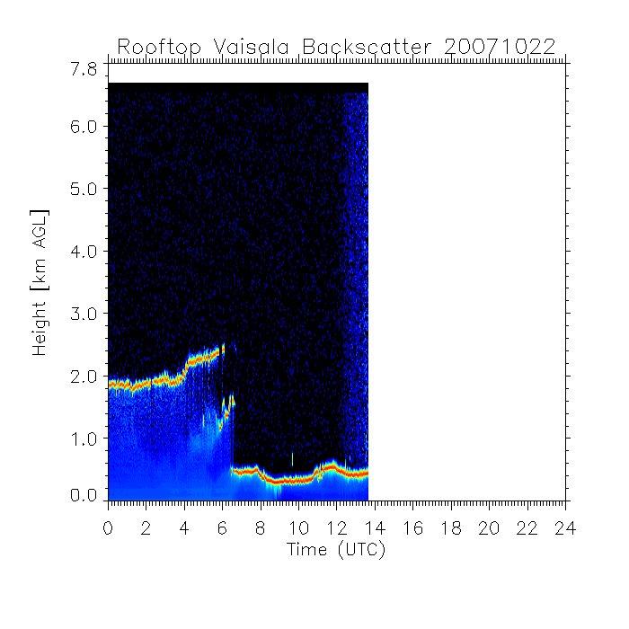
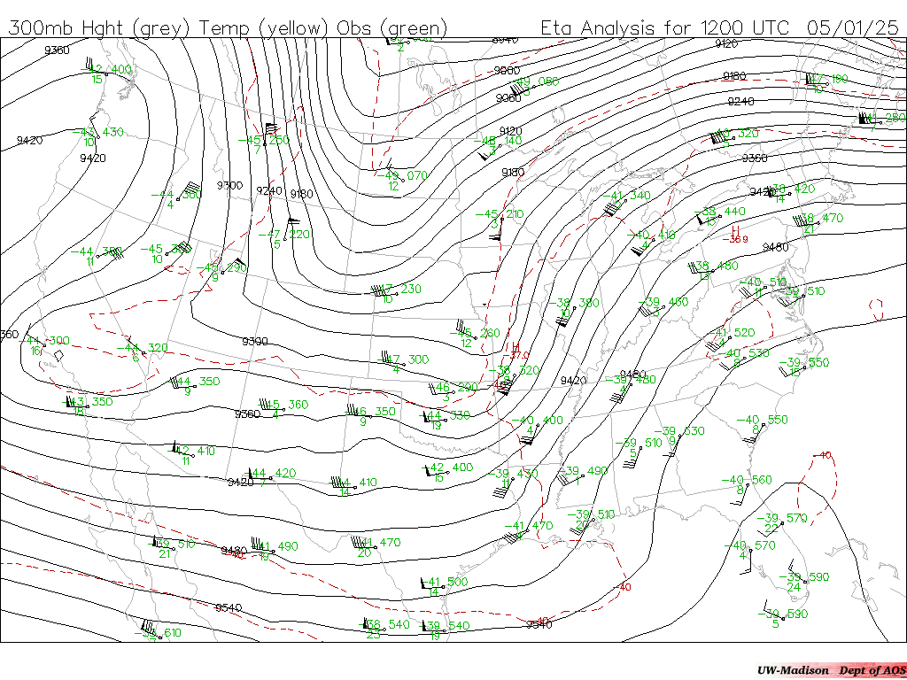
State Obs: MSN MKE LNR DBQ RFD LSE Fore Disc: MKE LSE DSM DLH GRB MSP Local Fore: MSN MKE LSE GRB MSP DSM Model Guide: MSN MKE LSE GRB MSP DSM Forecast Offices: MKE LSE GRB DLH MSP AOSS Rooftop Instruments: Tower Obs Ceilometer Surface: SSEC RAPS NWS COD Satellite: GOES-12 Vis/IR UCAR DSM COD Radar: MKE (SSEC) (AOS) (NWS) (RAPS) (COD) Wind Profiler: Blue River All Meteorogram: MSN MSN ETA Forecast Lightning (restricted): Upper Midwest WI Warn/Watch Snowfall Accum: Depth Daily Monthly Yearly Satellite: Visible COD Radar: MKE (SSEC) (NIDS) (NWS) (COD) Lightning Fli (restricted): Upper Midwest REGIONAL WEATHER SPC: Conv Out Day 1 Conv Out Day 2 Meso Severe Weather: Warnings Special Wx Damage Current Watches/Warnings: SPC Wx Under Models: SPC RUC2 Comp MSN RUC |
CONUS WEATHER
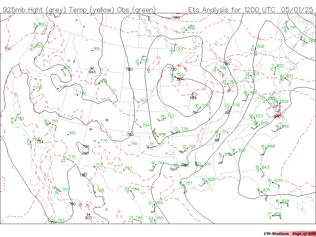
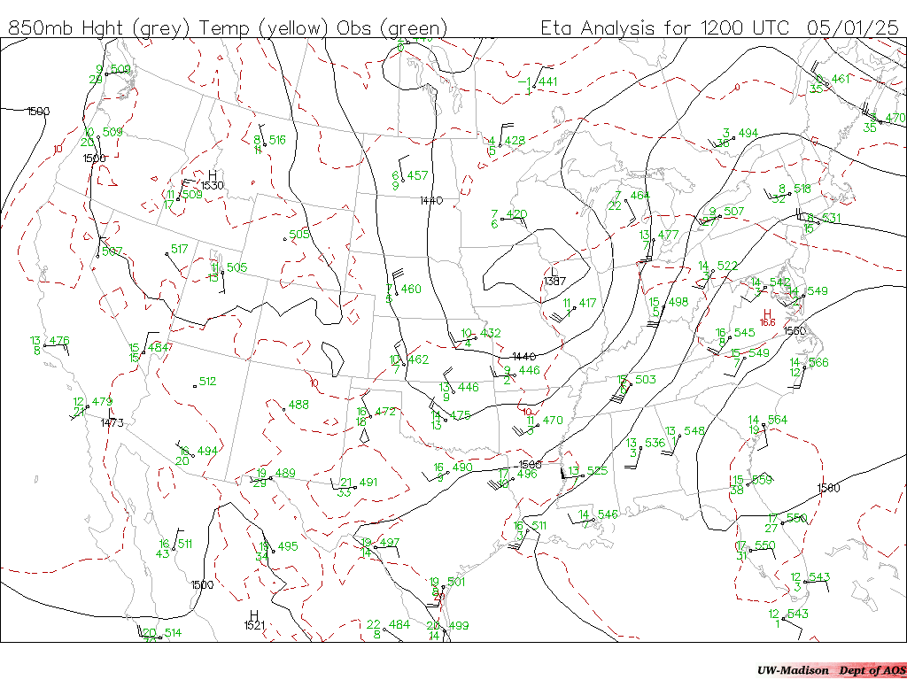
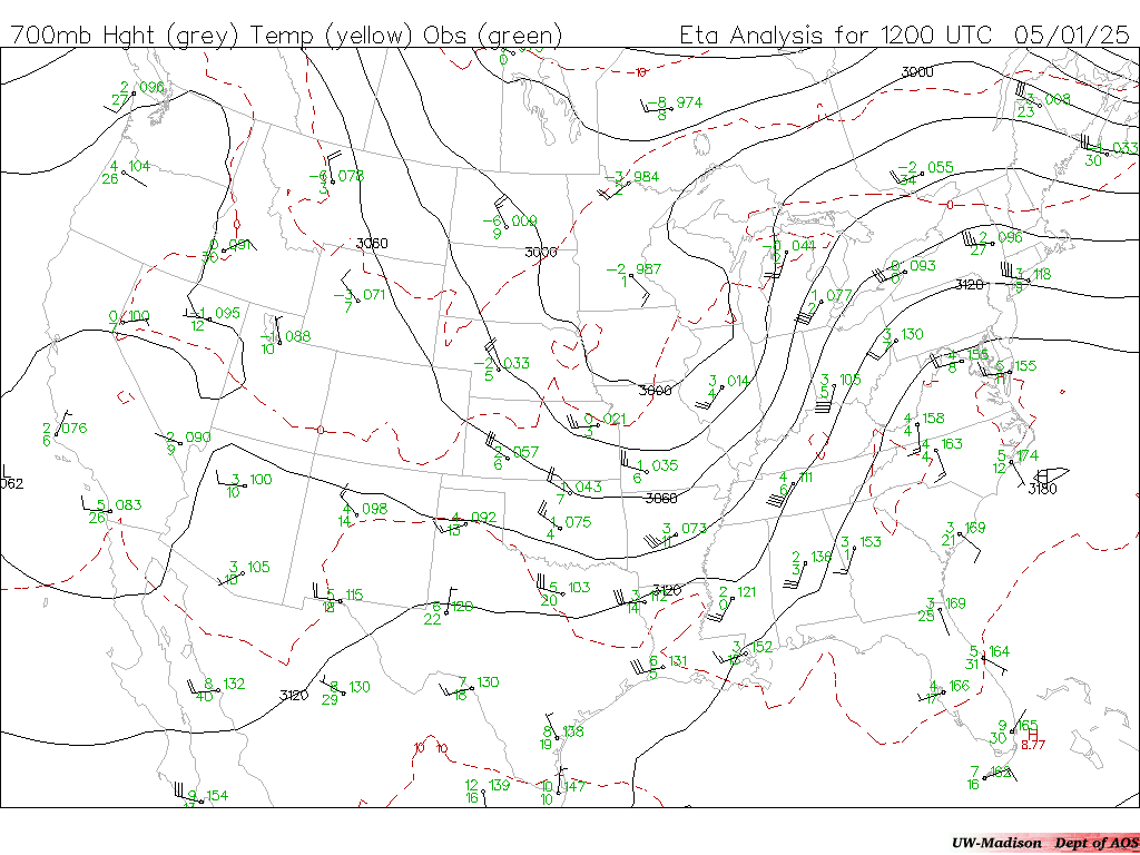
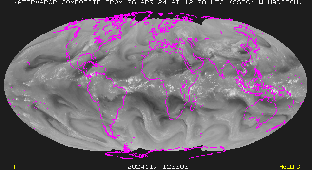
National Obs, TAFS, SKEWT's:Local Text Metars: U. Wyoming COD Nexlab NCEP Precip Discussion: NCEP/HPC DIFAX (NOAA): Wx Depict Radar Summary Surface: Sfc Ana MSLP Temp Moist 3hr Press Upper Air (U. Wisc.): 925 850 700 500 300 Winds Aloft National Radar: NWS National RAPS WSI GOES-12 Satellite (SSEC): Vis IR WV GOES-10 Satellite (SSEC): Vis IR WV Satellite Composite (SSEC): Vis/IR GOES Derived Products (SSEC): PWV LI CAPE Models: UW AOS RAPS/UCAR COLA Unisys Model Precip: ETA ETA Snow NGM AVN GOES-12 Satellite (SSEC): Vis IR WV GOES-10 Satellite (SSEC): Vis IR WV Satellite/Radar Composite: IR/Radar NWS Radar GOES Derived Products (SSEC): PWV LI CAPE GLOBAL WEATHER WMO Observations:World Obs GOES-12 Western Hemisphere (SSEC): Vis IR GOES-10 Western Hemisphere (SSEC): Vis IR Global Satellite Imagery (SSEC): IR WV Color Models: LLNL NOGAPS Texas AM ECMWF
|
| Updated 20 December 2002 CIMSS Weather Webmaster |
Cooperative Institute for Meteorological Satellite Studies University of Wisconsin-Madison |