Date: Dec 11, 2002
Mission: Aqua Cloud mission.
Mission Objectives
Collect subtropical cirrus scenes over southern Louisiana and the Gulf of Mexico w/Aqua (1916 UTC) to evaluate MODIS Cloud products, collect photo of LA coast for geomorphology, and coordinate with WB-57 for MAS/MASTER L1B comparisons.
Flight Summary
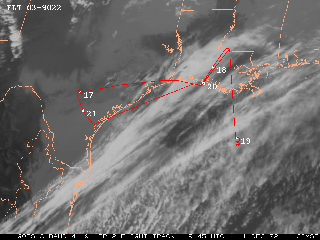
Take-off at 1700 UTC. ER-2 landed at 2130 UTC.
ER-2 flew east from SAT to western Louisiana muddy coast photo line (mostly cloudy with cirrus so no photo shoot), then on east to eastern Louisiana to pick up Aqua orbital track on a SSE bound 38 minute leg down to about 27 deg N in the Gulf of Mexico (GOM). Skies on this line were single layer thin cirrus over Louisiana then thin and thick cirrus overcast over patches of low and mid level cumulus overcast interspersed with patches of single layer cirrus over water. ER-2 reversed course to return on same line with similar sky conditions. Met the Aqua satellite with cirrus over patches of low and mid level cumulus. From northern end flew to western Louisiana coast for another run of photo line (mostly cloudy with cirrus so no photo shoot). WB-57 did not get airborne so rendevous over buoy 42019 in western GOM was canceled and ER-2 returned to SAT.
Highlights
Single layer cirrus over land near Aqua overpass. Cirrus over mid and low cloud w/Aqua.
Instrument Status