Date: Nov 27, 2002
Mission: Terra MODIS Cloud Product validation.
Mission Objectives
Collect data of single and multilayer (ice over water) cirrus cloud for validating MODIS Cloud Top heights and Cloud Phase using CPL depolarization data. Collect data of very thin cirrus for MODIS Cloud Mask thin cirrus bit validation.
Flight Summary
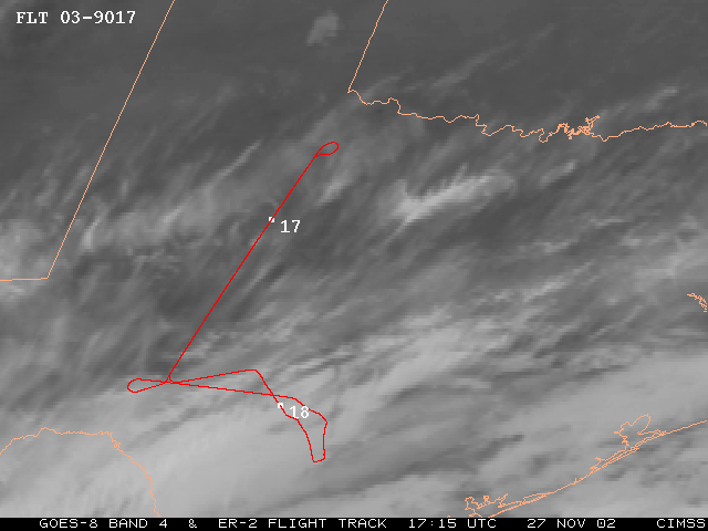
Take-off was at 1600 UTC. ER-2 landed at 1830 UTC.
ER-2 flew west to get on Terra orbital track line in western TX and flew NNE on 28 minute long leg up towards north central TX. Cirrus and low cloud cover at southern 1/3 of this line (ending about 1640 UTC), followed by single layer cirrus, thin and thick for northern 2/3 of the line. Some indication of mixed phase cloud from 1653 to 1704 UTC in CPL data. Reversed course at 1713 UTC flying SSW on the same line, meeting Terra at 1733 UTC (nadir view) about 40 km south of the midpoint of the line. Alternately thin and thick single layer cirrus present in the scenes at time of overpass. ER-2 continued southward to starting point of line, finding multi-layer cloud only at southern end point.
Highlights
Abundant single layer cirrus, thin and thick w/Terra overpass.
Instrument Status
Additional Pilot Notes: Could see surface through clouds
over 90% of time. Often couldn't see cirrus but when turning around
at northern end saw entire southern line to look milky white. Turbulence
occuring during much of flight in crosswinds at altitude (unusually strong
winds).