Current image of the Atlantic Ocean with areas of potential tropical cyclogenesis (invests) in white. Yellow dots represent the location of overshooting tops (OTs). 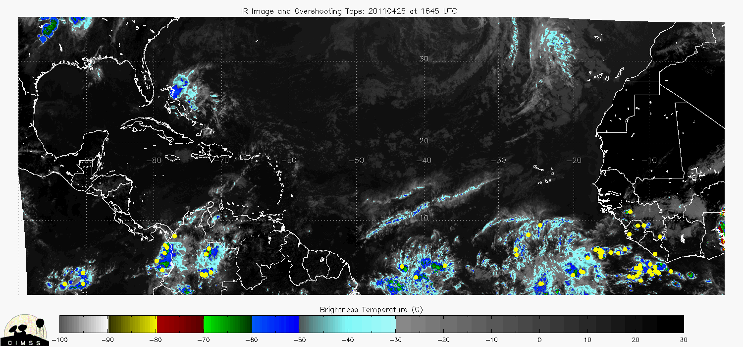
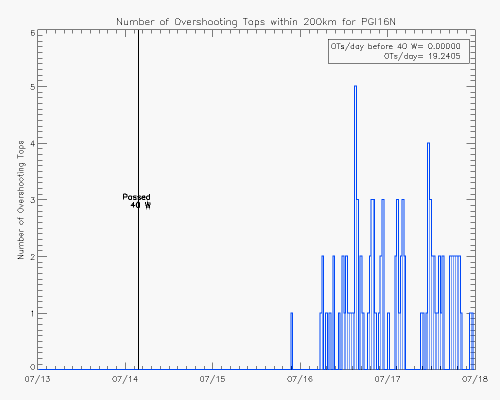
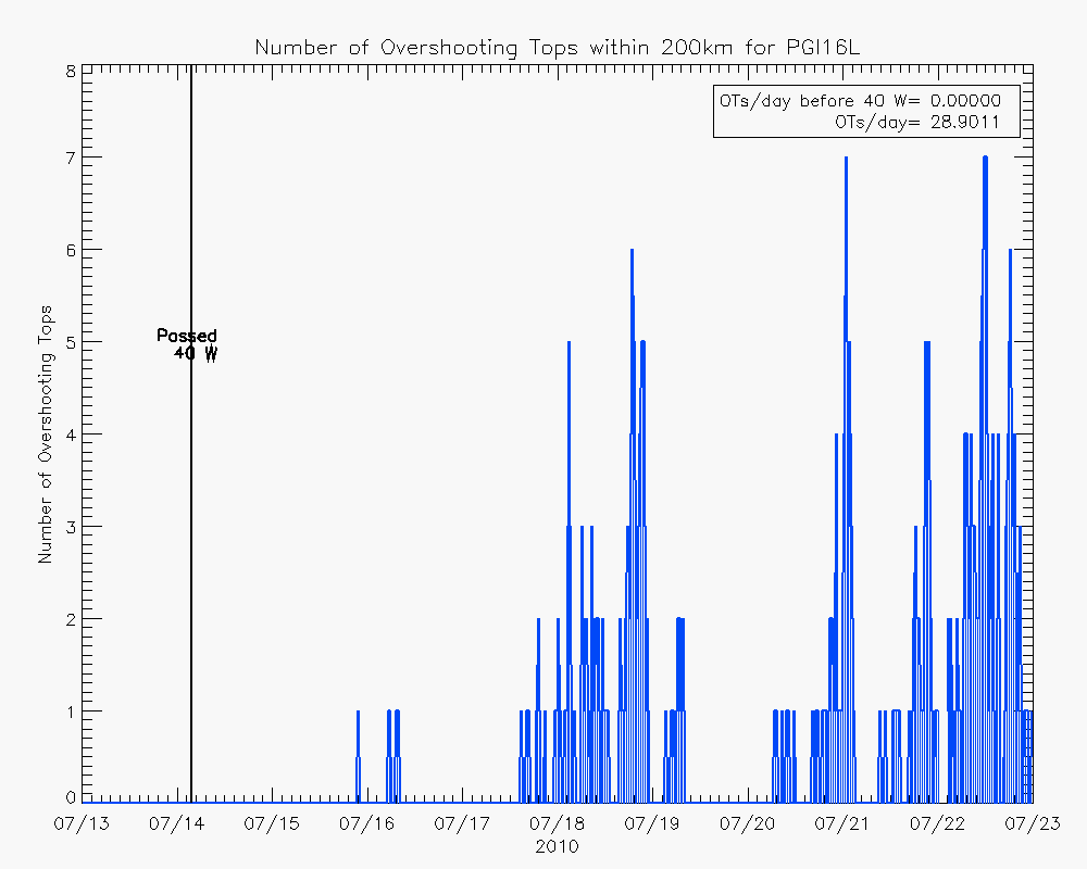
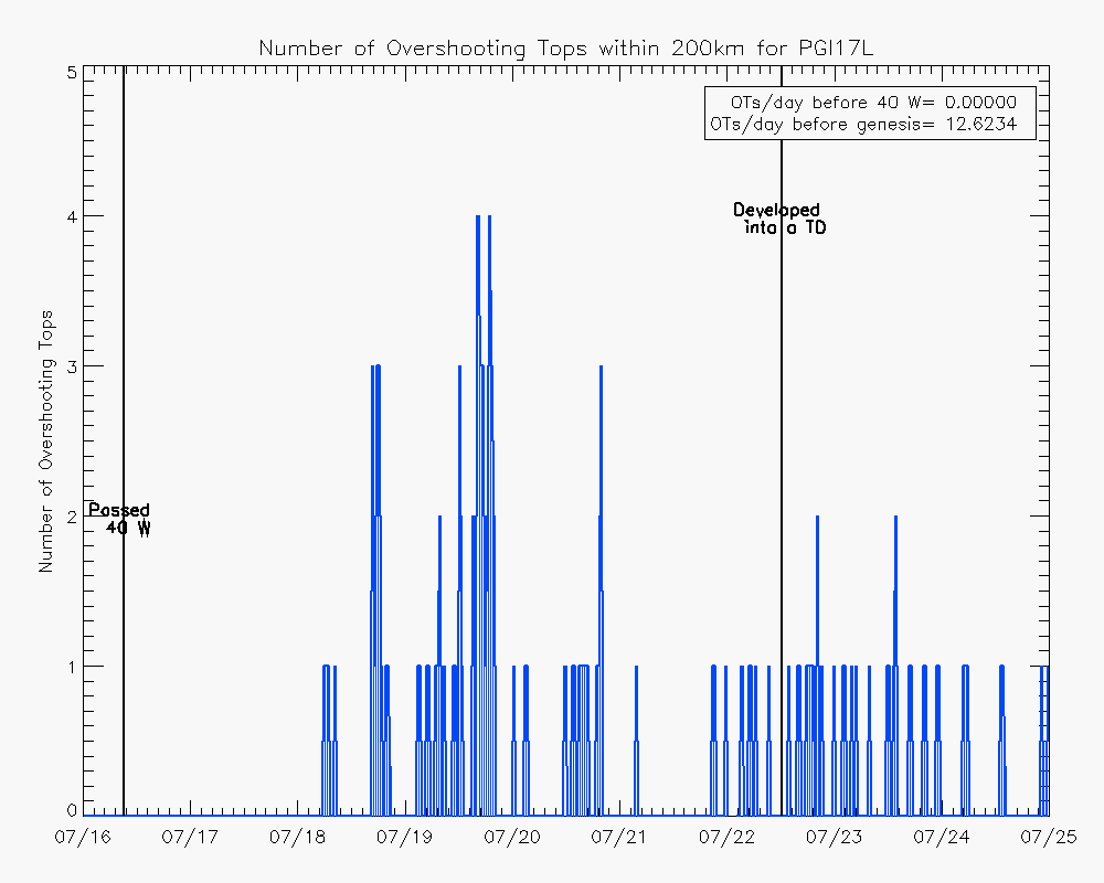
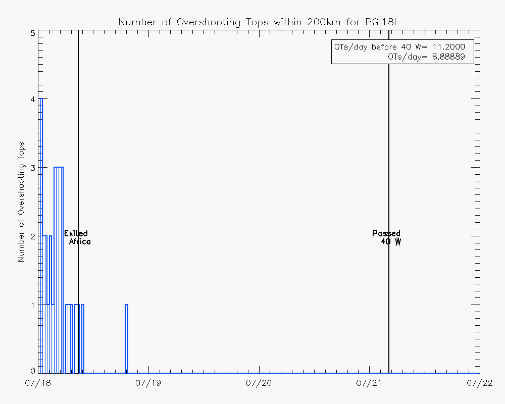
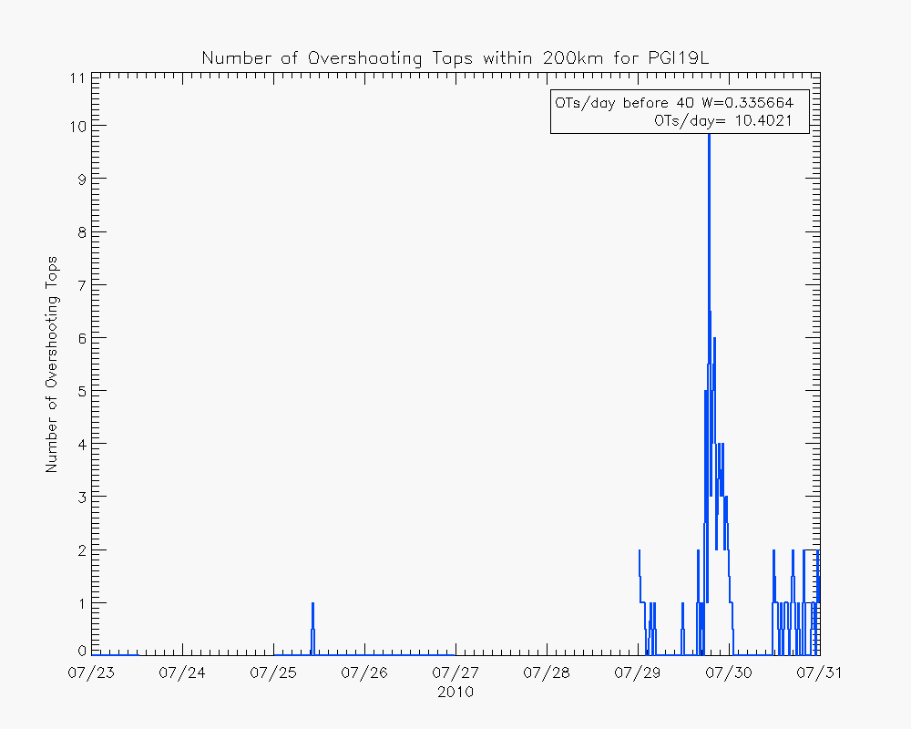
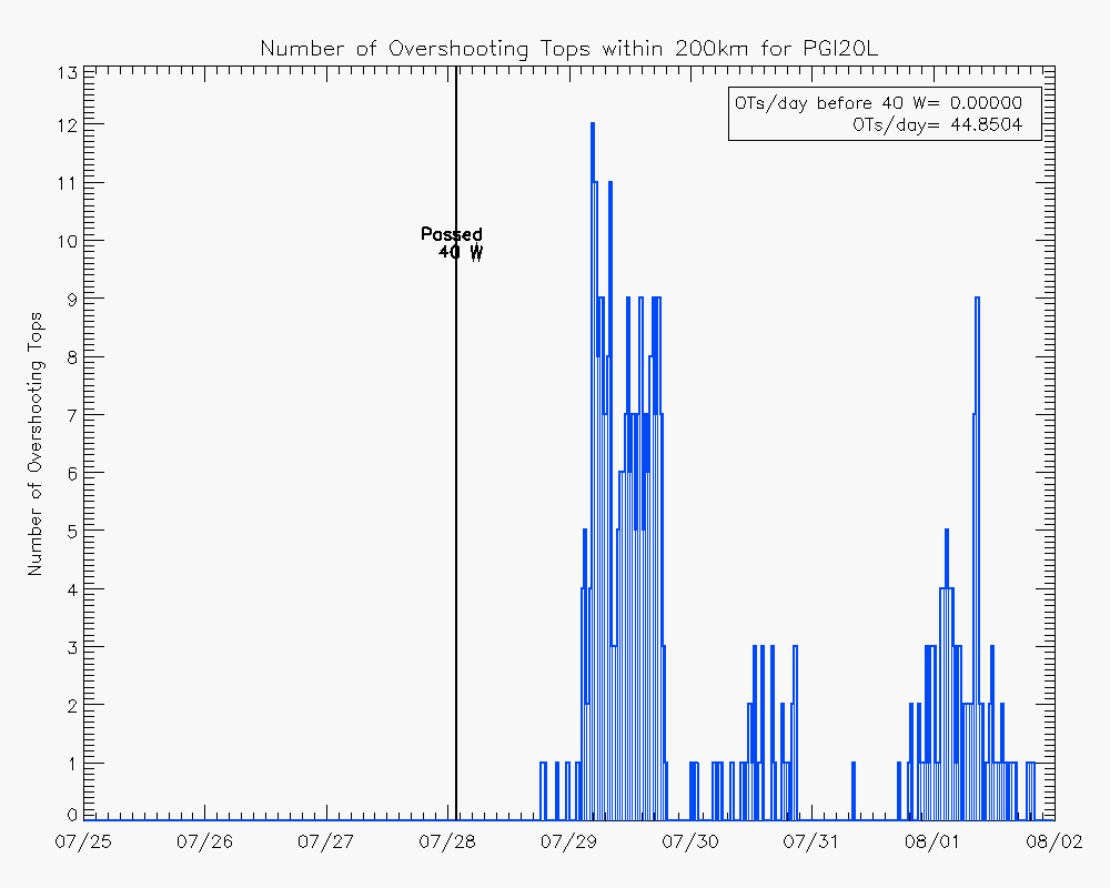
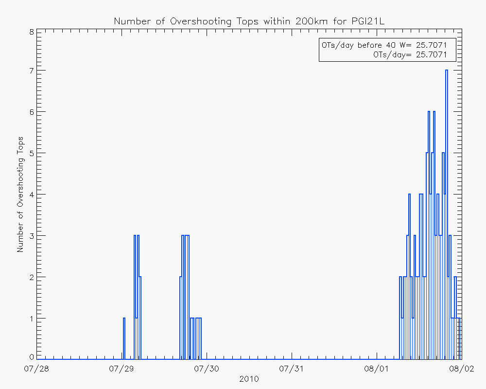
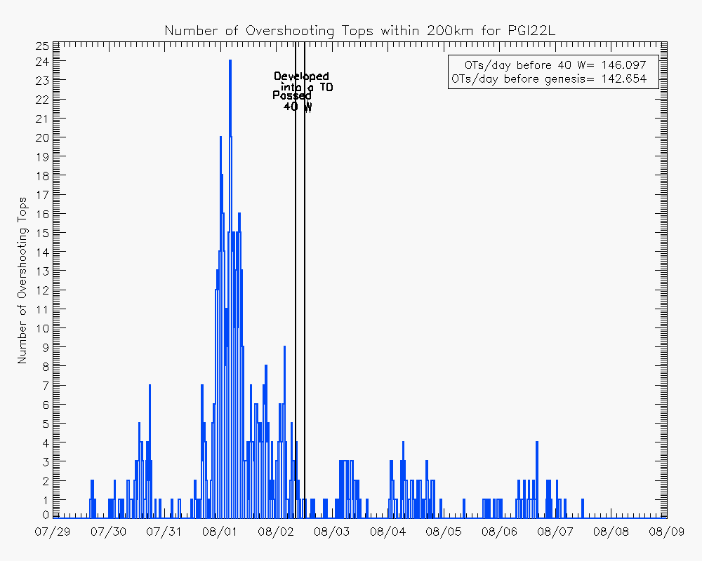
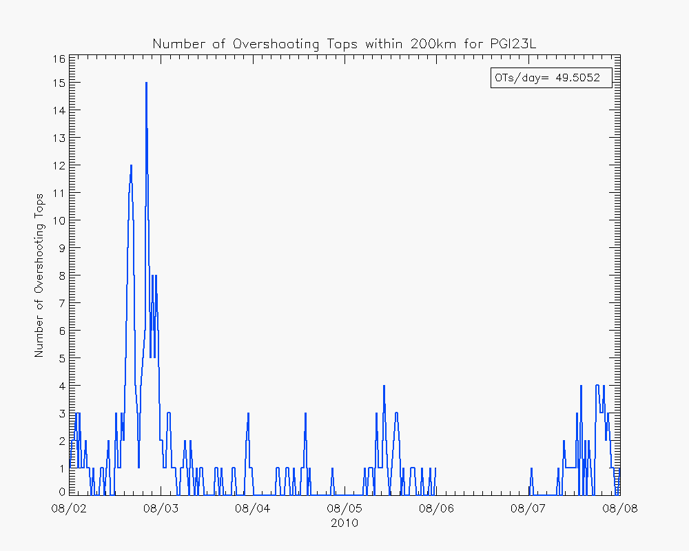
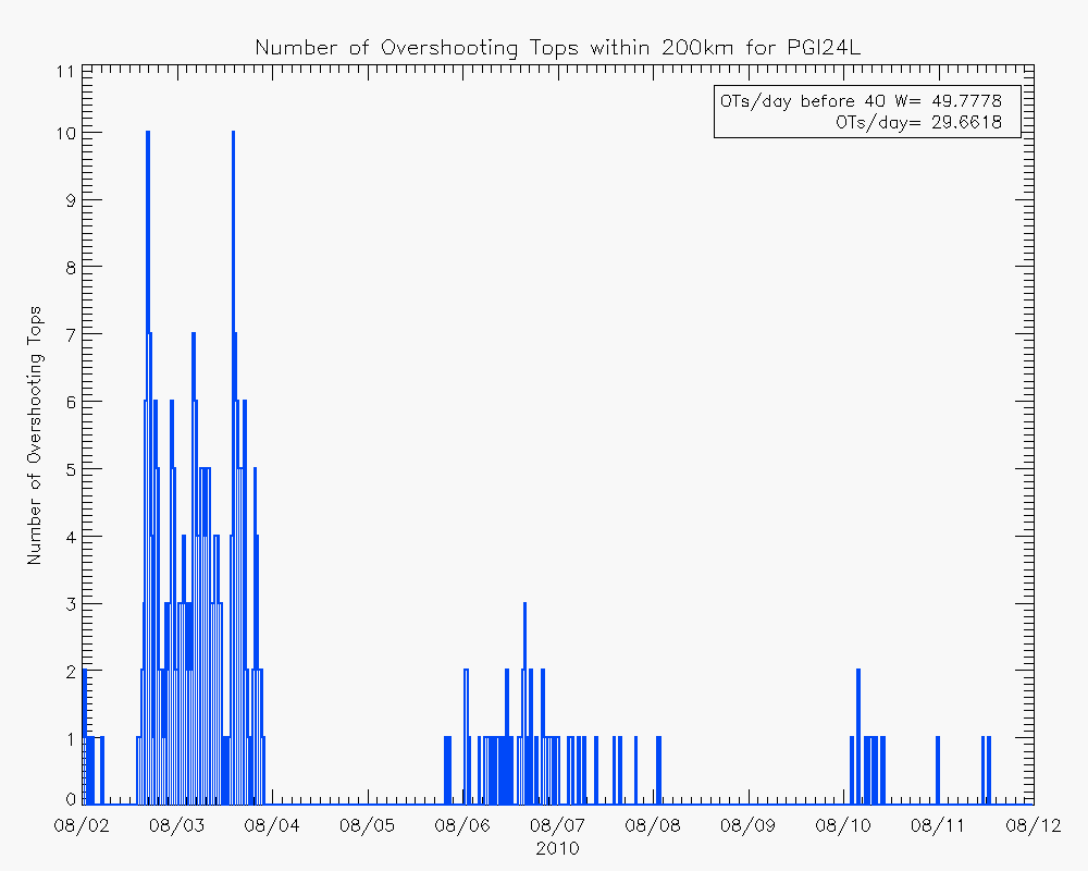
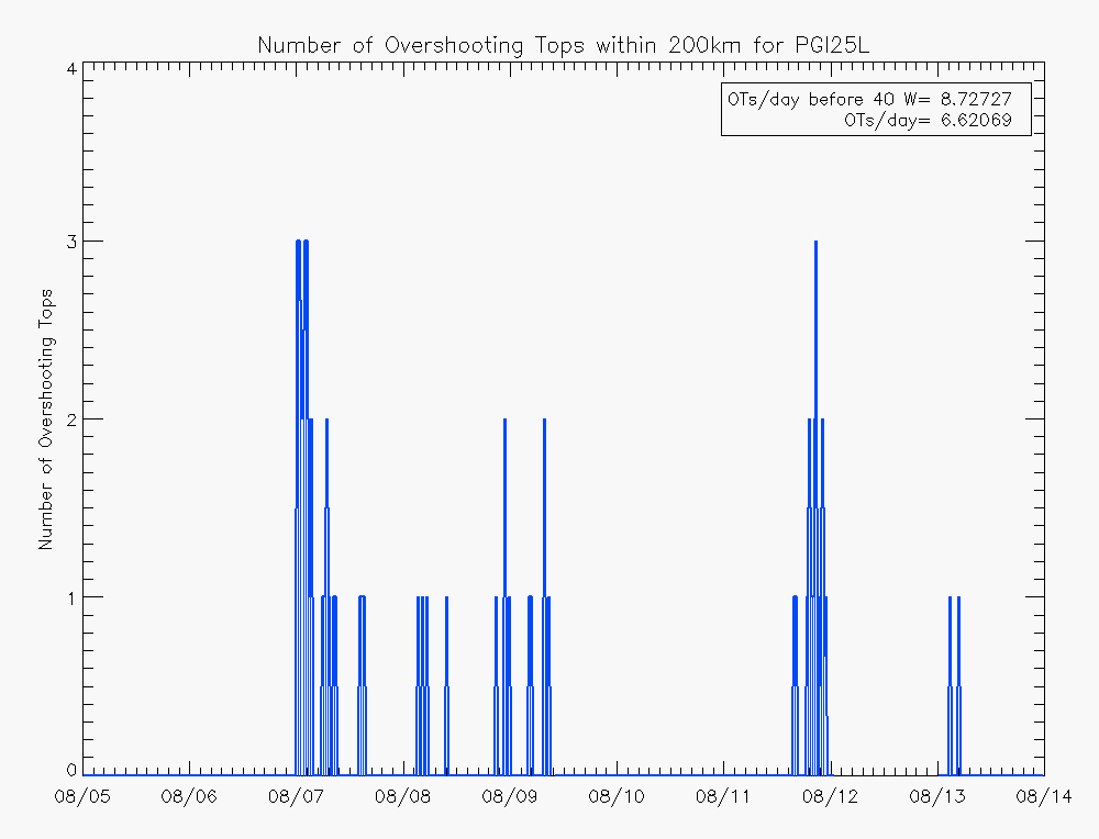
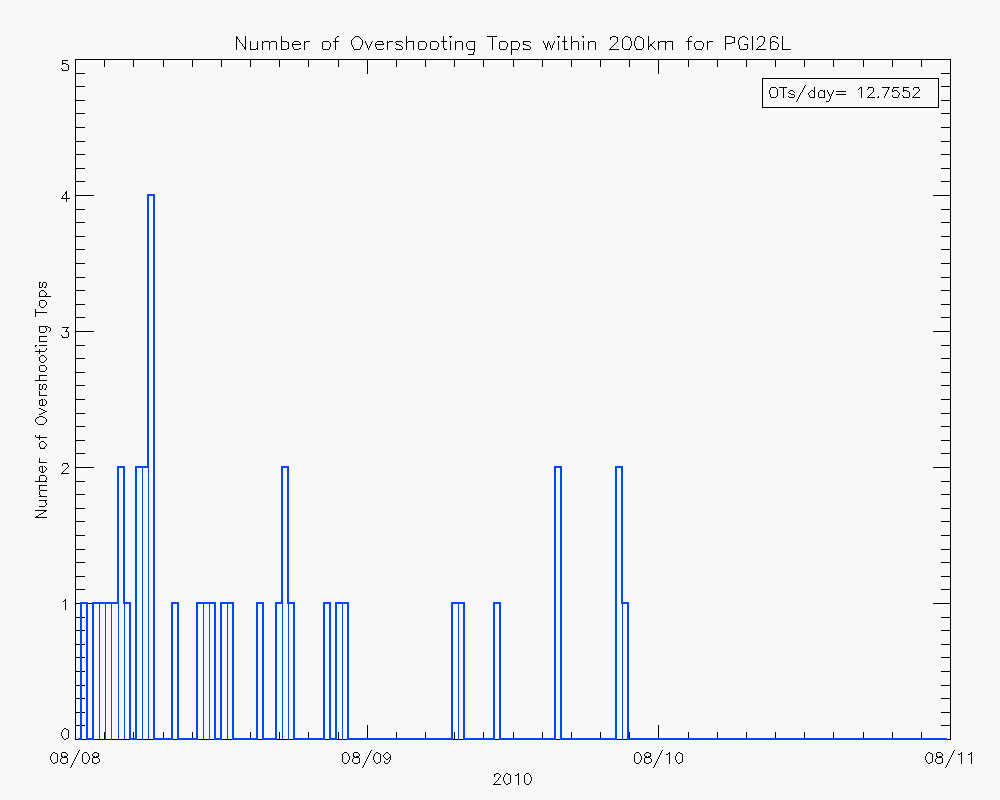
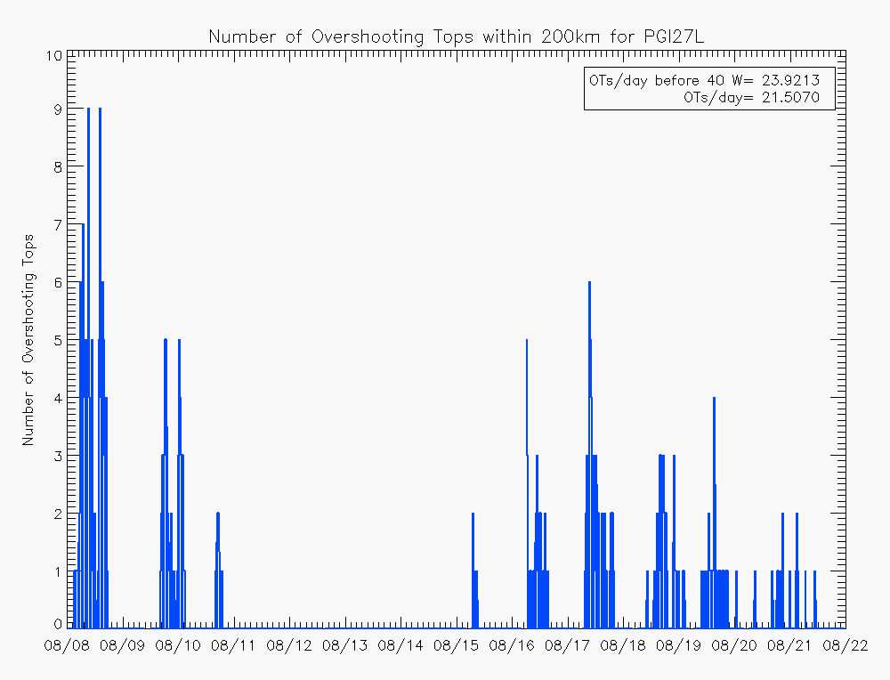
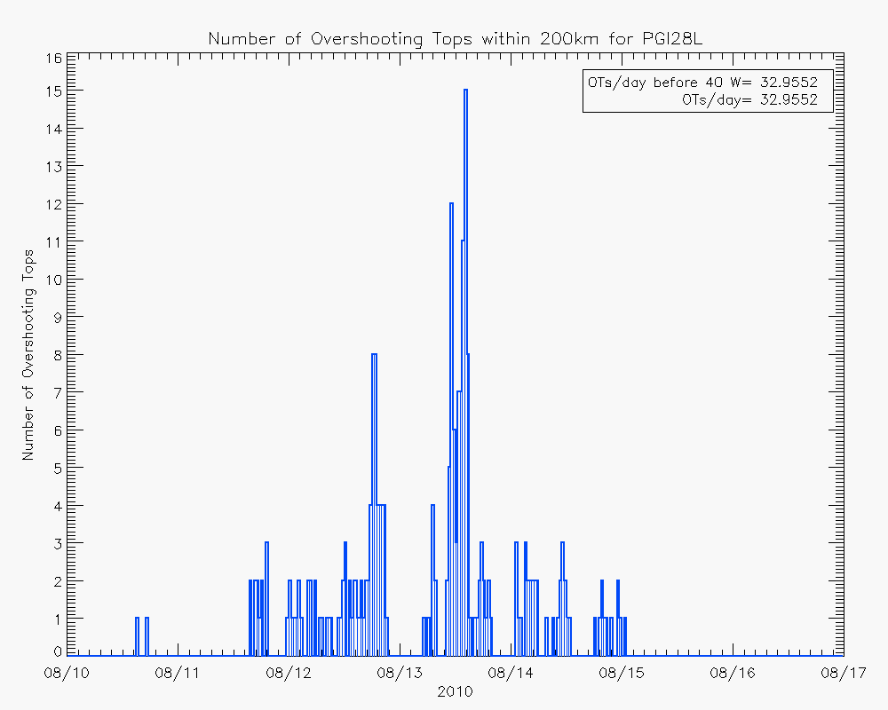
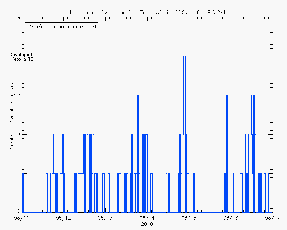
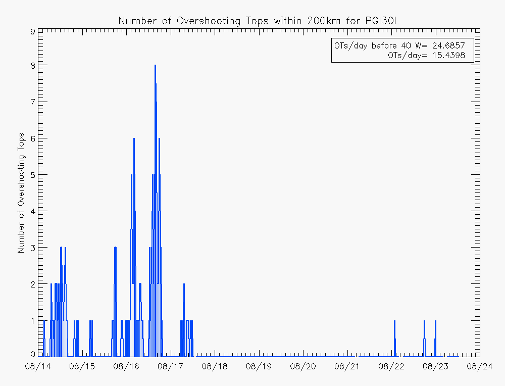
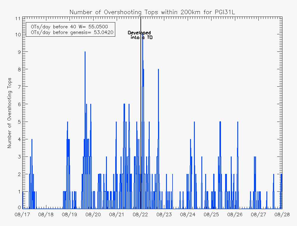
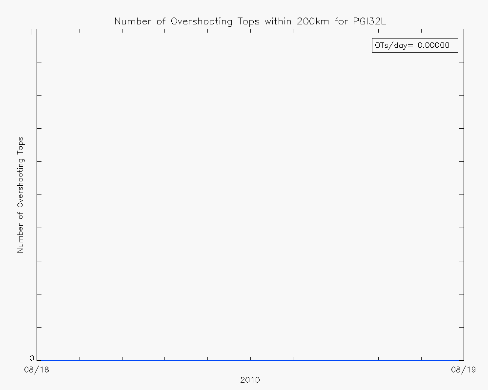
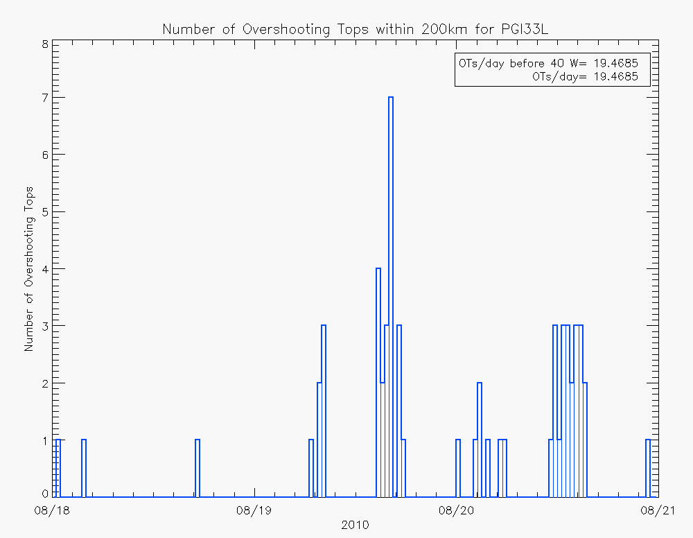
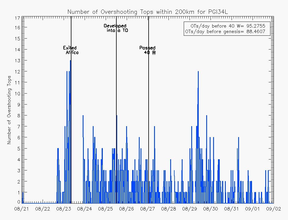
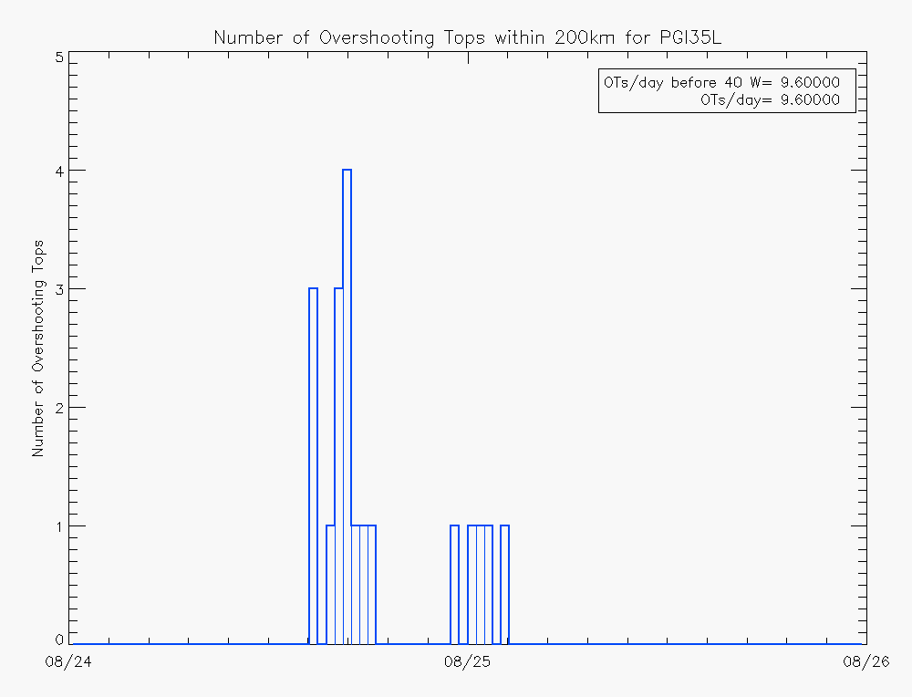
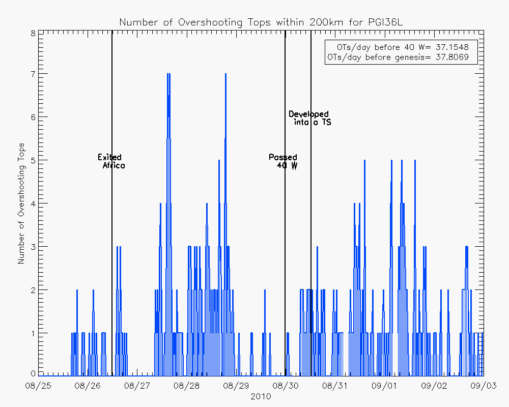
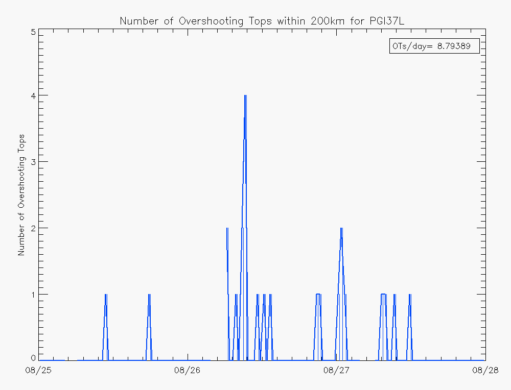
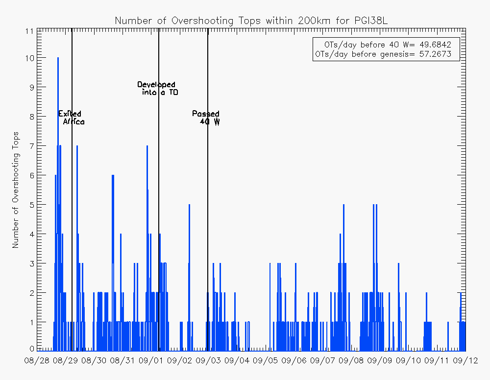
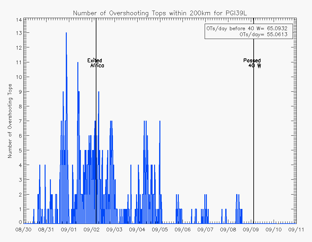
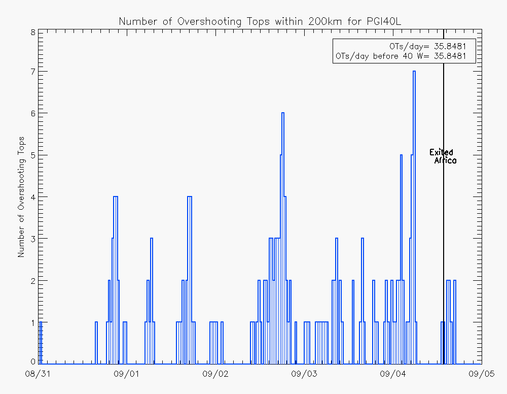
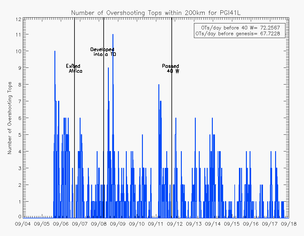
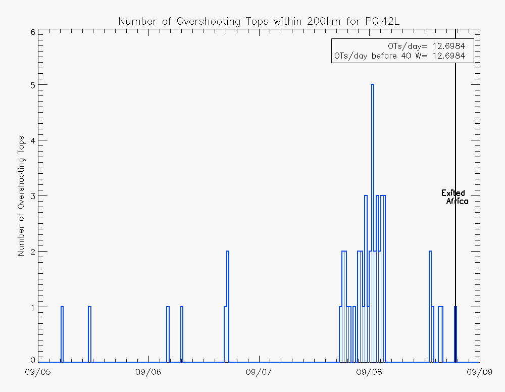
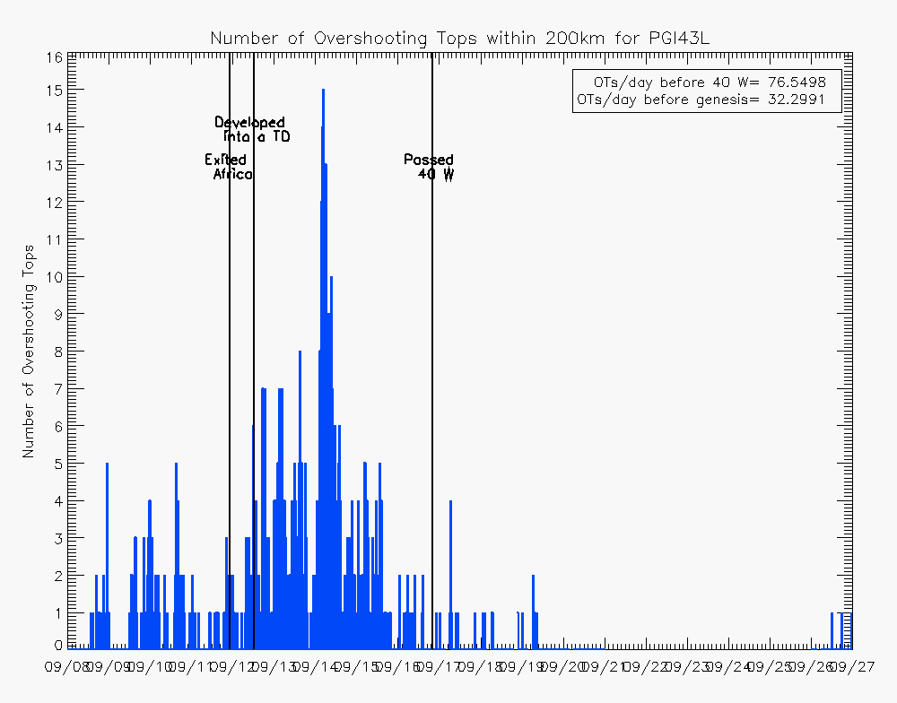
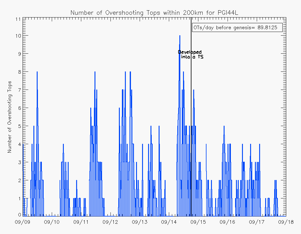
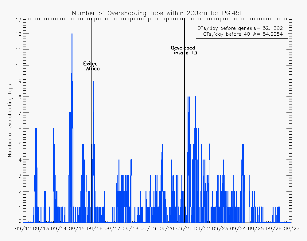
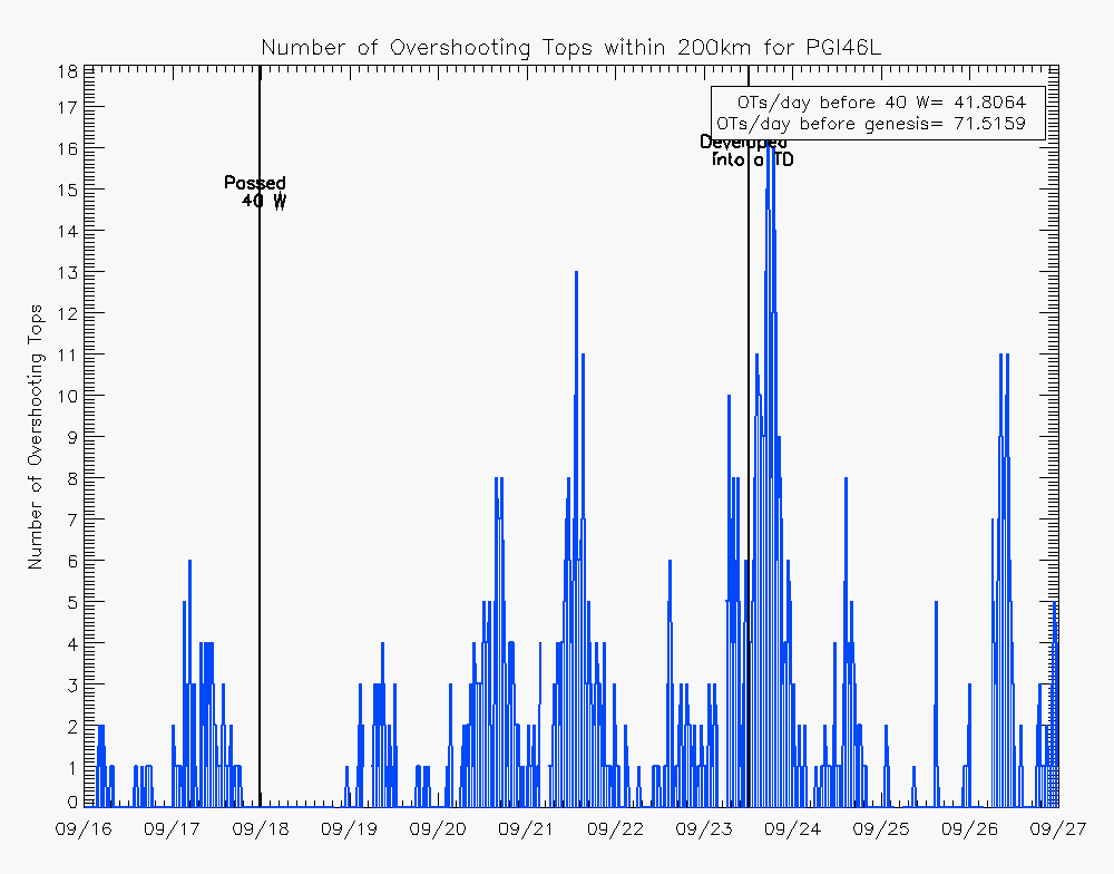
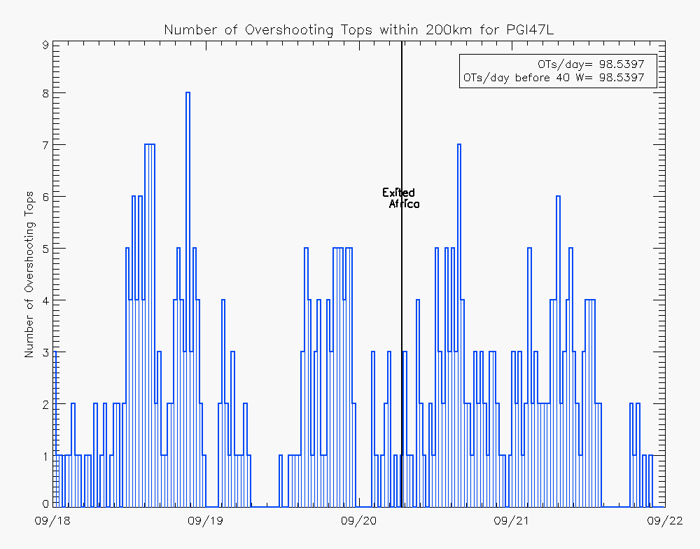
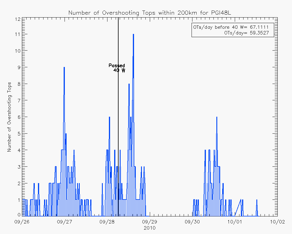
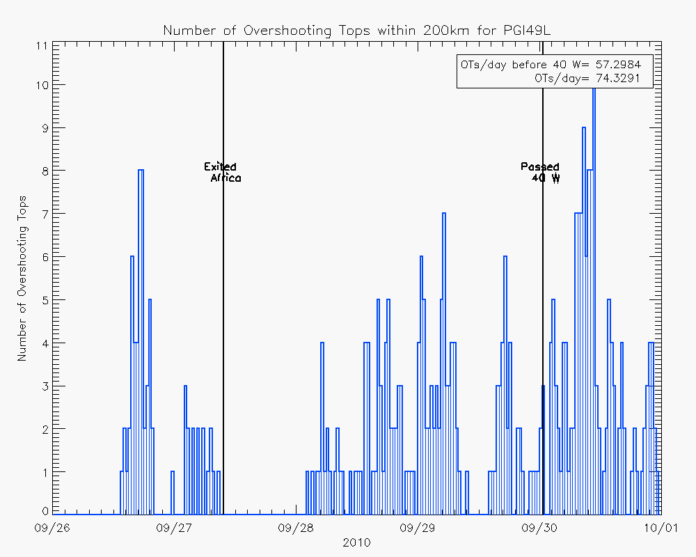
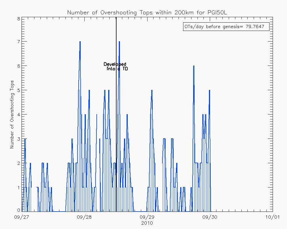
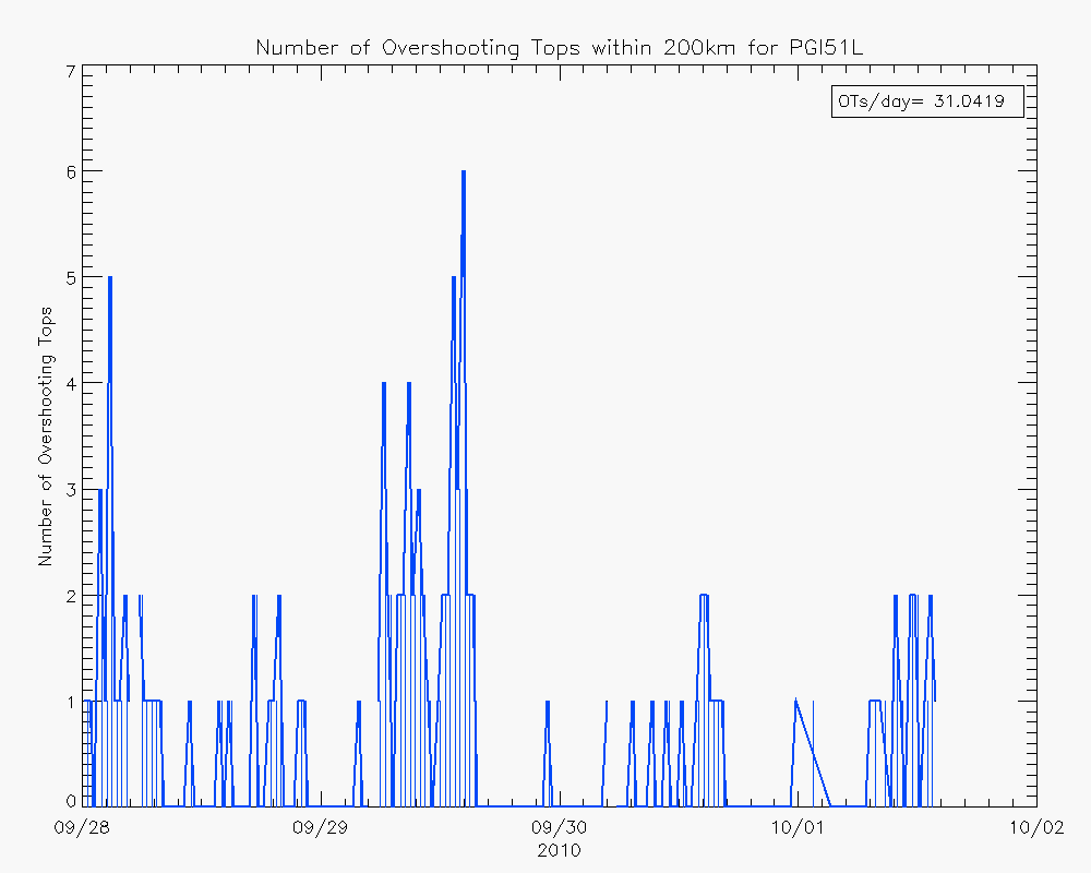
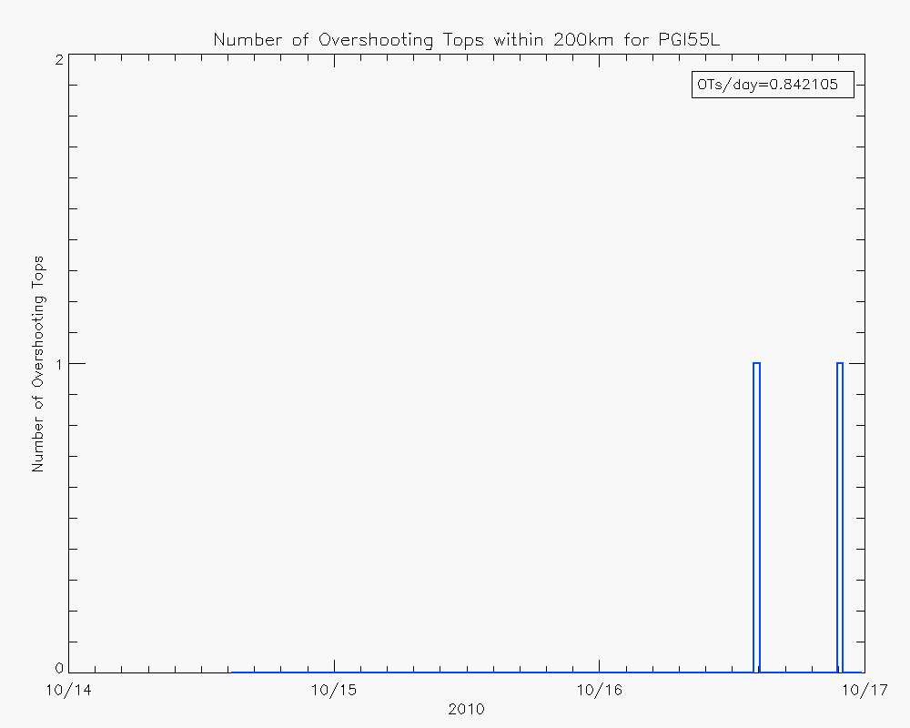
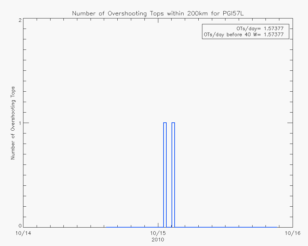
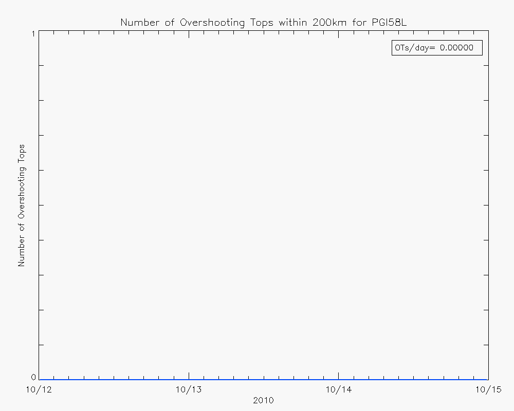
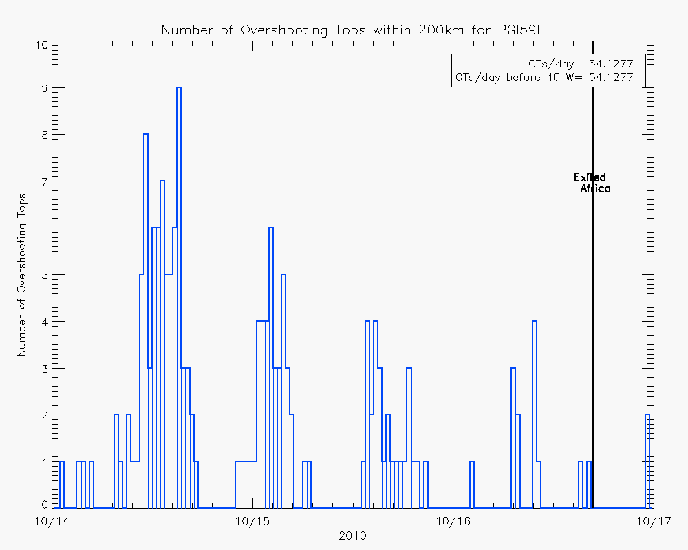
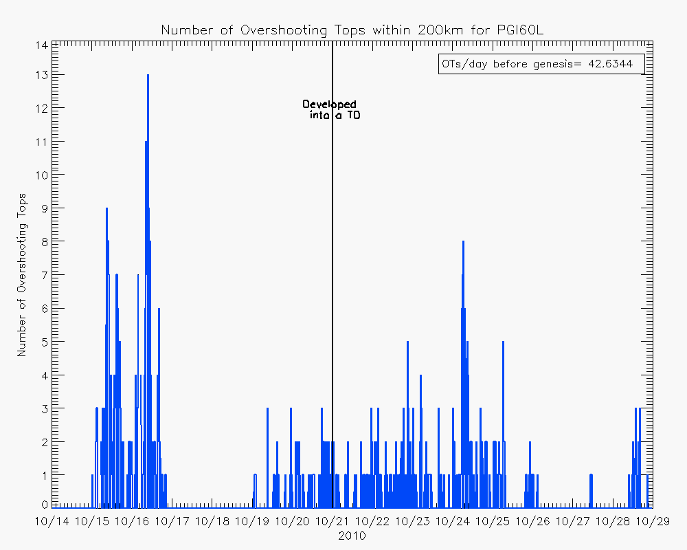
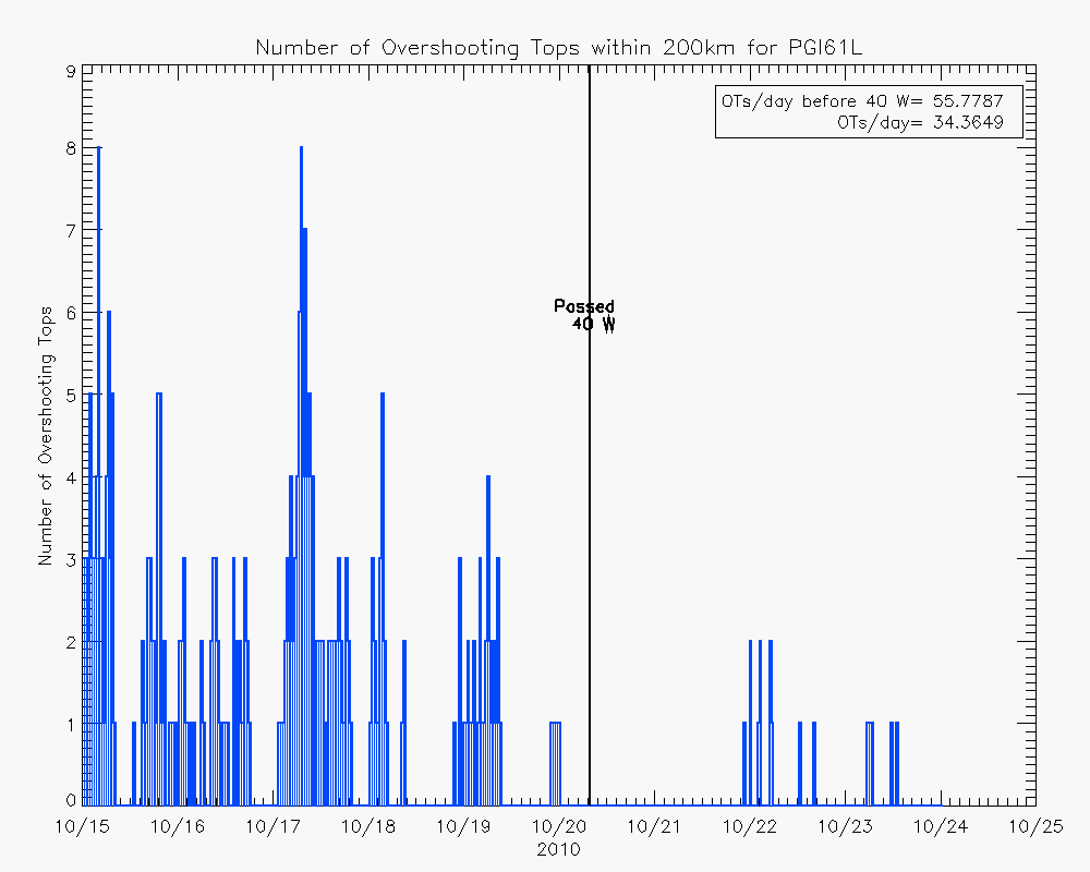
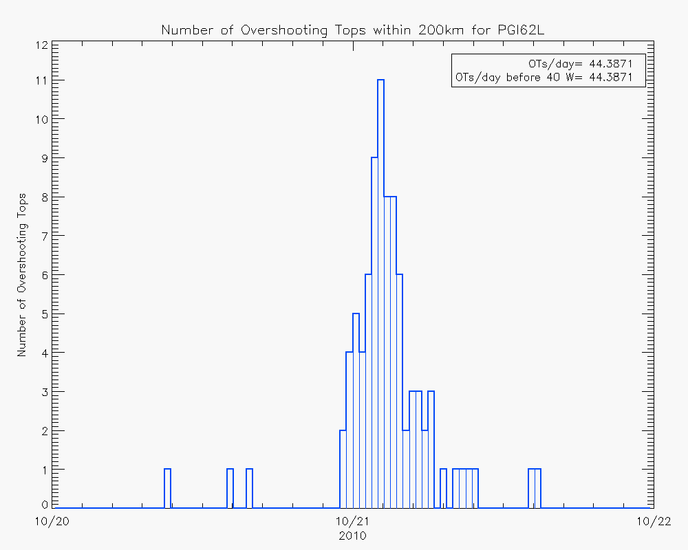
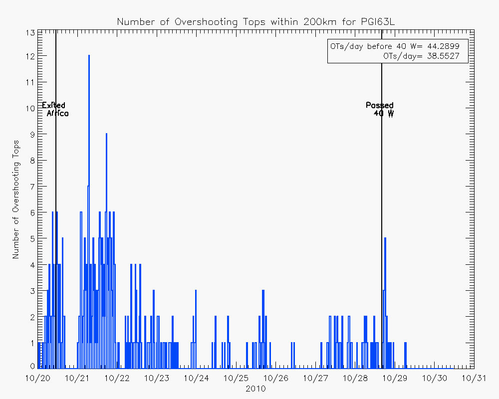
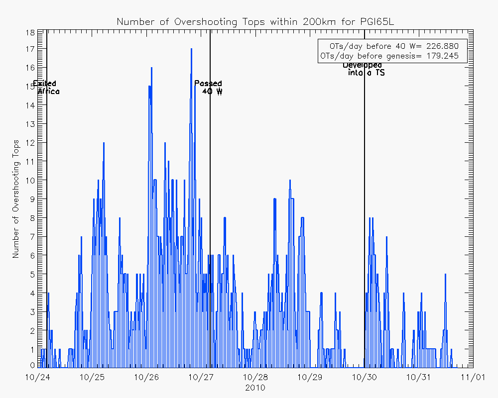
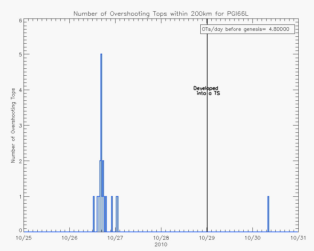
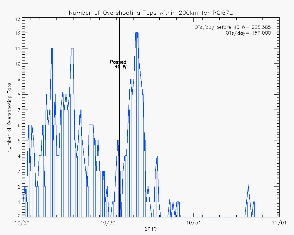
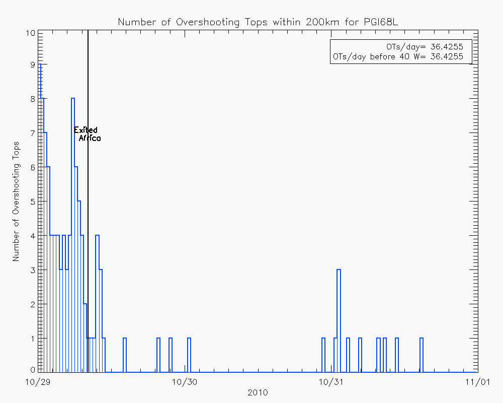
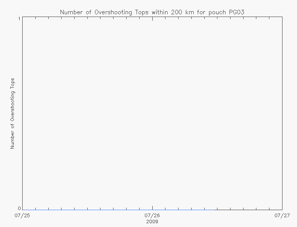
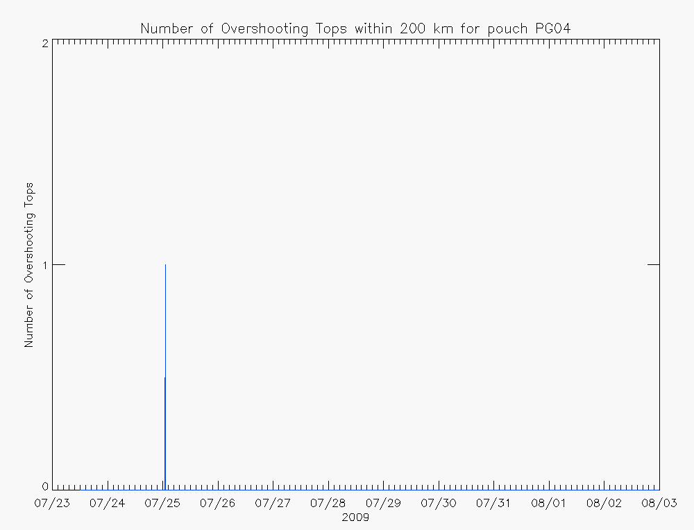
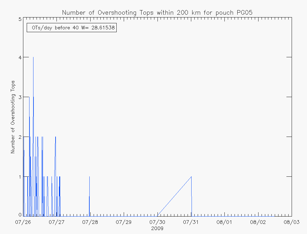
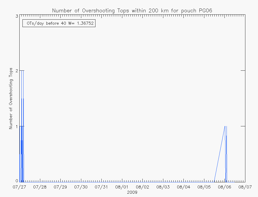
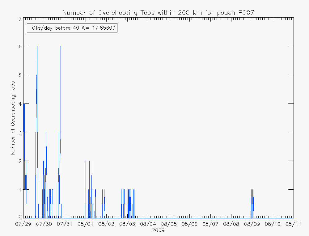
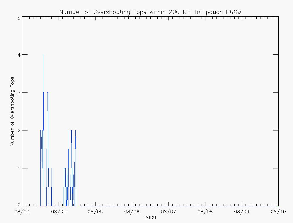
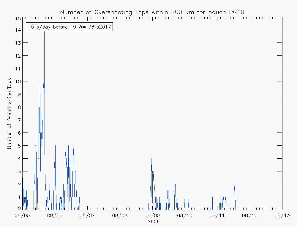
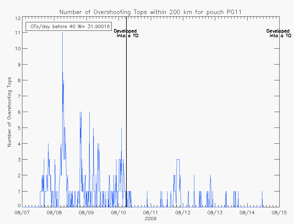
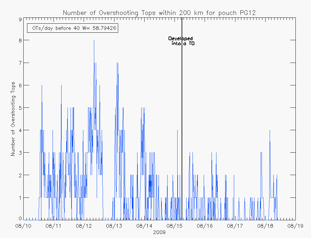
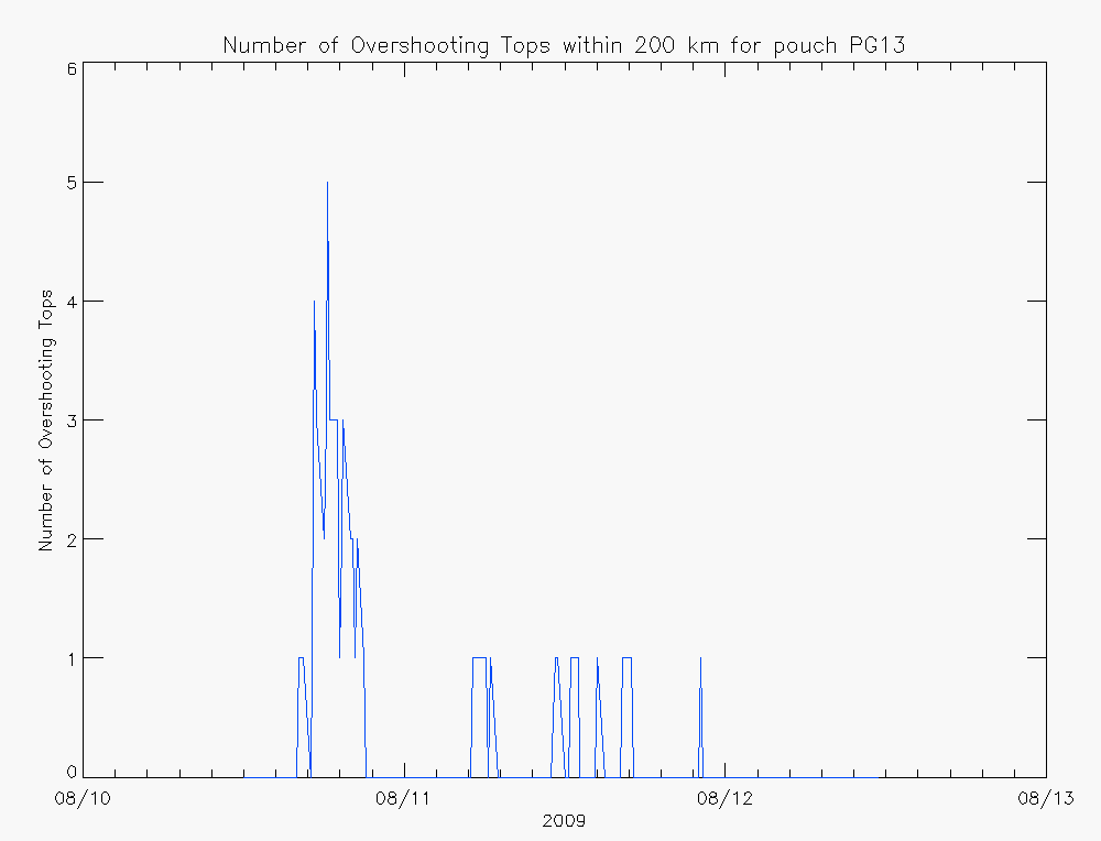
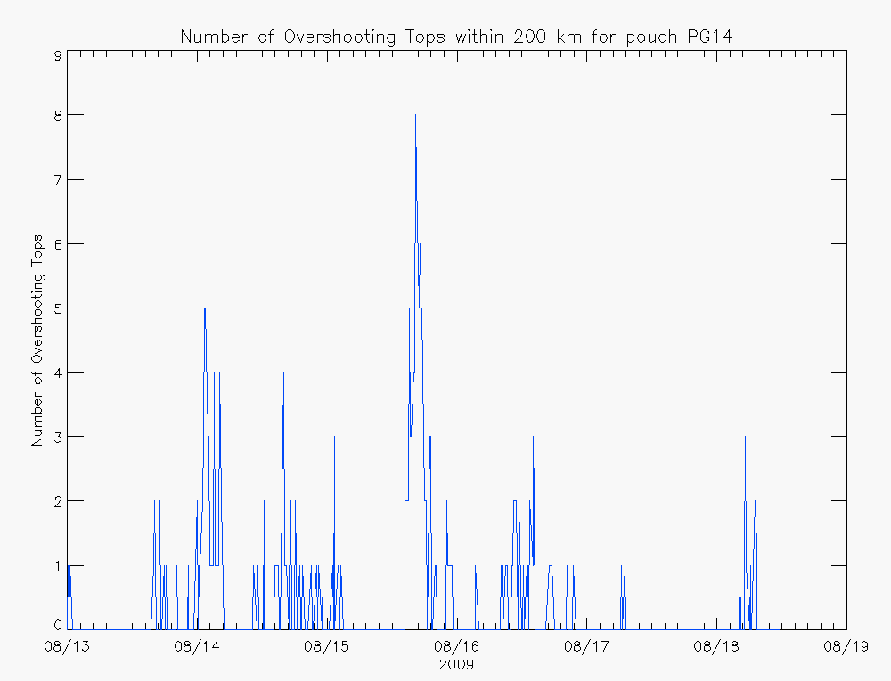
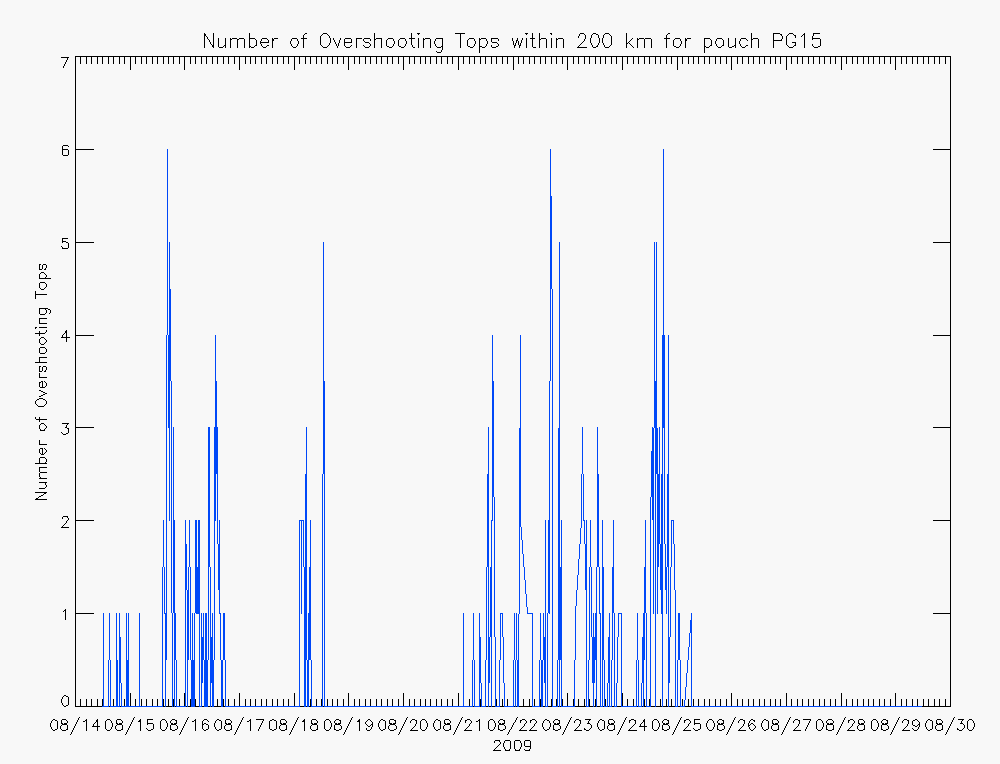
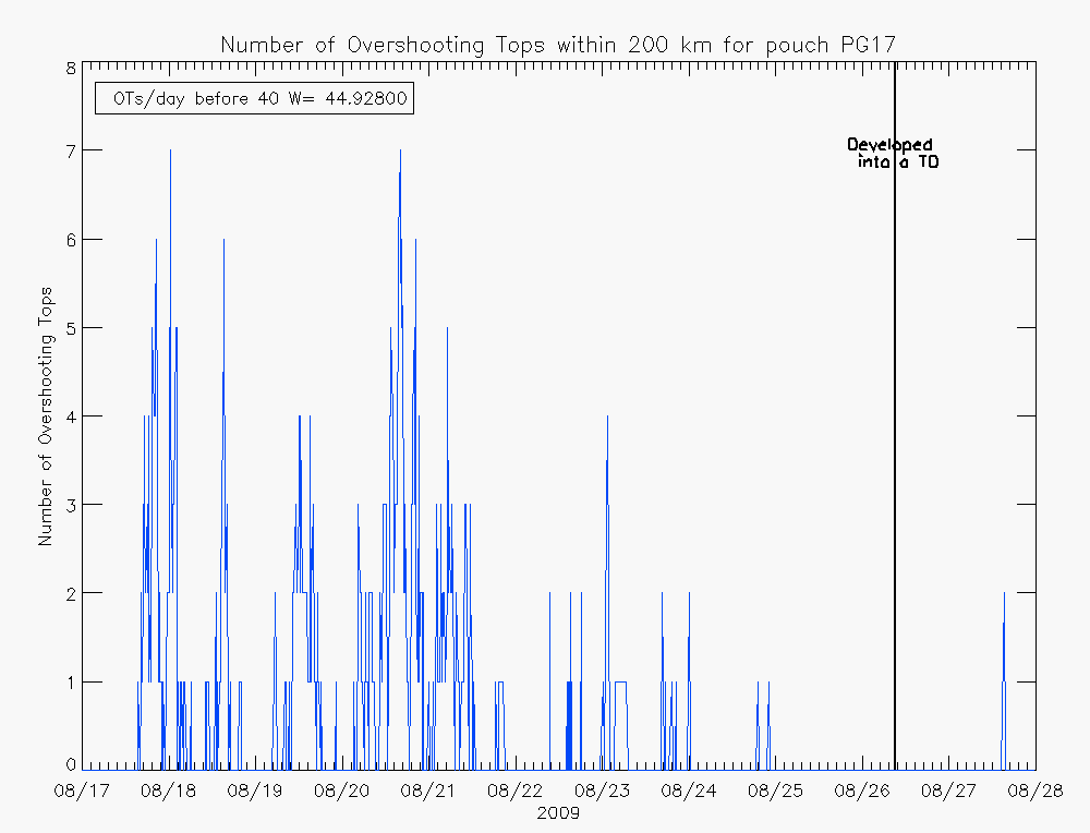
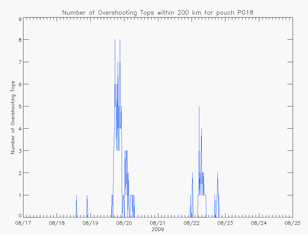
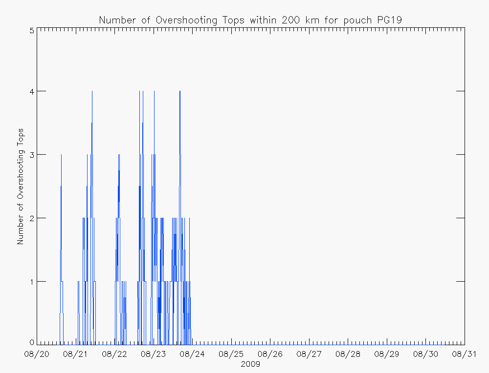
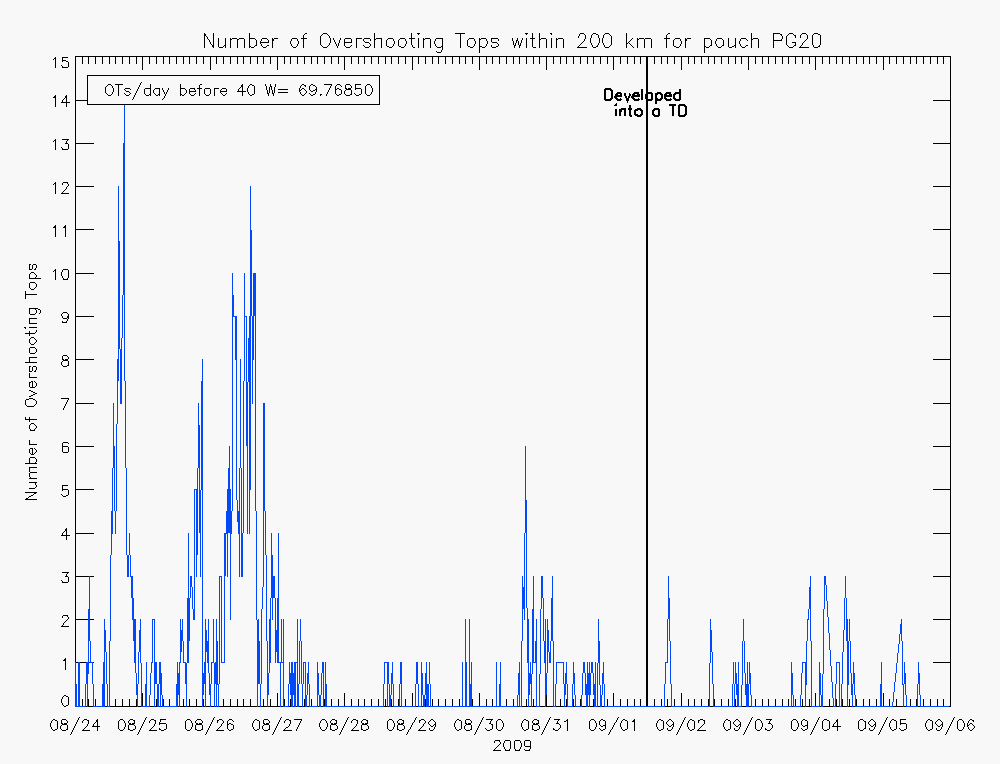
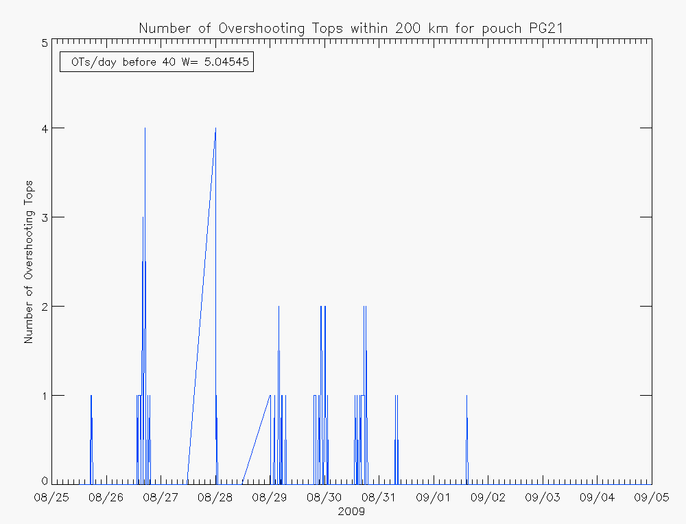
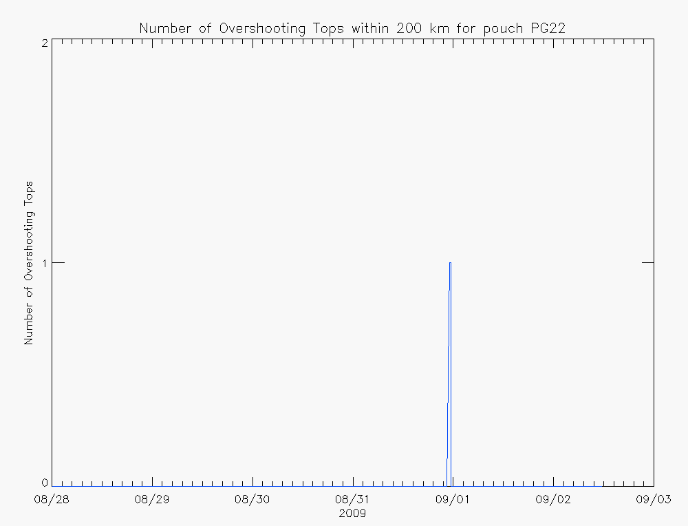
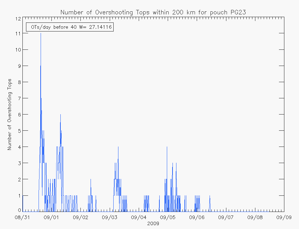
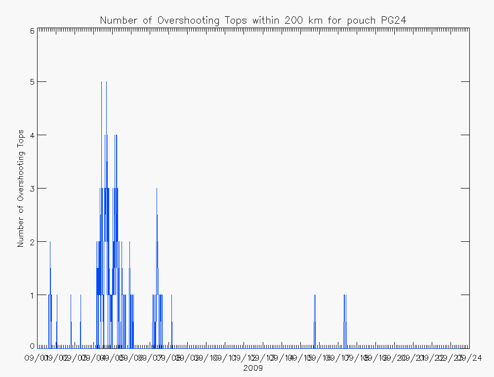
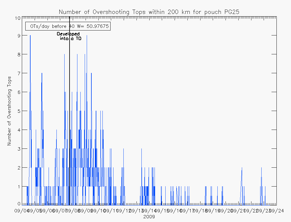
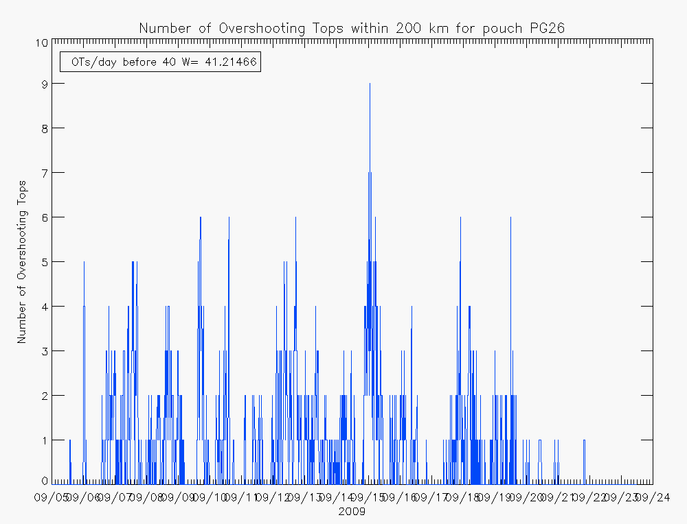
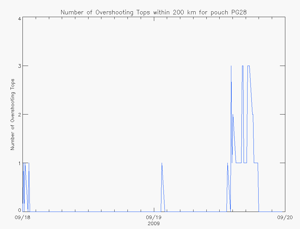
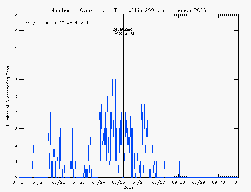
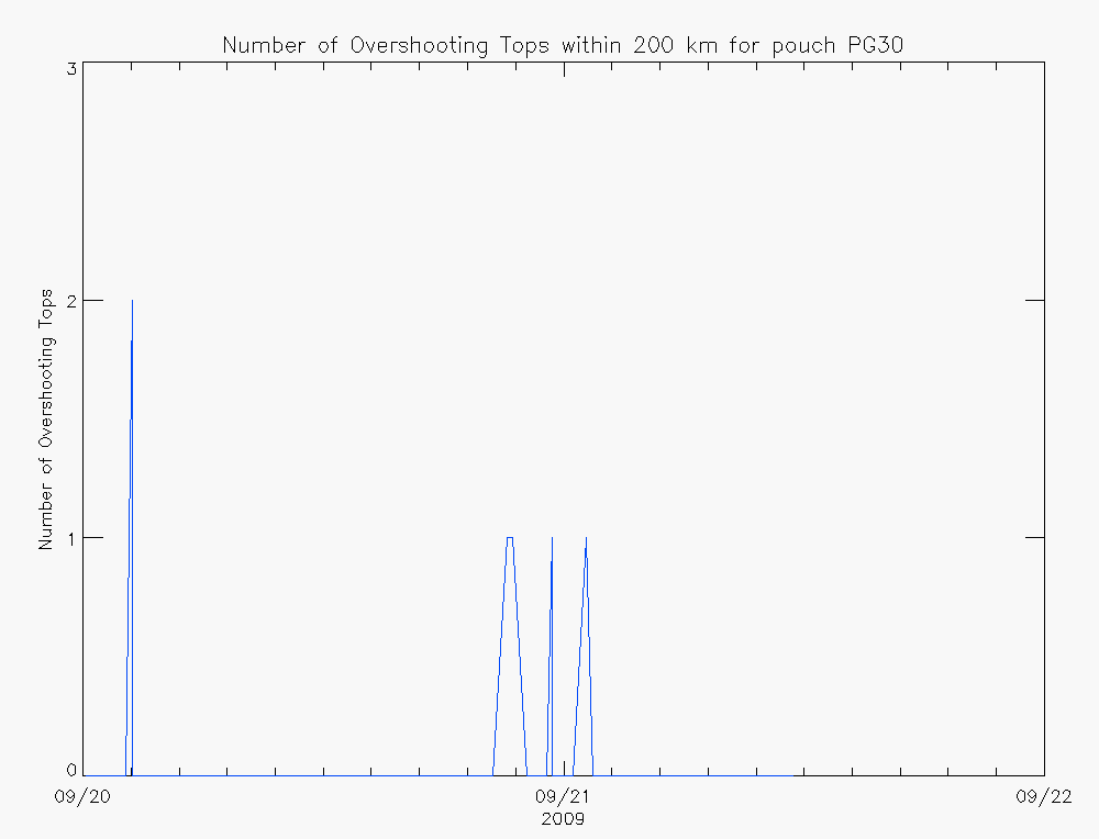
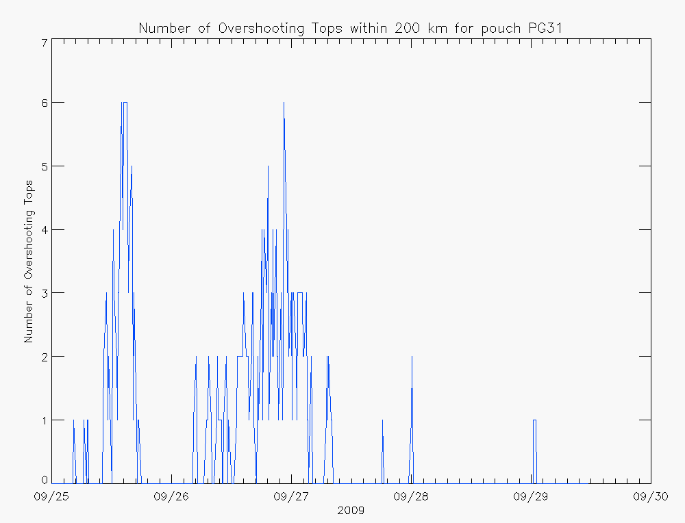
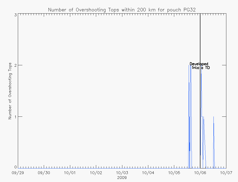
Recent research has indicated that the presence of "vortical" hot towers in pre-genesis tropical cyclones increases a concentrated vertical component of vorticity and therefore increases the likelihood of tropical cyclone development. "Vortical" hot towers are defined as updrafts extending to at least the tropopause (A Vortical Hot Tower Route to Tropical Cyclogenesis, Montgomery et al, 2006). This research looks to employ an objective satellite-based overshooting top detection algorithm to average the number of overshooting tops experienced by an area of potential tropical cyclogenesis. However, instead of using a 6-hour tropopause forecasts, a greater temperature difference between the potential OT and surrounding anvil was used, with potential OTs being colder than 215K. Using this method, potential areas of topical cyclogenesis from 2010 are currently being analyzed and compared to results from 2009, evaluating the average number of overshooting tops per day with the vertical component of vorticity at 40W. Results can be seen at the bottom of the page. The average number of overshooting tops experienced per day can be compared to the UKMet (or ECMWF) 700 hPa vertical component of vorticity at a temporal resolution of 6 hours. Therefore the invest vertical component of vorticity was linearly extrapolated for each satellite scan between the forecast times. Results from 2010 can be seen below. 
In addition, results from 2009, where both position and vertical component of vorticity were linearly extrapolated have a corrlation of 0.792 does not include Hurricane Bill, since Hurricane Bill was a hurricane when crossing 40W whereas the other invests (Hurricane Fred and TD 8) were not (both lost strength before 40W). When including Hurricane Bill, the correlation drops to 0.628. Combining invests from 2009 and 2010 leads to a correlation of 0.75. Main CIMSS PREDICT Support Page DISCLAIMER: THESE PRODUCTS ARE GENERATED ON AN EXPERIMENTAL BASIS. ACCURACY AND TIMELINESS ARE NOT GUARANTEED. Last updated at Mon Apr 25 17:03:20 UTC 2011
|
Past 2010 invest areas
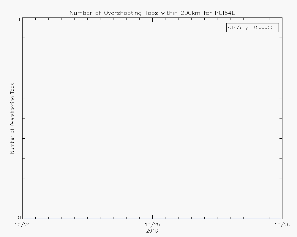
PGI01L PGI02L PGI03L PGI04L PGI05L PGI06L PGI07L PGI08L PGI09L PGI10L PGI11L PGI12L PGI13L PGI14L PGI15L PGI16N PGI16L PGI17L PGI18L PGI19L PGI20L PGI21L PGI22L PGI23L PGI24L PGI25L PGI26L PGI27L PGI28L PGI29L PGI30L PGI31L PGI32L PGI33L PGI34L PGI35L PGI36L PGI37L PGI38L PGI39L PGI40L PGI41L PGI42L PGI43L PGI44L PGI45L PGI46L PGI47L PGI48L PGI49L PGI50L PGI51L PGI52L PGI53L PGI54L PGI55L PGI56L PGI57L PGI58L PGI59L PGI60L PGI61L PGI62L PGI63L PGI64L PGI65L PGI66L PGI67L PGI68L 2009 invest areas PG02L PG03L PG04L PG05L PG06L PG07L PG08L PG09L PG10L PG11L PG12L PG13L PG14L PG15L PG16L PG17L PG18L PG19L PG20L PG21L PG22L PG23L PG24L PG25L PG26L PG27L PG28L PG29L PG30L PG31L PG32L | |||||||||||
