|
|
Low-Level Visible/ShortWave Infrared AMV
Background:
Atmospheric Motion Vectors are derived using a sequence of three images.
Features are targeted in the second image (cirrus cloud edges, gradients in
water vapor, small cumulus clouds, etc.) are tracked within the first and
third images yielding two displacement vectors. These vectors are
averaged to derive the final wind vector.
Vector heights are assigned in a two-step process. The first utilizes the measured
radiances of the target and is based on the spectral response function of the
individual satellite and channel being sampled. The brightness temperature
of the target is derived from this radiance measurement. Once determined,
the brightness temperature is compared with a collocated numerical model
guess temperature profile, from which an initial height is estimated. The
final vector height is derived in the post-processing of the vector field.
CIMSS runs the raw winds through two quality control processes to assure
vector correctness and uniformity. The first process called "autoediting",
a two-stage, three-dimensional objective analysis of the wind field (Hayden and Pursor, 1995).
This scheme utilizes conventional data assimilation, neighboring wind "buddy"
checks, and numerical model analyses for wind vector editing and height
adjustments (Velden et al. 1997).
The second process is the EUMETSAT "Quality Indicator" (QI) methodology
(Holmlund et al., 2001). The QI is a statistically-based scheme which highlights
internal consistancy between vectors without use of a background numerical model.
Uses:
Low-level infrared AMVs are utilized to monitor the atmospheric
motion in the lower troposphere and near the Earth's surface
typically below 600mb
(explanation of heights) by
tracking cloud edges over a sequence of visible or shortwave infrared imagery.
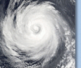
Low-level wind speeds around tropical cyclones (TC) can be monitored using these
AMVs and can be utilized by tropical cyclone (TC) forecasters
to help determine current atmospheric conditions that could affect TC development,
intensity change, and movement (Velden et al., 1998).
Visible imagery has an
inherent advantage over other imagery from other satellite channels due to its
increased spatial resolution, which allows smaller clouds to be tracked and
smaller time periods between imagery to be utilized. This can result in a greater
amount of AMVs analyzed from a sequence of images.
Shorwave infrared (SWIR) imagery can act as a proxy to visible imagery during non-daylight
time periods due to its ability to identify and track clouds near the surface (as opposed to
longwave infrared imagery which typically "sees" higher in the atmosphere).
The spatial and temporal resolution of the SWIR imagery is decreased, as compared to the
visible imagery, resulting in a reduced analysis capability.
Visible and SWIR winds can be numerically adjusted to the surface to estimate the actual
surface wind speeds around a TC. This can provide TC forecasters with information about
TC wind field structure when in situ data from aircraft, buoy, or land observing stations
are not available.
In addition, AMVs can be imported into regional and global numerical models to
provide information within data sparse regions, such as over the oceans and land regions
with little or no atmospheric monitoring capabilities. AMVs have been shown to have
a significant positive impact on the accuracies of numerical models
(Soden et al., 2001 and Goerss et al., 1998).
References:
• Holmlund, K., C. Velden, and M. Rohn, 2001: Enhanced Automated Quality Control
Applied to High-Density Satellite-Derived Winds. Mon. Wea. Rev., 129, 517-529.
• Soden, B. J., C. Velden, and R. Tuleya, 2001: The Impact of Satellite Winds
on Experimental GFDL Hurricane Model Forecasts. Mon. Wea. Rev., 129, 835-852.
• Velden, C. S., T. Olander, and S. Wanzong, 1998: The Impact of Multispectral
GOES-8 Wind Information on Atlantic Tropical Cyclone Track Forecasts in 1995.
Part 1: Dataset Methodology, Description and Case Analysis. Mon. Wea. Rev., 126, 1202-1218.
• Goerss, J., C. Velden, and J. Hawkins, 1998: The Impact of Multispectral GOES-8
Wind Information on Atlantic Tropical Cyclone Track Forecasts in 1995. Part 2:
NOGAPS Forecasts. Mon. Wea. Rev., 126, 1219-1227.
• Velden, C. S., C. Hayden, S. Nieman, W. Menzel, S. Wanzong, and J. Goerss, 1997:
Upper-Tropospheric Winds Derived from Geostationary Satellite Water Vapor
Observations. Bull. Amer. Meteor. Soc., 78, 173-195.
• Hayden, C. M., and R. Purser, 1995: Recursive Filter Objective Analysis of
Meteorological Fields: Applications to NESDIS Operational Processing. J. Appl.
Meteor., 34, 3-15.
Additional AMV-related references available.
For more AMV information, please visit the
International Winds Working Group (IWWG)
page.
|
|
|