
9
Monitoring the Global Environment

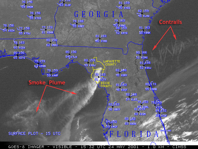
GOES Spots Forest fires
The Geostationary Operational Environmental Satellite (GOES) does much more than track weather systems, GOES images can also help detect wildfires, sometimes before people on the ground know about the danger. GOES has four-4km resolution IR spectral bands that measure electromagnetic radiation in the form of emitted heat so they can detect forest fires of only a few acres in size both day and night. GOES visible images, acquired every 15–30 minutes at up to 1km resolution, monitor the evolution of associated smoke plumes by measuring reflected light.
| 3/ 15 |