
Weather Satellites and Orbits

Geostationary Orbit
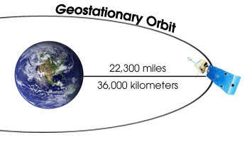
Geostationary satellites orbit the Earth's axis as fast as the Earth spins.
They hover over a single point above the Earth at an altitude of about 36,000 kilometers
(22,300 miles). To maintain constant height and momentum, a geostationary satellite
must be located over the equator.
Scientists determined this position by using Newton's Law of Gravity. The same force
that makes apples fall from trees on Earth is the force that keeps the satellite in
its orbit. Sir Isaac Newton realized that the force of gravity depends on the masses
of the objects involved (more massive objects feel a stronger gravitational force),
and the distance between the objects involved (objects which are close together feel
a stronger gravitational force).
The United States typically operates two geostationary satellites called GOES (Geostationary Operational Environment Satellite). One has a good view of the East Coast; the other is focused on the West Coast. Another satellite in geostationary orbit is the European METEOSAT (METEOrological SATellite), which views the eastern Atlantic Ocean, Africa, and Europe. The Japanese GMS (Geostationary Meteorological Satellite) has a good view of Asia, Australia, and the western Pacific Ocean.
| 3 / 11 |