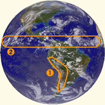
 Mountains & Clouds Mountains & Clouds  This view shows the Andes Mountain range in South America and This view shows the Andes Mountain range in South America and
 a band of clouds at the equator called the ITCZ or Intertropical Convergence Zone. a band of clouds at the equator called the ITCZ or Intertropical Convergence Zone.
| 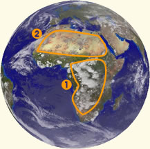 Deserts & Clouds Deserts & Clouds Cumulus clouds developing over Africa are prominent in this image, along with the
vast dry African desert.
|
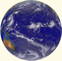 Oceans Oceans This view supports the "Blue Marble" label that Apollo astronauts applied to the planet, largely due to the fact that the surface of Earth is approximately 71% water. | 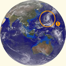 Tropical Storms Tropical Storms This view shows a typhoon in the eastern Pacific ocean.
While most weather moves from west to east, hurricanes and typhoons that form in the tropics track from east to west due to the trade winds.
|