 MODIS MOD07 Direct Broadcast Retrieval Products - TPW
See GOES-MODIS comparisons of Lifted Index
See other MOD07 products: Temperature, Mixing Ratio, Total Ozone, High/Low PW, LI
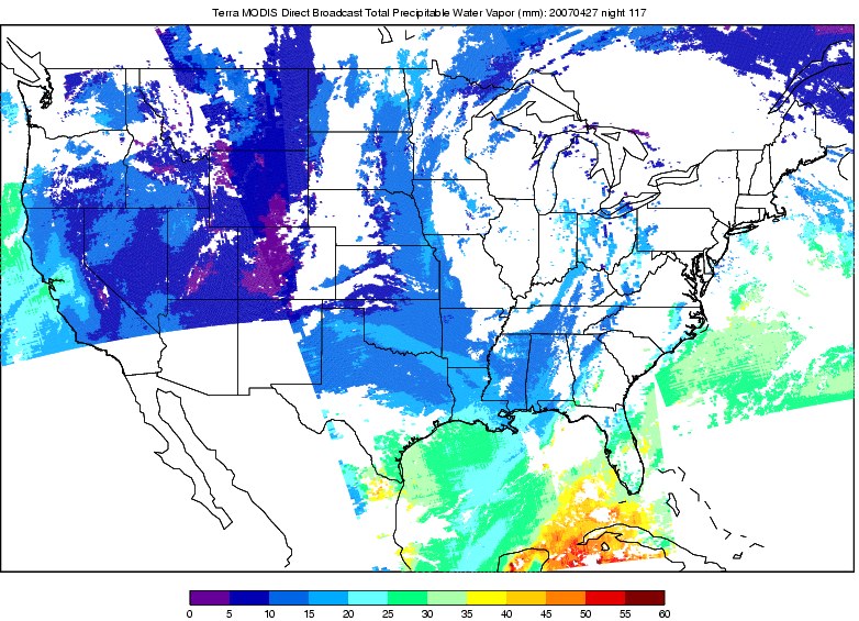 TPW Night Terra |
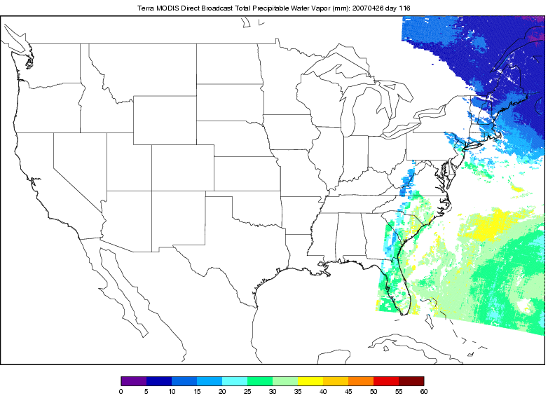 TPW Day Terra |
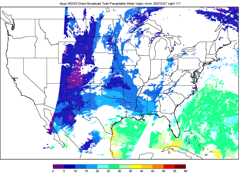 TPW Night Aqua |
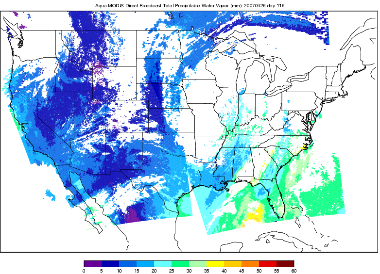 TPW Day Aqua |
 GOES 10 & 12 0400 UTC |
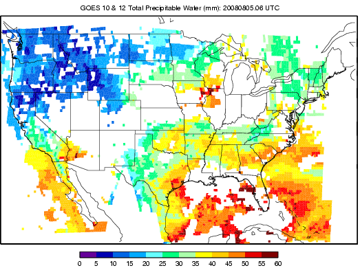
 GOES 10 & 12 0500 UTC |
 GOES 10 & 12 0600 UTC |
 GOES 10 & 12 0700 UTC |
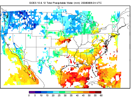
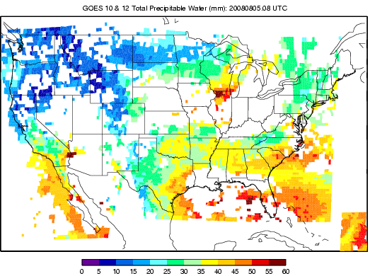 GOES 10 & 12 0800 UTC |
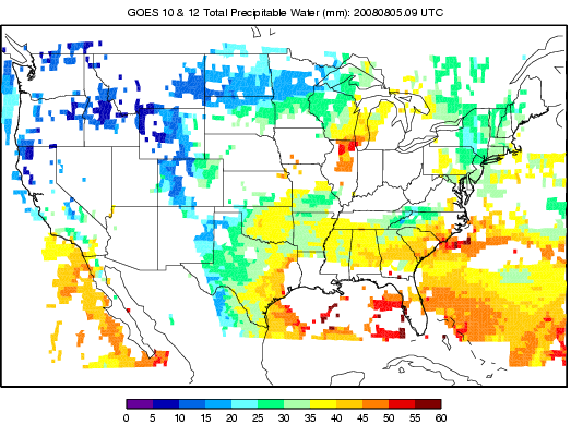 GOES 10 & 12 0900 UTC |
 GOES 10 & 12 1600 UTC |
 GOES 10 & 12 1700 UTC |
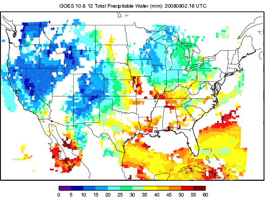
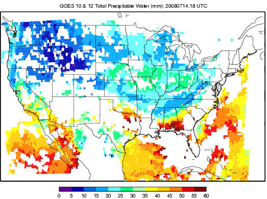 GOES 10 & 12 1800 UTC |
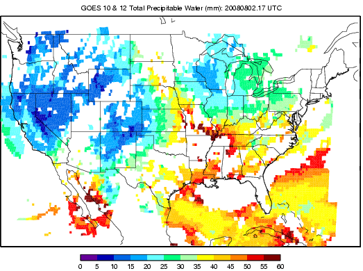
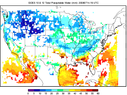 GOES 10 & 12 1900 UTC |
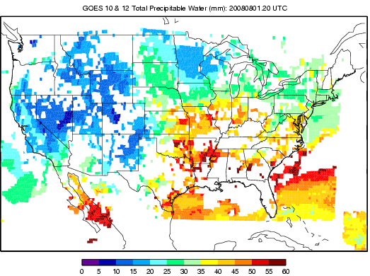 GOES 10 & 12 2000 UTC |
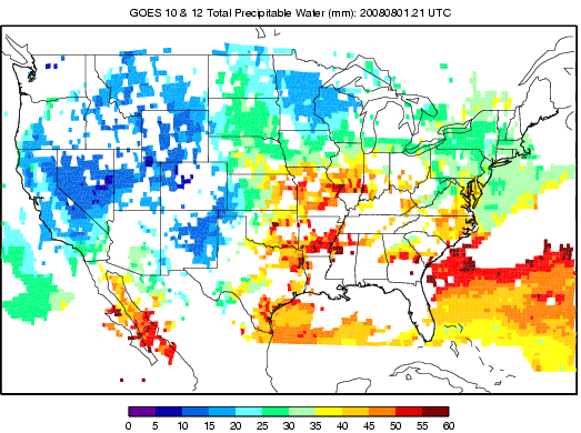 GOES 10 & 12 2100 UTC |
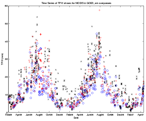
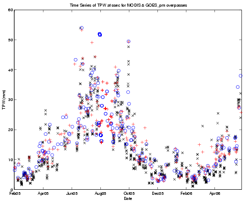
TPW Time Series: MODIS Terra & Aqua, GOES
|
Aqua o Terra + GOES x SGP MWR . |
 SGP: Night Passes |
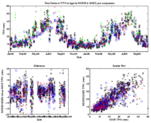 SGP: Day Passes |
 SSEC: Night Passes |
 SSEC: Day Passes |
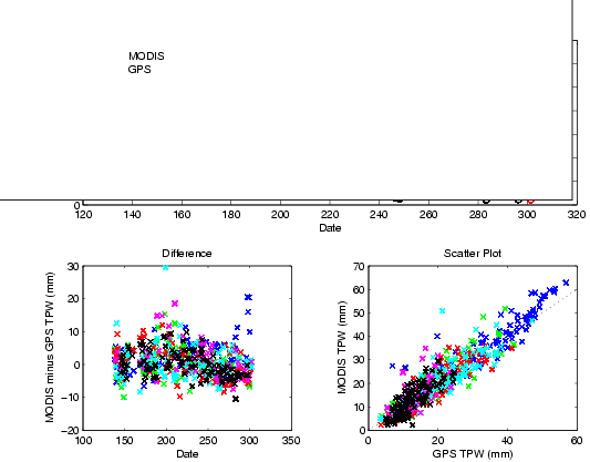
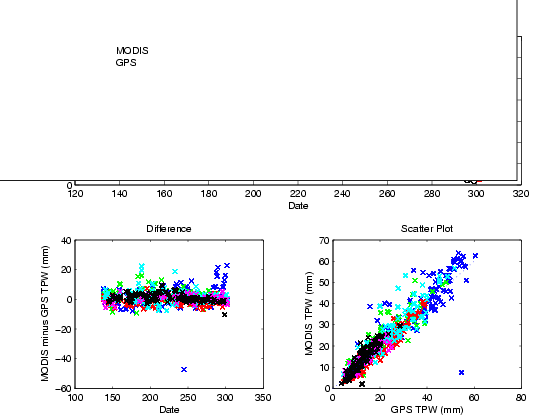
TPW Time Series: MODIS Terra & Aqua, GPS
|
CCV3 |
 Terra: Night Passes |
 Terra: Day Passes |
 Aqua: Night Passes |
 Aqua: Day Passes |
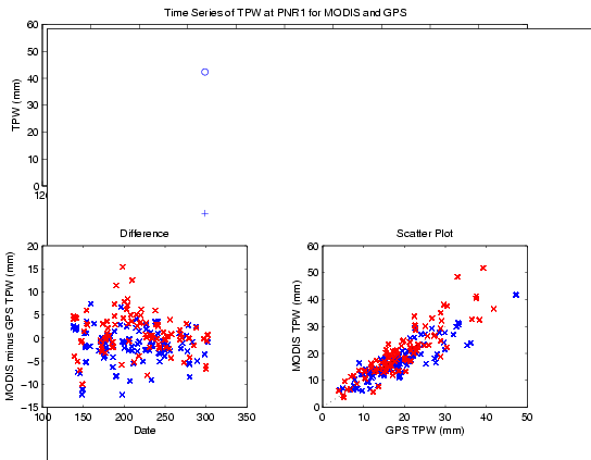
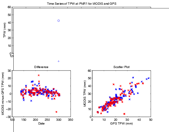
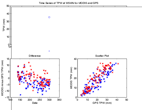
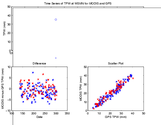
TPW Time Series at GPS Station Sites
Night, Day CCV3: Cape Canaveral, FL. Elevation: 3.82 m, Latitude: 28.46, Longitude: -80.55
Night, Day PNR1: Pine River, MN. Elevation: 446.84 m, Latitude: 46.86, Longitude: -94.72
Night, Day WSMN: White Sands, NM. Elevation: 1226.04 m, Latitude: 32.41, Longitude: -106.35
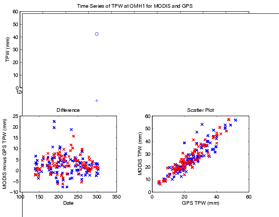
Night, Day OMH1: Omaha, NE. Elevation: 426.05 m, Latitude: 41.78, Longitude: -95.91
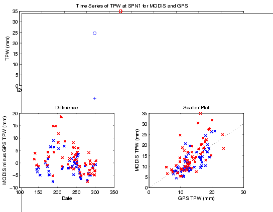
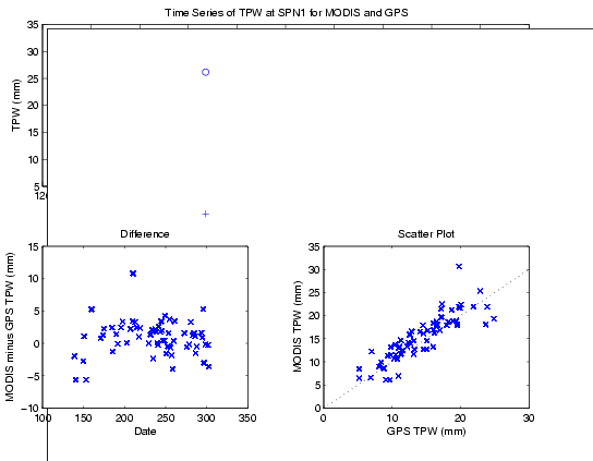
Night, Day SPN1: Spokane, WA. Elevation: 738.21 m, Latitude: 47.52, Longitude: -117.42
Night, Day MBWW: Medicine Bow, WY. Elevation: 1997.71 m, Latitude: 41.90, Longitude: -106.19