'MIMIC': A new approach to
visualizing microwave imagery of
tropical cyclones
Supplemental Animations
Movie 1.
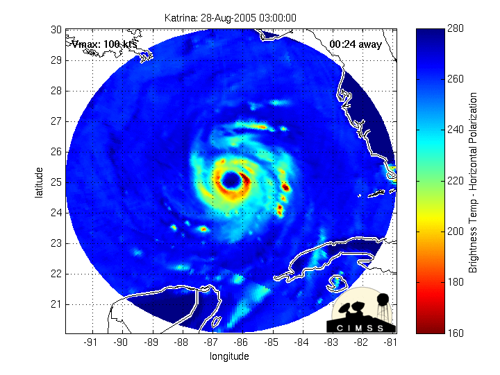
Demonstration MIMIC-TC product using three microwave images of
Hurricane
Katrina (2005)
Movie 2.
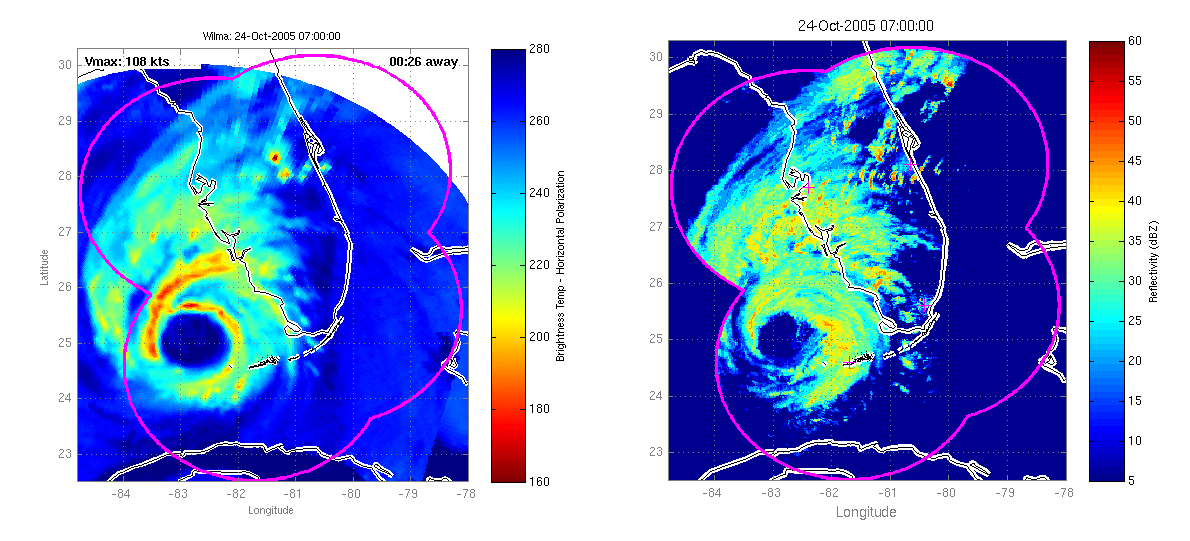
Side-by-side comparison of MIMIC-TC and NEXRAD surface-level radar
composite for Hurricane Wilma (2005) landfall on Florida
Movie 3.
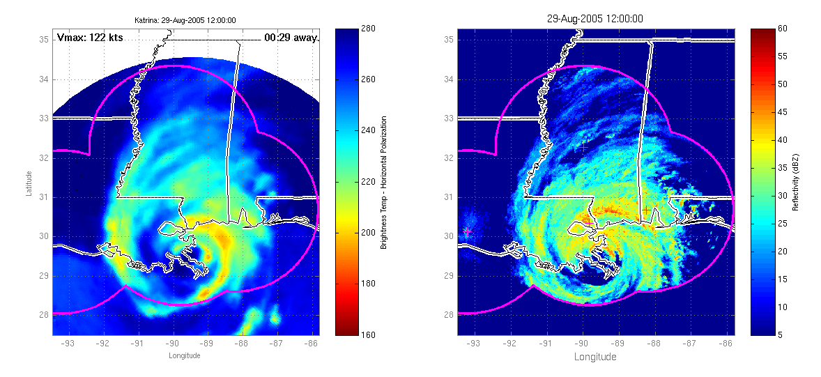
Side-by-side comparison of MIMIC-TC and NEXRAD surface-level radar
composite for Hurricane Katrina (2005) landfall on the Gulf coast
Movie 4.
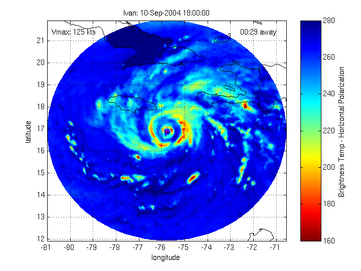
Eyewall replacement cycle in Ivan (2004) and its brush with Jamaica
Movie 5.
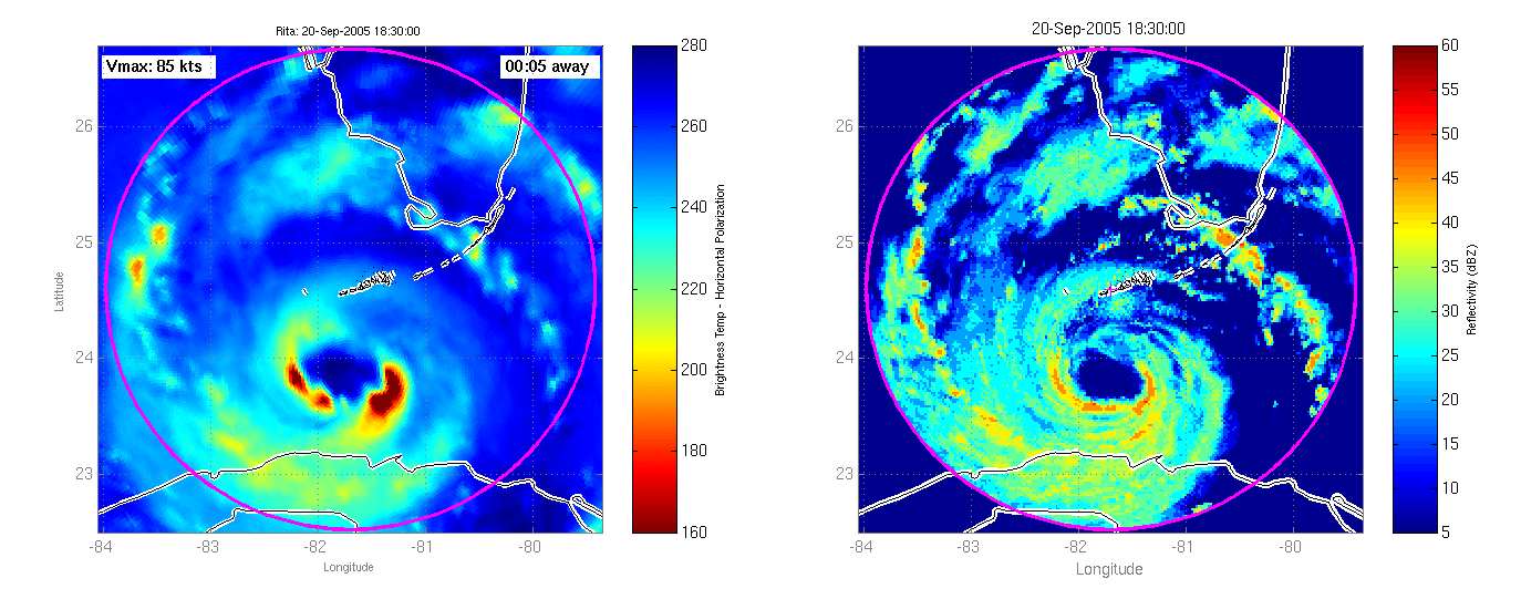
Side-by-side comparison of MIMIC-TC and NEXRAD surface-level radar
composite for Hurricane Rita (2005) crossing the Key West radar station
Movie 6.
Demonstration of MIMIC-IR for Hurricane Wilma (2005)
Additional Links
MIMIC
real-time operational product, archive, and gallery
CIMSS Tropical
Cyclones page
Last Revised: 26 Feb 2007
Anthony Wimmers and Chris Velden
Cooperative Institute for Meteorological Satellite Studies
University of Wisconsin - Madison