 Joint
Airborne IASI Validation Experiment (JAIVEx) at UW-Madison SSEC/CIMSS
Joint
Airborne IASI Validation Experiment (JAIVEx) at UW-Madison SSEC/CIMSSForecast Discussion for 0300 - 830 UTC 15 April 2007 N. GOM
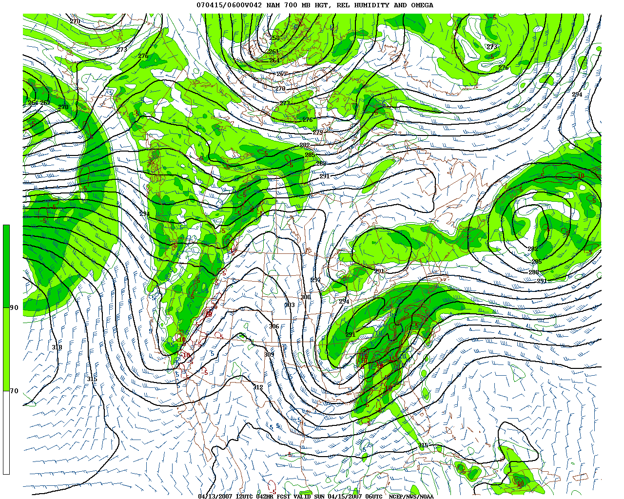
The major weather story is the strong low pressure system in the Southern US and trailing cold front extending through north central GOM. Strong subsidence will occur in the wake of the cold frontal passage, however the frontal system will be in the area of flight interest during the target time/location domain. Here is the 42 Hour 700 mb RH and precipitation NAM forecast valid for 6 UTC 15 April (from 12 UTC 13 April run…)

The situation will have to be monitored tomorrow (Saturday)……