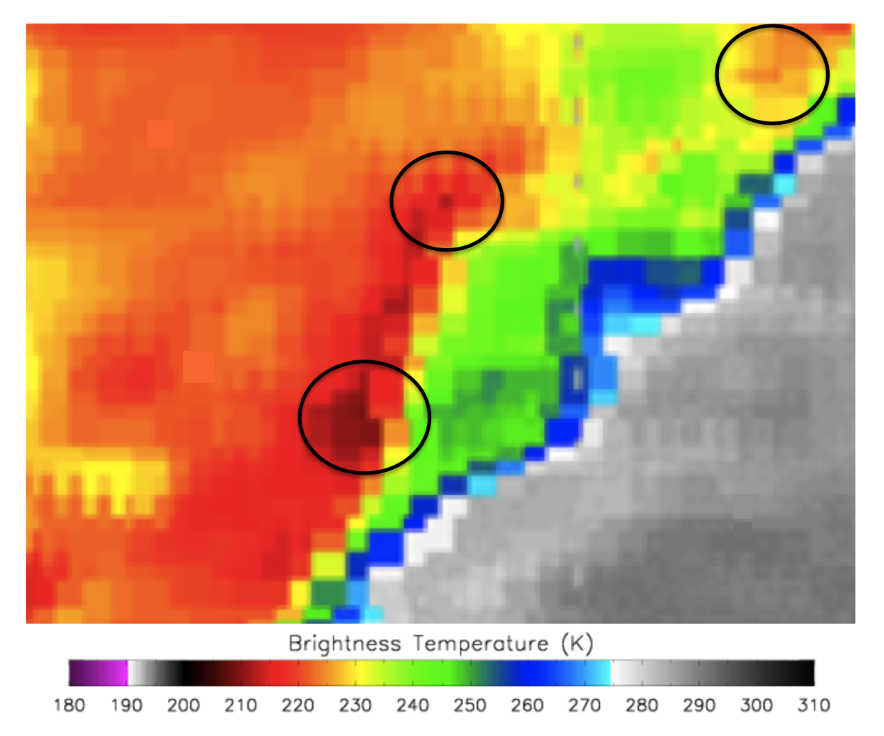
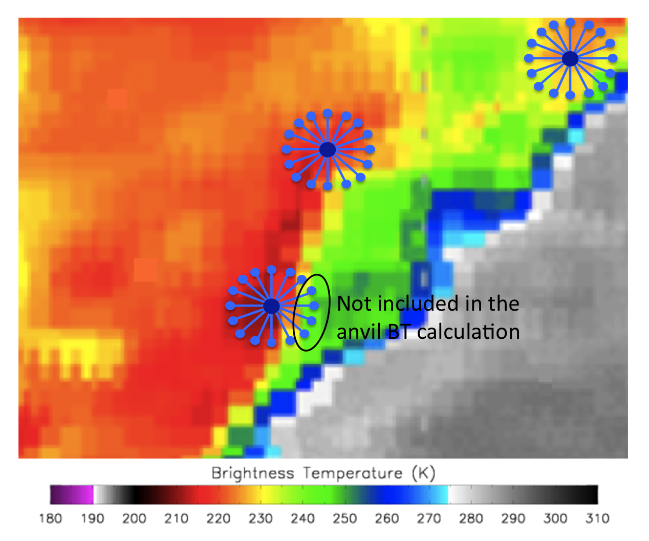
About the algorithmThe objective satellite-based tropical overshooting cloud top (TOT) detection algorithm is a modified version of the mid-latituded overshooting top detection algoirthm presented be Bedka et al. (2010). Formulated around the premise that TOTs appear as small clusters of pixels (≤ 15 km diameter) significantly colder than the surrounding anvil cloud, relative BT minima that are lower than 215 K are first identified. Checks are then performed to ensure that no minima are located within 15 km of each other so that portions of the same TOT are not classified as two independent tops.
The IRW BT of the anvil cloud surrounding the potential TOT is then sampled at an ~8 km radius in 16 directions. The surrounding anvil pixels must have an IRW temperature at or colder than 225 K to be included in the mean computation. At least 5 valid anvil pixels must be present. The 9-of-16 pixel criterion is imposed to ensure that the anvil is of relatively large horizontal extent.
A pixel is classified as an overshooting top if it is &le 9 K colder than the mean BT of the surrounding anvil cloud. This would imply that the pixel is approximately 1.2 km above the anvil (Folkins 2002). As this process identifies only one pixel at the location of an TOT minimum BT, a filling procedure is performed when necessary to capture the remaining neighboring pixels that comprise the entire TOT. In addition, candidate overshooting top pixels can be compared NWP tropopause temperature to verify that these pixels are indeed overshooting. The American Meteorological Society (AMS) Glossary of Meteorology (Glickman 2000) defines an OT as “A domelike protrusion above a cumulonimbus anvil, representing the intrusion of an updraft through its equilibrium level.” Lui and Zipser (2005) indicates the mean reference height for the equilibrium level, which must be exceeded based on the AMS definition of an OT, is almost 2 km lower than the NCEP tropopause height in the tropics. Therefore, no reference for the tropopause height will be included when analyzing Tropical OTs. For a full description, please see Bedka et al. (2010).
|