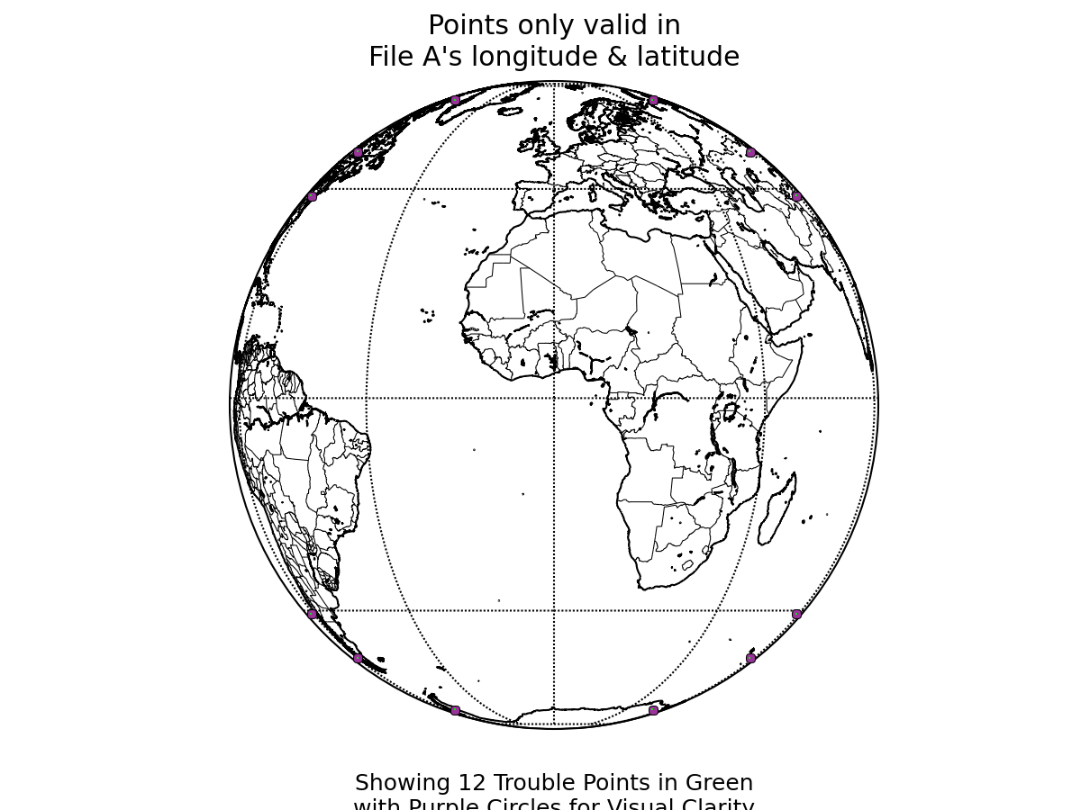
File A has 12 valid data points not present in File B.
File A has a total of 25.39% invalid longitude/latitude data.
report produced with glance, version 0.2.6.12
comparison generated Fri Oct 23 17:07:23 2009 by user evas on craackly.ssec.wisc.edu
file A:
path: /tmp/graemem/geocatNAV.Meteosat-8.2006237.120000.updated_terms.hdf
md5sum for file A: ee03be65dcdb4557743300fc31230a02
last modified: Fri Oct 23 16:46:20 2009
file B:
path: /home/rayg/Data/seviri_nav/msgnav_geocat2.hdf
md5sum for file B: 024170ff14caf3f2523151b146defb3a
last modified: Thu Oct 22 22:12:56 2009
latitude: pixel_latitude
longitude: pixel_longitude
longitude/latitude comparison epsilon: 0.1
File A has 12 valid data points not present in File B.
File A has a total of 25.39% invalid longitude/latitude data.
lon/lat data that is invalid in either file A or file B: 25.39%

Variable: pixel_latitude
Epsilon used: 2e-05
Finite values within one epsilon of difference: 49.0192%
Data that matched in finite-ness between the files: 100%Variable: pixel_longitude
Epsilon used: 2e-05
Finite values within one epsilon of difference: 34.0474%
Data that matched in finite-ness between the files: 100%
The following variables were common to both files:
pixel_latitude
pixel_longitude
Variables only found in file A:
pixel_sea_surface_temperature
pixel_desert_mask
pixel_land_mask
pixel_coast_mask
pixel_satellite_azimuth_angle
pixel_surface_elevation
pixel_volcano_mask
pixel_ecosystem_type
pixel_surface_type
pixel_space_mask
pixel_satellite_zenith_angle
pixel_snow_mask