
File A has 88 valid data points not present in File B.
File A has a total of 25.39% invalid longitude/latitude data.
report produced with glance, version 0.2.6.12
comparison generated Thu Oct 22 23:23:58 2009 by user evas on craackly.ssec.wisc.edu
file A:
path: geocatNAV.Meteosat-8.xxxxxxx.000001.hdf
md5sum for file A: 3ae850f04c421ba95f7e805980bb9836
last modified: Thu Oct 22 19:55:45 2009
file B:
path: nav_geocat2.hdf
md5sum for file B: 5db00f839216229af8cf9ea8254b68ca
last modified: Thu Oct 22 19:55:46 2009
latitude: pixel_latitude
longitude: pixel_longitude
longitude/latitude comparison epsilon: 0.1
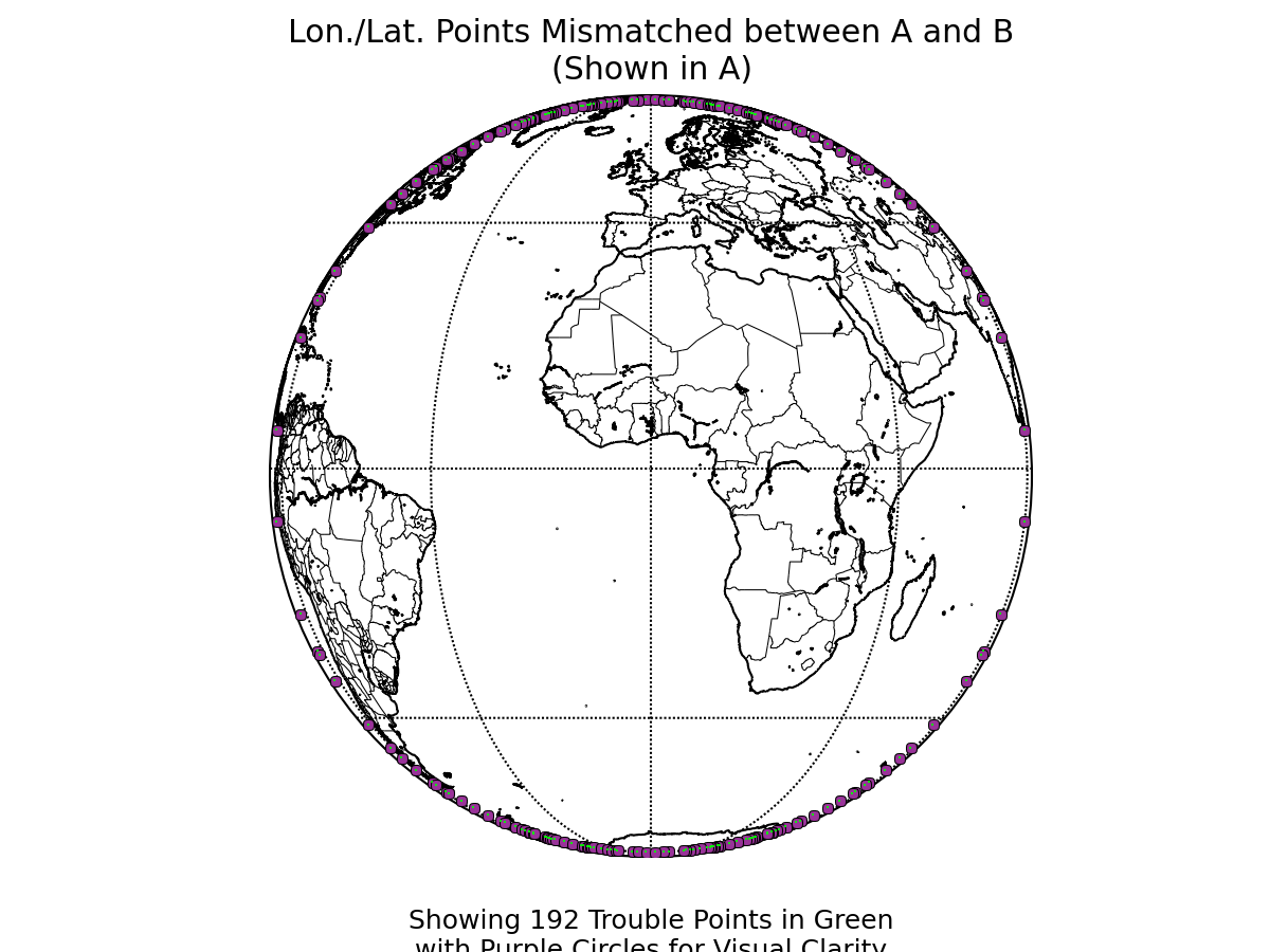
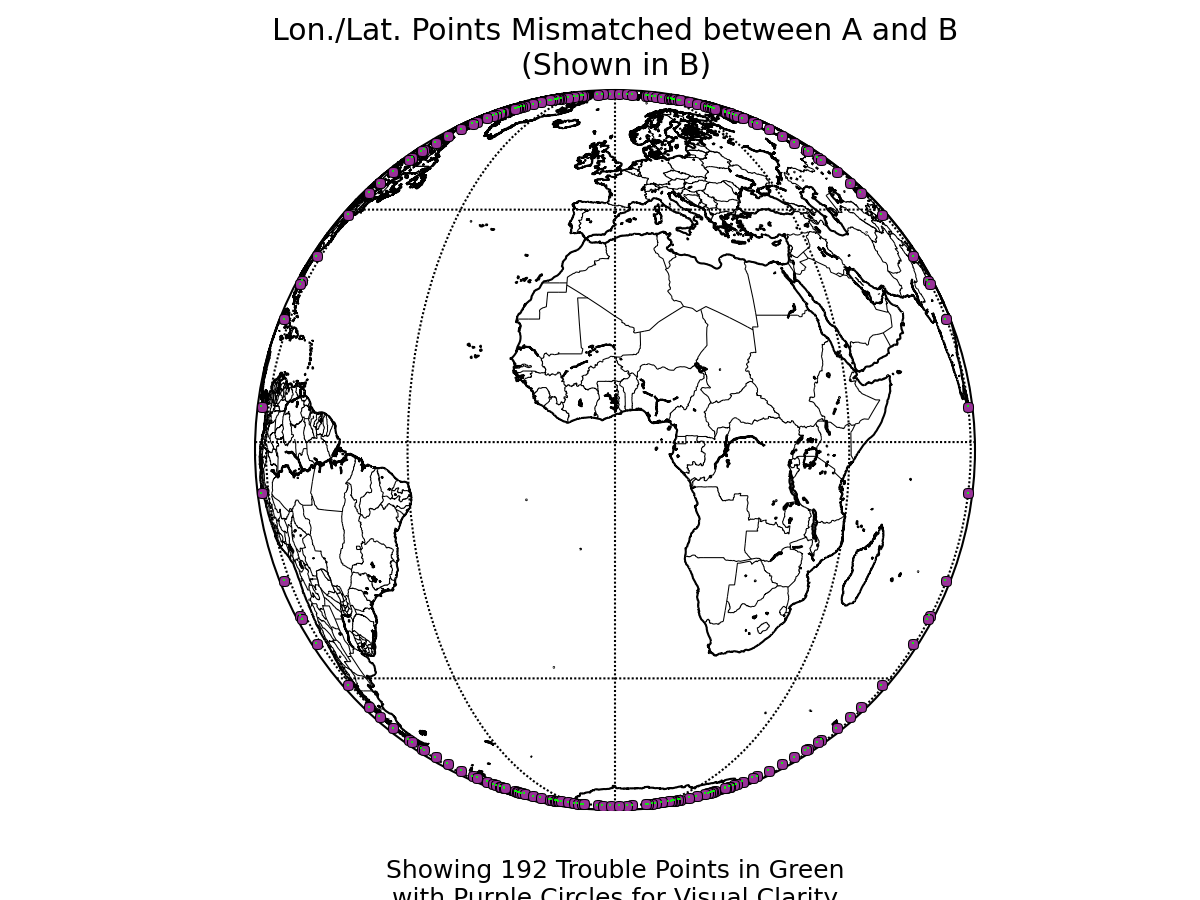
WARNING: 192 data points
(0.001393% of all data)
show possible mismatch in values stored in file a
and file b longitude and latitude values. Depending on the degree of mismatch, some data value comparisons
in this report may be distorted or spatially nonsensical. Please consider re-running this report and including an
examination of your longitude and latitude variables with appropriate epsilons in order to analyze the significance
of the difference.
View mismatching points in A's lon/lat system
View mismatching points in B's lon/lat system
File A has 88 valid data points not present in File B.
File A has a total of 25.39% invalid longitude/latitude data.
lon/lat data that is invalid in either file A or file B: 25.39%

Variable: pixel_latitude
Epsilon used: 0.0002
Finite values within one epsilon of difference: 70.4034%
Data that matched in finite-ness between the files: 100%Variable: pixel_longitude
Epsilon used: 0.0002
Finite values within one epsilon of difference: 53.3909%
Data that matched in finite-ness between the files: 100%
The following variables were common to both files:
pixel_latitude
pixel_longitude
Variables only found in file A:
pixel_sea_surface_temperature
pixel_desert_mask
pixel_land_mask
pixel_coast_mask
pixel_satellite_azimuth_angle
pixel_surface_elevation
pixel_volcano_mask
pixel_ecosystem_type
pixel_surface_type
pixel_space_mask
pixel_satellite_zenith_angle
pixel_snow_mask