comparison produced Fri Jul 17 14:37:05 2009 by user graemem on yurt.ssec.wisc.edu
file A:
file path: /Volumes/rets5/cvs/geocat/l2_output/geocatL2.GOES-R.2005155.220000.cape_stability_test_1.hdf
md5sum for file A: 74f1b78bd3570d5ad67fa2beab9f7974
last modified: Fri Jul 17 11:36:25 2009
file B:
file path: /Volumes/rets5/cvs/geocat/l2_output/geocatL2.GOES-R.2005155.220000.cape_stability_test_5.hdf
md5sum for file B: 374be47b305a8ea950746b708490efee
last modified: Fri Jul 17 12:17:17 2009
latitude: imager_prof_retr_abi_r4_generic2
longitude: imager_prof_retr_abi_r4_generic1
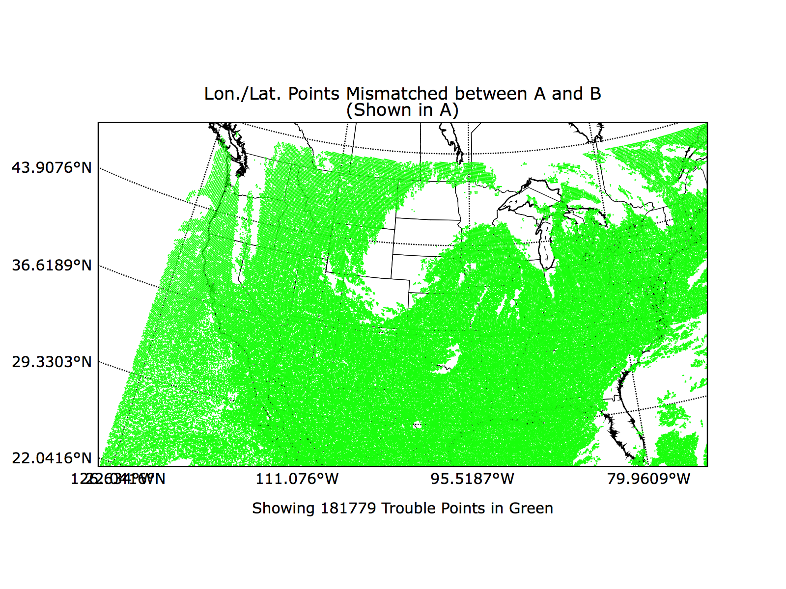
WARNING: 181779 data points show possible mismatch in values stored in file a
and file b longitude and latitude values. Depending on the degree of mismatch, some data value comparisons
in this report may be distorted or spacially nonsensical. Please consider re-running this report and including an
examination of your longitude and latitude variables with appropriate epsilons in order to analyze the significance
of the difference.
View mismatching points in A's lon/lat system
View mismatching points in B's lon/lat system
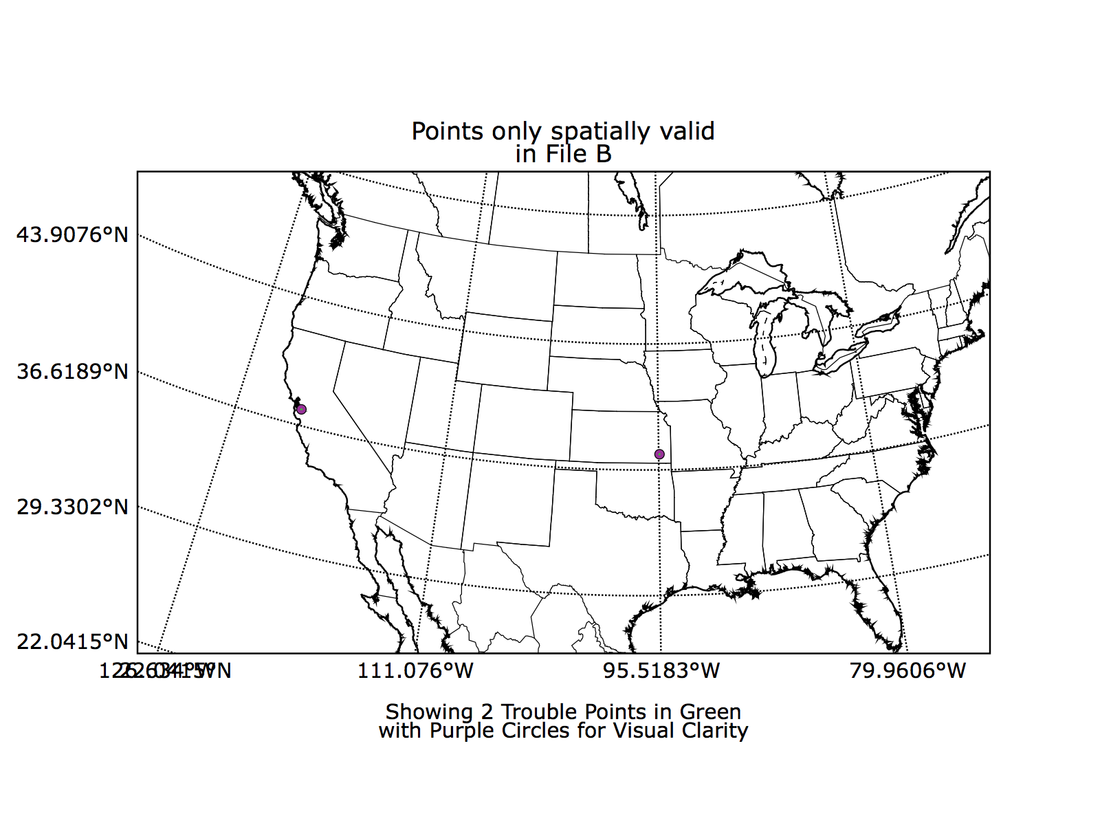
File A has
2 spacially valid data points not present in File B.
File A has a total of 42.5% spacially invalid data.
File B has
2 spacially valid data points not present in File A.
File B has a total of 42.5% spacially invalid data.
data that is spacially invalid in either file: 42.5%
Variable: imager_prof_retr_abi_cape
Epsilon used: 0.0
Finite values within one epsilon of difference: 47.19%
The following variables were common to both files:
pixel_relative_azimuth_angle
imager_prof_retr_abi_showalter_index
imager_prof_retr_abi_total_totals_index
baseline_cmask_seviri_cloud_mask_packed
pixel_ecosystem_type
imager_prof_retr_abi_wprof
imager_prof_retr_abi_total_precipitable_water_high
imager_prof_retr_abi_k_index
imager_prof_retr_abi_total_precipitable_water
nwp_x_index
baseline_cmask_seviri_i1_generic1
pixel_solar_zenith_angle
imager_prof_retr_abi_tprof
imager_prof_retr_abi_cape
imager_prof_retr_abi_r4_generic1
imager_prof_retr_abi_r4_generic2
pixel_surface_type
baseline_cmask_seviri_r4_generic2
baseline_cmask_seviri_r4_generic3
baseline_cmask_seviri_r4_generic1
imager_prof_retr_abi_total_precipitable_water_mid
nwp_y_index
pixel_satellite_zenith_angle
baseline_cmask_seviri_cloud_mask
imager_prof_retr_abi_lifted_index
pixel_latitude
imager_prof_retr_abi_land_surface_temperature
imager_prof_retr_abi_total_precipitable_water_low
pixel_longitude