On 18 September 1997, substantial changes were implemented for the GOES-8 and GOES-9 Sounder Derived Product Images (DPI) disseminated on the Realtime GOES section of the CIMSS Homepage (CHoP). A strong motivation for the change was to improve the overall consistency between the DPI from the two satellites. Due to computer resource limitations as well as practical difficulties dealing with maintaining stability amidst system and version upgrades, a mixed set of DPI had previously existed on the CHoP: GOES-9 DPI (in the west) were obtained by a hybrid physical/statistical method, where coefficients to be applied to the final radiances were pre-computed from appropriate model forecasts; while, GOES-8 DPI (in the east) were obtained by a full physical retrieval method. In addition, a small subset of the central and eastern US was done at single field-of-view (fov) resolution; otherwise, all other DPI were processed for 5x5 fov boxes.
The current DPI generation is specified by the following:
o full physical retrieval algorithm version 1.75
o use of the NCEP ETA model as the first-guess
o processing for 5x5 fov boxes everywhere (for GOES-8 and -9)
o use of newer transmittance model (PLOD)
o zenith angle increased from 60 to 62.5 deg
o process down to 10 N if data are available
o skin-air temperature difference restricted to 2 K
o ignore one of cloud clearing checks on shortwave windows
o minimum sample of 3 clear fov needed (out of 5x5 box)
     Period                    guess           v1.6            v1.7
Dec 1996 at 00 UTC		2.0		1.9		1.7 mm
Dec 1996 at 12 UTC		2.3		2.2		1.8

Aug 1997 at 00 UTC		5.0		4.3		4.4
Aug 1997 at 12 UTC		4.8		4.5		4.4
Thus, comparable, and generally slightly better, statistics have resulted with use of the latest version. Larger error levels in PW are to be expected with moist summer airmasses compared with dry winter conditions.
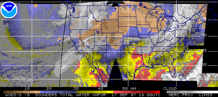
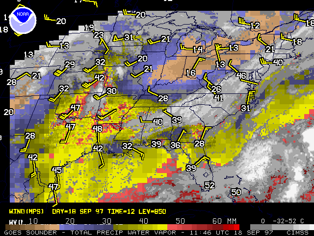
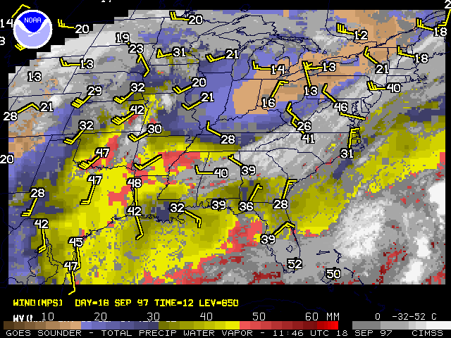
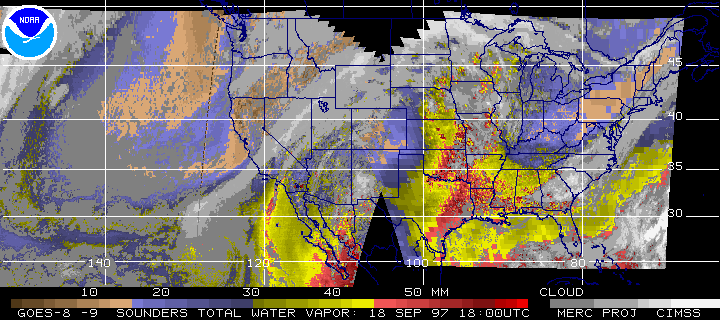
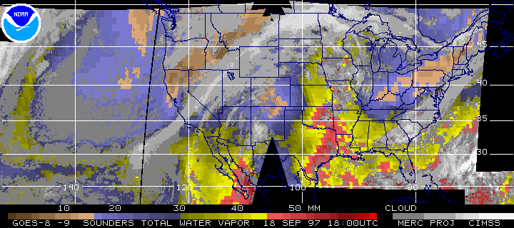
Examples of the DPI from the previous and current methods are available below. These images from 17 and 18 September 1997 are for total precipitable water vapor (PW), with both large scale (East Pacific to West Atlantic) and regional scale (central and eastern US) views. In general, the overall patterns match well. The very high resolution single fov portion in the large scale view can be problematic, as seen in the southeastern US at 18 UTC 17 September 1997, where no pattern is evident. Although the new Pacific data are not as smooth as those of the previous version, the completeness of the new algorithm ("fast" versus full retrieval) should provide more accurate and robust data. Also, note two improvements in coverage: Montana and North Dakota are almost entirely included, and the moveable "Atlantic" sector from GOES-8 is now being processed.
GOES-8/9 sounder PW -- Old Method 17 Sep 1997 (large view)
GOES-8/9 sounder PW -- New Method 17 Sep 1997 (large view)
GOES-8 sounder
PW -- Old Method 18 Sep 1997 (regional with raobs)
GOES-8 sounder PW -- New Method 18 Sep 1997 (regional with raobs)
GOES-8/9 sounder PW -- Old Method 18 Sep 1997 (large view)
GOES-8/9 sounder PW -- New Method 18 Sep 1997 (large view)