 |
 |
 |
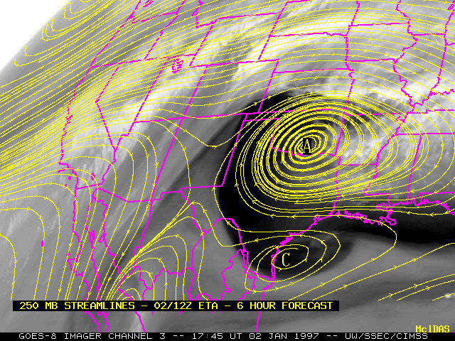 |
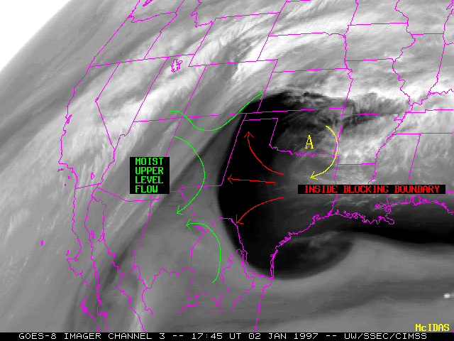
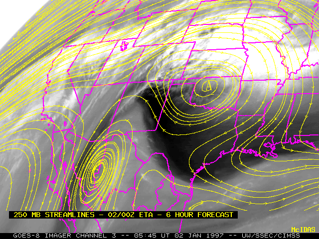
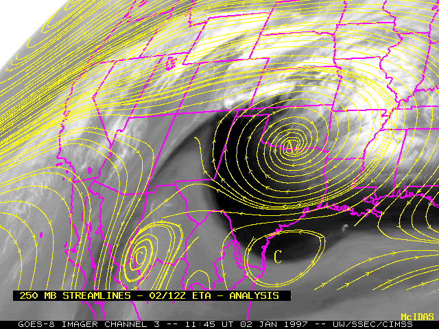
This is an example of an inside blocking boundary which is created by active synoptic scale subsidence along the equatorward side of a region of anticyclogenesis. Water vapor imagery and 250 mb streamline fields at 23:45 UT 01 January 1997 (upper left), 05:45 UT 02 January 1997 (upper right), 11:45 UT 02 January 1997 (lower left) and 17:45 UT 02 January 1997 (lower right) show an anticyclone building from the central Rockies into the central and southern Plains region.As the anticyclone (A) began to close off over Oklahoma, an increasing easterly component of dry subsiding flow in the middle and upper troposphere became evident as a cresent-shaped dark region on water vapor imagery. The edge of the inside blocking boundary is along a deformation axis in the upper flow, between the dry easterly winds around the anticyclone and the moist westerly and southerly winds over the western U.S. and Mexico.
Note the closed cyclonic circulation (C) along the southern portion of the dry region; such cyclonic centers are common during the latter stages of inside blocking boundary formation.