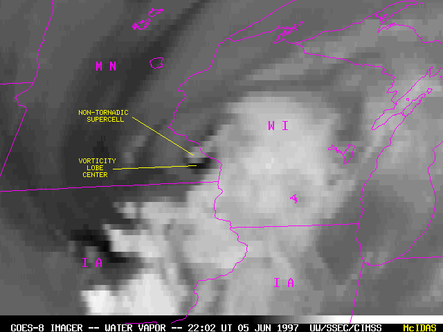
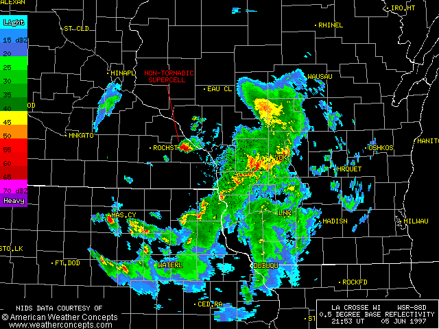
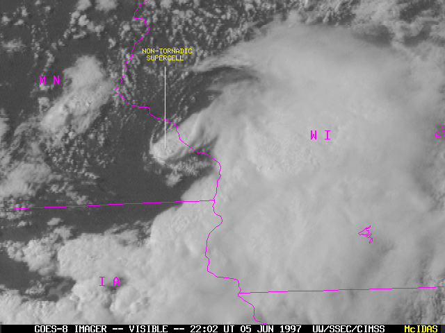
A strong lobe of vorticity was rotating southward across Minnesota during the day on 05 June 1997. Severe thunderstorms developed during the afternoon hours across parts of southern Minnesota, northern Iowa, and western Wisconsin. Behind this initial area of convection, a small pocket of dry mid-level air associated with the vorticity lobe center moved across the region of persistent instablity west of La Crosse WI, where an isolated non-tornadic supercell developed. This thunderstorm produced golf ball size hail at Utica in extreme southeastern Minnesota.
