Early Stage | Mature Stage | Decay Stage | Animations
Early Stage of MCS Development
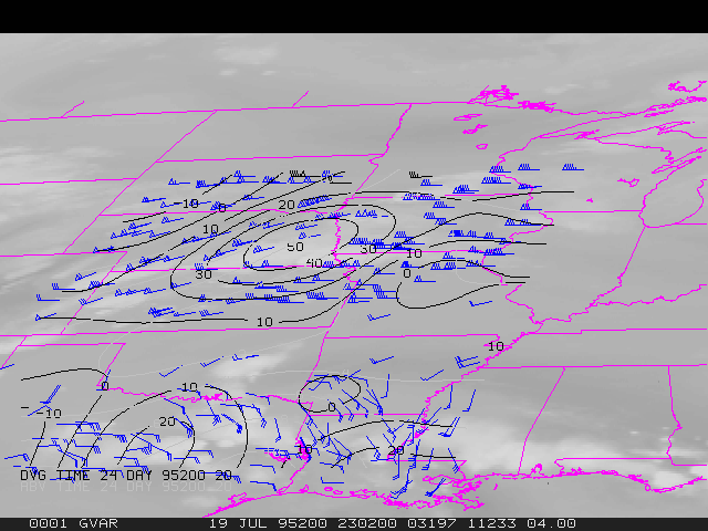
23:02 UTC 19 July 1995 -- Water vapor winds, Divergence
During the early stages of MCS development (23:00-02:00 UTC), maximum wind divergence values ranged from 45-55 x 10-5 s-1 over eastern Nebraska and northern Kansas, generally aligned with the cirrus cloud sheild.
Mature Stage of MCS -- Maximum Divergence Aloft
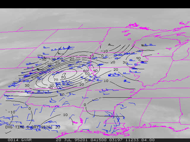
04:15 UTC 20 July 1995 -- Water vapor winds, Divergence
The MCS was mature with respect to deep convection from about 02:00-05:00 UTC. The maximum divergence aloft (indicative of the region of strongest upward vertical motion) occurred between 04:00 and 05:00 UTC, with values of 70-80 x 10-5 s-1 over northcentral Kansas. Note the preferred expansion of the cirrus cloud shield to the southeast (to the right of the ambient southwesterly flow).
Decay Stage of MCS -- Rapid Decline of Divergence Aloft
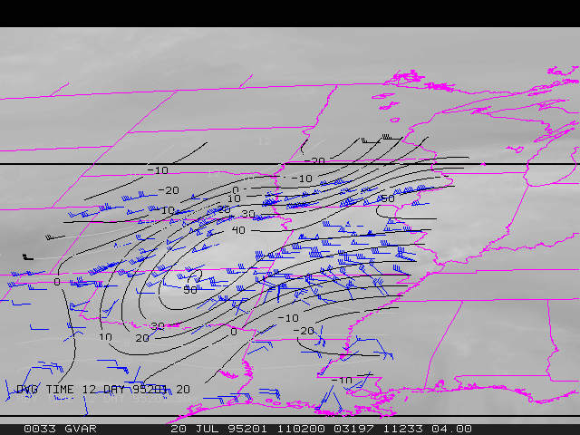
11:02 UTC 20 July 1995 -- Water vapor winds, Divergence
The MCS began to decay from about 05:00 to 08:00 UTC. There is a rapid decrease in the storm-top divergence after 05:30 UTC, with values remaining between 50-60 x 10-5 s-1 over eastern Kansas. Maximum divergence values appeared to migrate to the rear (southwestern) portion of the MCS during the final hours.
Image animation at 30-minute intervals (23:00 UTC 19 July to 13:00 UTC 20 July):
Java | QuickTime