|
|
|
|
|
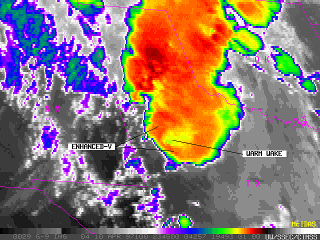
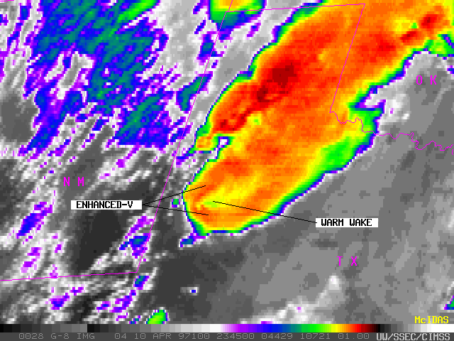
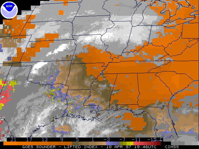
Severe convection developed in the Texas panhandle region during the afternoon and evening of 10 April 1997. These thunderstorms spawned several tornadoes and produced large hail up to 2 inches in diameter. GOES-8 sounder-derived lifted index showed that the atmosphere over that region was was beginning to destabilize by the early afternoon hours, when a tornado watch was issued by the Storm Prediction Center.
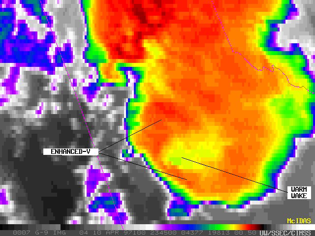
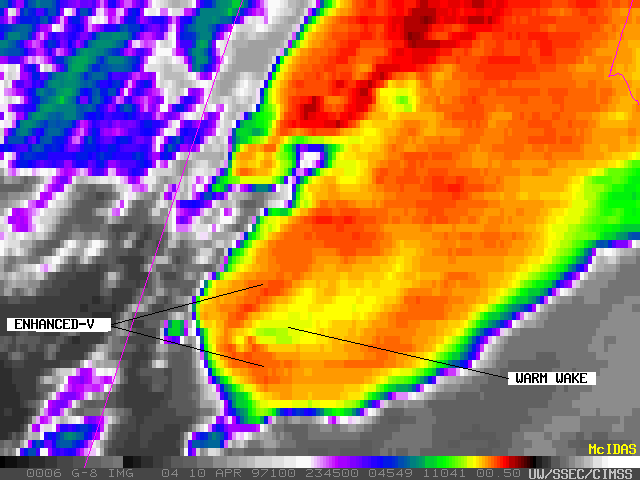
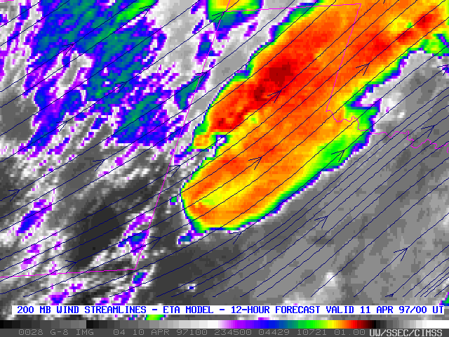
An "enhanced-V" signature is noted in the coldest temperatures (the orange/red enhancement) around the outer portions of the thunderstorm cirrus canopy, with a pocket of warmer cloud top temperatures (the yellow/green enhancement) just downstream. This enhanced-V and warm wake signature is a result of upper-level flow being diverted around the intense updraft region of the overshooting tops [magnified image].
The difference in perspective between GOES-9 and GOES-8 imagery of this storm is due to the fact that GOES-9 is in a geostationary orbit at 135 West longitude, while GOES-8 is positioned at 75 West longitude.