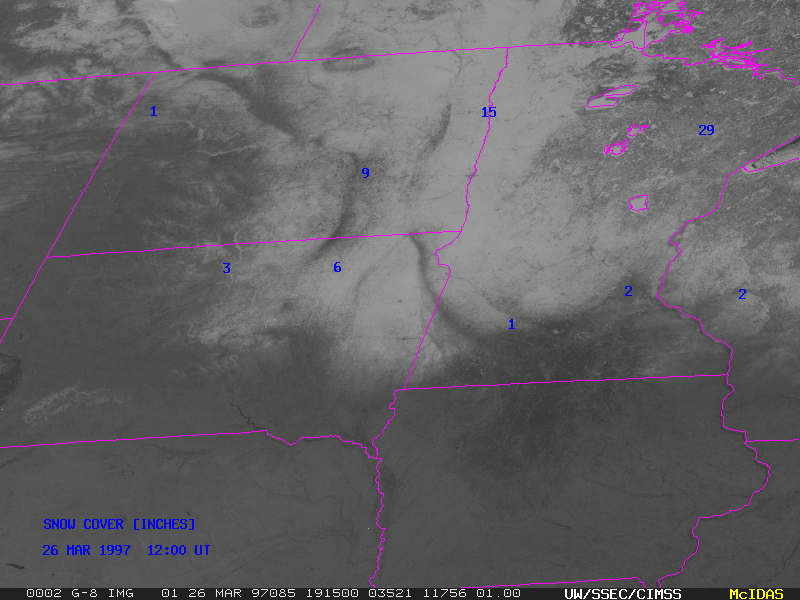
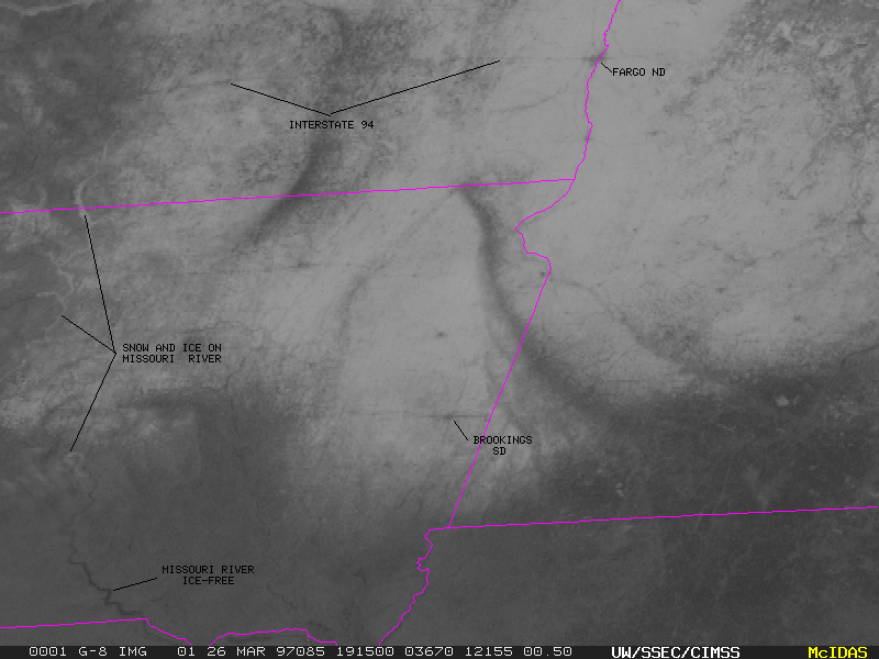
This GOES-8 visible image shows the extent and variablilty of the snow cover that remained over much of the northcentral U.S. on 26 March 1997. Portions of the Missouri River still covered with snow and ice are visible in a closer view, along with roadways leading into cities such as Brookings SD and Fargo ND.
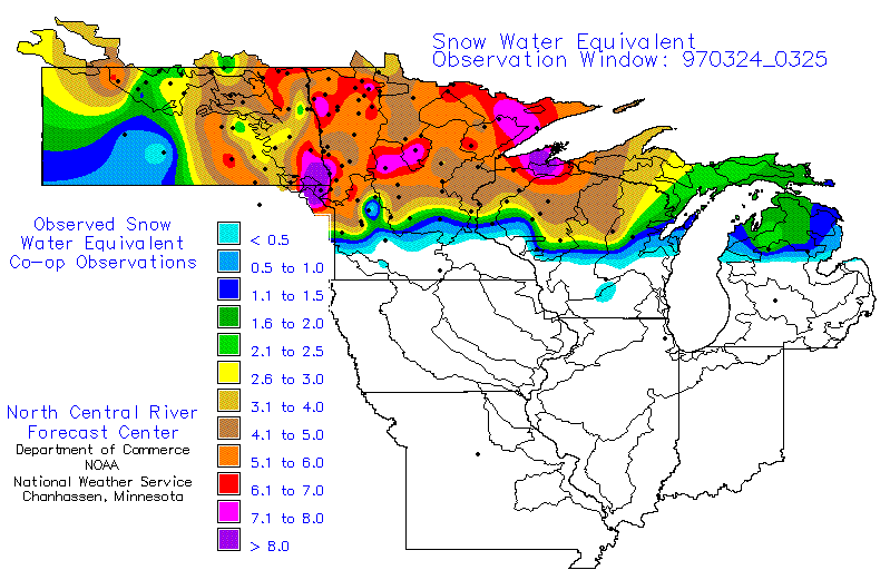
Above-normal snowfall and below-normal temperatures during much of the 1996-1997 winter season acted to sustain a significant snow cover until the end of March. As a result, there was a high risk for Spring snowmelt flooding over parts of the northern Plains (especially the Red River valley of North Dakota/Minnesota). The water equivalent of the snow cover exceeded 6 inches in many places. River ice jams also compounded the flooding problem in some areas. For additional information and imagery, see the National Climatic Data Center Northern Plains Flooding summary.