|

|
(- Terra MODIS image comparison using channels 1, 6, 22 and 31 -)
|
|
|
(- Terra MODIS image comparison using channels 1, 6, 22 and 31 -)
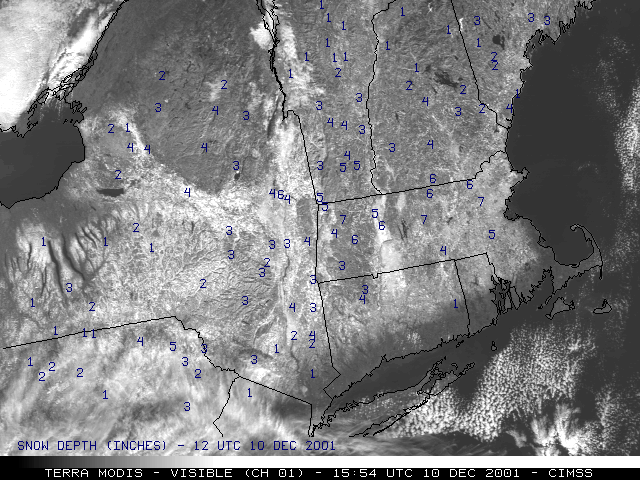
Much of New England received several inches of snow on 08-09 December 2001, with up to 9 inches reported over parts of Massachusetts. Terra MODIS visible imagery (above, left) shows the extent of the resulting snow cover on the morning of 10 December, with snow depth (in inches) plotted on the image. However, use of the visible channel alone does not allow easy detection of areas of fog/stratus over the snow pack, and snow cover over regions of dense forest (such as the Adirondack Mountains in northeastern New York) is also more difficult to discern. A 3-channel composite using the MODIS visible (channel 1), 1.6 micrometer near-IR (channel 6) and 11.0 micrometer longwave IR (channel 31) data (above, right) make the detection of these low cloud features (and snow cover vs. no snow cover) much easier. Snow cover appears as light red (with a blue tint in regions of dense forest), while bare ground is green. Cloud features appear as light yellow (low clouds) or white (high clouds).
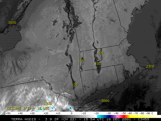
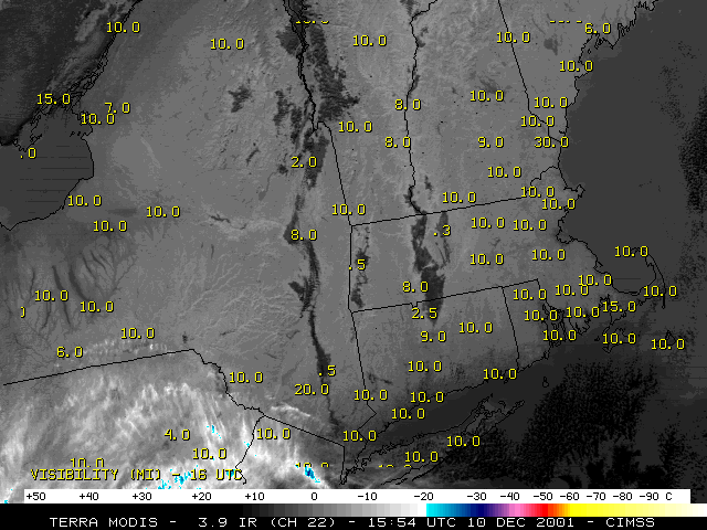
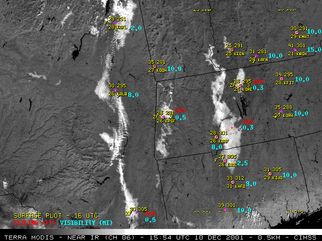
The Terra MODIS 3.9 micrometer shortwave IR channel imagery (below) shows these areas of fog/stratus as warmer (darker enhancement) since these water-based (supercooled droplet) clouds reflect shortwave solar energy, while the surrounding snow pack does not. Plots of cloud ceiling and surface visiblity reveal that ceilings were as low as 100 feet, and visibilities below 1 mile in parts of these fog/stratus features, making their accurate detection important to aviation interests. A closer view is also available using the 0.5-km resolution 1.6 micrometer near-IR channel.
|
Terra MODIS shortwave IR channel |
