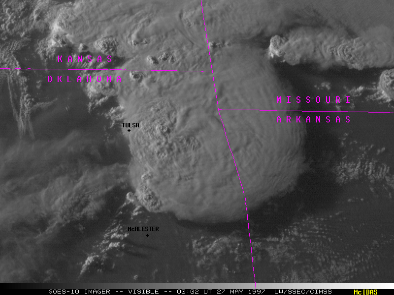
Visible test imagery from the GOES-10 sounder(left) and imager(right) shows the supercell which generated severe weather over parts of Oklahoma and Kansas late in the day on 26 May 1997. Several tornadoes were reported in eastern Oklahoma (between Tulsa and McAlester), and large hail (1-3 inch diameter) was observed over parts of southeastern Kansas. The large shadow cast by the storm complex is evident over Missouri and Arkansas.
