Applications of GOES sounder retrievals with radar and profiler observations in forecasting thunderstorm development

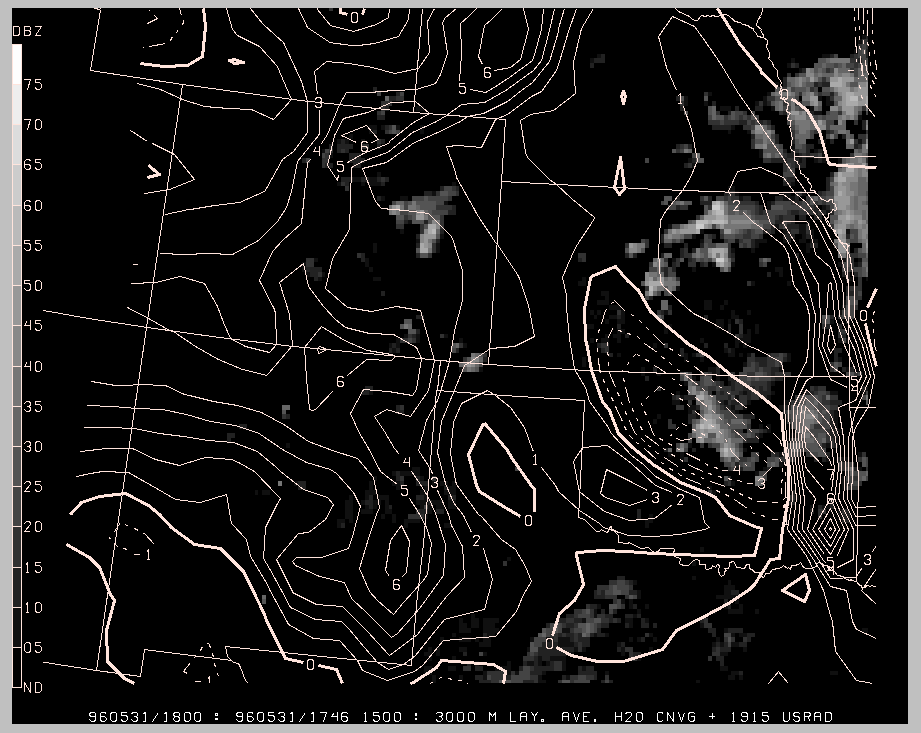
Elevated moisture convergence (850-700 mb) from profiler and WSR-88D winds and GOES-8 moisture retrievals at 18 UTC compared to radar echos at 1915 UTC on 31 May 1996.

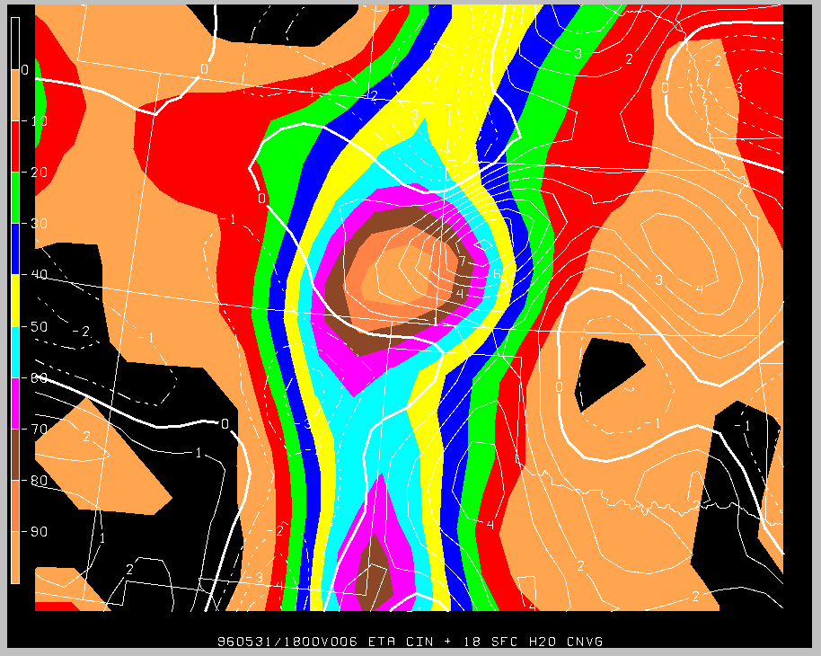
Moisture convergence from surface observations at 18 UTC and convective inhibition (cap strength) from ETA 6-h forecast (color shading).

