A very intense upper level trough deepened over the northern Plains and upper Midwest region, which is a rare occurrence during the month of July. This system exhibited a well-defined dry slot which became entrained into the circulation
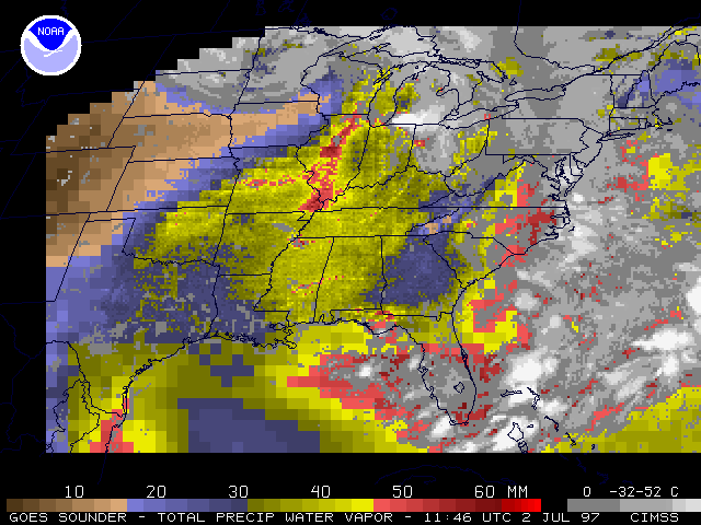
center. The image and animations on the left
show precipitable water, a derived product from the GOES-8 sounder.
Precipitable water (PW) is often directly associated with strong storms and heavy
rains, as it is a measure of the amount of moisture available in the atmosphere. Dry
air (PW less than 20 mm) can clearly be seen wrapping into the low pressure system counter-clockwise
over Minnesota and into Wisconsin. Very high precipitable water values (greater than 50 mm) can be seen
over Illinois and Missouri. A large gradient exists in this region and is
characteristic of a dryline. Numerous severe storms developed in conjunction
with this dry air intrusion over the Midwest.
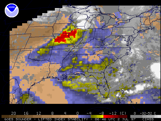
The image and animations on the right
show the lifted index derived product from the GOES-8 sounder. The lifted index is a
stability parameter used to forecast the likelihood of thunderstorms and severe
weather. Very stable air can be seen wrapping around the low, as indicated by
the positive lifted index values. Favorable conditions for convection are located in
eastern Iowa, Illinois, and Missouri as indicated by the large area of negative lifted indices
(reds and yellows).
A longer sequence of lifted index images (every 2 hours, spanning 3 days) is also available as an
FLI animation (5MB file)
A time series of
GOES-8 sounder retrievals over Omaha, NE shows how the troposphere becomes progressively drier as the dry slot moves across that region.
Sounder values can be checked for accuracy by comparing them with the 12Z
and 00Z radiosonde measurements. The following images have the radiosonde
measured values overlaying the GOES-8 sounder products.
Precipitable Water:
00Z
July 2 Precipitable Water.
12Z
July 2 Precipitable Water.
Lifted Index:00Z
July 2 Lifted Index.
The GOES-8 sounder also measures the height of cloud tops. Animation for cloud top
pressures shows the intrusion of the dry air as well as the numerous storms
developed. Blue and white colors indicate very high cloud tops which are often
associated with strong storms.
Cloud Top Pressure animations: MPEG |
FLI
All GOES-8 and GOES-9 sounder products can be found at the CIMSS Realtime GOES
Page.
Back to
Interesting Images page