| 
|
|
|
|
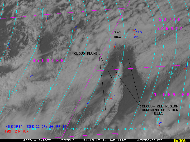
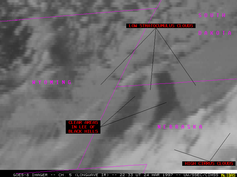
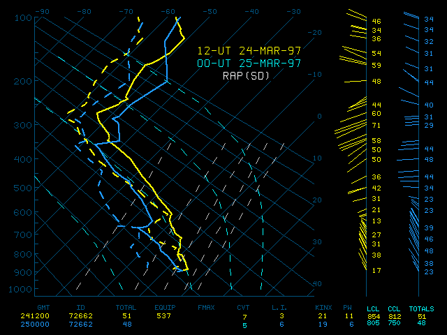
Rawinsonde reports from Rapid City SD indicated that the airmass at 00 UT was convectively unstable below 700 hPa, with a strong capping inversion at about 660 hPa. Convective temperatures ranged from 7.2 C at 12 UT to 5.5 C at 00 UT. Surface heating within the cloud-free notch along the southern portion of the Black Hills was sufficient to create a cloud plume below the capping inversion, which was then fanned outward toward the south by the strong north-northeasterly winds over the Nebraska panhandle. Brian Klimowski (Science and Operations Officer at NWS Rapid City) hypothesizes that a hydraulic pressure jump could also have been involved in the generation of this cloud plume.
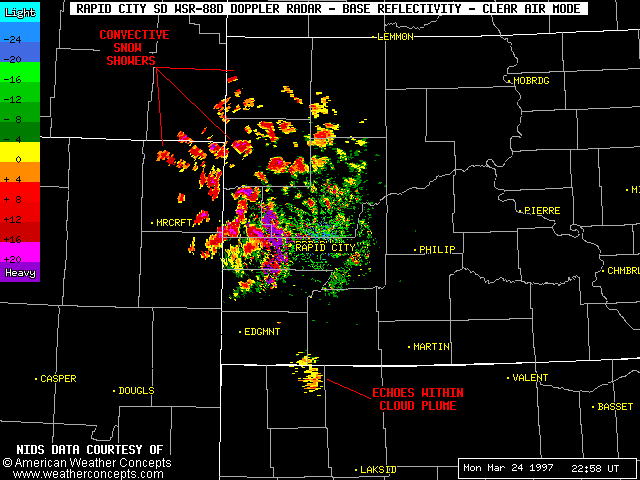
Upslope flow of the moist, unstable low-level air mass resulted in low-topped convective snow showers along the northern portions of the Black Hills (1-2 inches of snow were recorded in Deadwood SD). These convective elements were shown very well by the Rapid City WSR-88D Doppler radar, along with some very light echoes within the cloud plume along the SD/NE border.