31 October 1999 | Fires Over Montana and North Dakota | GOES-10 Imager 10.7um IR
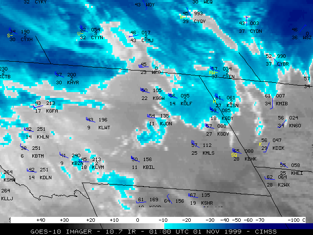
This loop of GOES-10 10.7 micrometer longwave InfraRed (IR) imagery shows the leading edge of the cooler air behind the cold front (lighter gray enhancement) which was advancing southeastward across Montana into the Dakotas and Wyoming. Hourly surface reports are plotted on each image.
