04 October 1999 | Lake Effect Rain Band | GOES-8 Sounder IR Difference Product
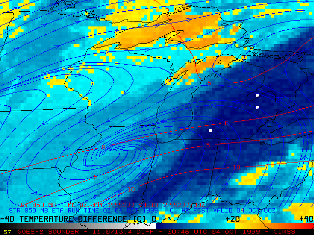
This is a loop of GOES-8 Sounder IR difference product during the development of a lake effect cloud band over Lake Michigan on 04 October 1999. Calculating the difference between Sounder channel 8 (longwave IR window channel, 11.0 micrometer wavelength) and Sounder channel 5 (longwave IR, 13.4 micrometer wavelength) brightness temperatures generates an estimate of the "Delta-T" over cloud-free regions of the Great Lakes. A higher Delta-T implies greater instability within the lowest 1-2 km of the troposphere, which is more conducive to lake effect cloud band development.
The Eta model analyzed 850 hPa temperatures warmer than -5 C over most of Lake Michigan at at both 00:00 and 12:00 UTC. However, the 00:00 and 12:00 UTC Green Bay WI rawinsondes reported 850 hPa temperatures of -3.7 C and -4.5 C respectively, indicating that the colder air aloft was located farther to the south over Lake Michigan. With lake water temperatures near 15-17 C, the Delta-T was 20 C or greater. Higher temperature differences were indicated over the northern and central portions of Lake Michigan, where the lake effect cloud band initially formed.
