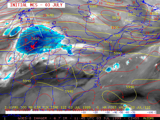
03-06 July 1999 -- GOES-8 Imager 6.7 Micrometer IR
Mesoscale Vorticity Center (MVC) Over the Carolinas
(this 14-image Java animation sequence will take a minute or two to load...)
(this 14-image Java animation sequence will take a minute or two to load...)
This loop of GOES-8 6.7 micrometer IR ("water vapor") imagery at 6-hour intervals shows the development and motion of a convective system across the northeastern U.S. on 03-04 July, followed by the southward then westward propagation of the resultant MVC circulation as it turned back toward the southeast U.S. coast on 05-06 July. 500 hPa geopotential height and absolute vorticity from the Eta model are overlaid on the imagery. The large ridge of high pressure (within the 5940 m contour) was responsible for a heat wave across much of the eastern U.S. during early July. Note how the model handled the circulation poorly as it began to move westward across the Atlantic, toward the Carolina coast.
