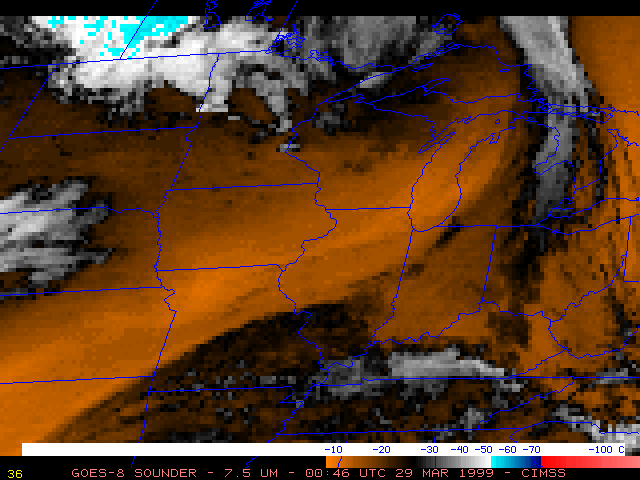
29 March 1999 -- GOES-8 Sounder 7.5 Micrometer IR ("Water Vapor")
Stratospheric Intrusion Over Southern Wisconsin?
(this 21-image Java animation sequence will take a minute or two to load...)
(this 21-image Java animation sequence will take a minute or two to load...)
This loop of GOES-8 Sounder 7.5 micrometer InfraRed ("water vapor") imagery shows the rapid eastward propagation of a shortwave across Nebraska, Iowa, and the southern Great Lakes region on 29 March 1999. The map overlay has been removed from most of the images to show that prominent surface features (the southern portion of Lake Michigan, and Lake Winnebago in eastern Wisconsin) were evident in this lower-tropospheric water vapor channel. The very low water vapor content of the tropospheric column in the wake of the shortwave led to a 7.5 micrometer weighting function which peaked very near to the surface, allowing upwelling thermal radiation from surface features to be sensed by the satellite (with very little attenuation by water vapor aloft).
The region of warmest brightness temperatures (indicating the driest portion of the troposphere behind the exiting shortwave) corresponded to the area across southern Wisconsin that reported low surface dew points (5 to 9 F) and low relative humidities (11-14%) during the afternoon hours.
