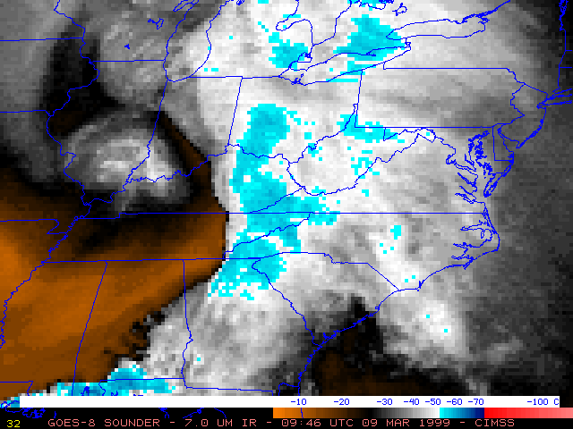
09 March 1999 -- GOES-8 Sounder 7.0 Micrometer IR (Water Vapor)
Heavy Snow Over the Mid-Atlantic Region
(this 8-image Java animation sequence will take a minute or two to load...)
(this 8-image Java animation sequence will take a minute or two to load...)
This loop of GOES-8 Sounder 7.0 micrometer InfraRed (water vapor) imagery shows evidence of the northeastward transport of low-level moisture (gray to black enhanced features) along the warm conveyor belt flow from southern Alabama and northern Georgia into the Mid-Atlantic region on 09 March 1999. In addition, the core of the mid-level dry slot (lighter orange enhancement) was becoming better-defined in this imagery, moving into northern Alabama and Georgia. Both the moist ascending flow and the mid-level dry slot were feeding into the rear portion of the cold cloud band approaching the East Coast, helping to produce moderate to heavy snowfall over that area.
An isentropic analysis along the 310K surface is overlaid on the 11:46 UTC image (isentropic data derived from 12:00 UTC rawinsonde reports).
