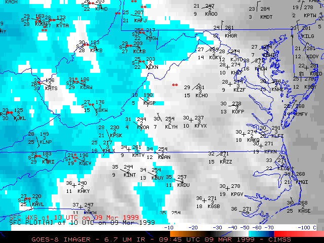
09 March 1999 -- GOES-8 6.7 Micrometer IR (Water Vapor)
Heavy Snow Over the Mid-Atlantic Region
(this 28-image Java animation sequence will take a minute or two to load...)
(this 28-image Java animation sequence will take a minute or two to load...)
This loop of GOES-8 6.7 micrometer InfraRed (water vapor) imagery shows a mid-level dry slot advancing east-northeastward across the central Appalachian and Mid-Atlanic regions on 09 March 1999. Snowfall rates were enhanced beneath the band of cold cloud tops (temperatures of -50 to -60 C, light blue enhancement) which was along the leading edge of this dry slot. Hourly surface reports are also plotted on the imagery.
In addition, a lobe of vorticity can be seen moving eastward across West Virgina toward the Washington DC area during the 18:00 UTC to 23:00 UTC time frame. Upward vertical motion ahead of this vorticity lobe helped to enhance showfall rates later in the day, after the passage of the main cold cloud band.
