09 March 1999 -- GOES-8 Visible Imagery (0.5 km resolution)
Heavy Snow Over the Mid-Atlantic Region
(this 19-image Java animation sequence will take a minute or two to load...)
(this 19-image Java animation sequence will take a minute or two to load...)
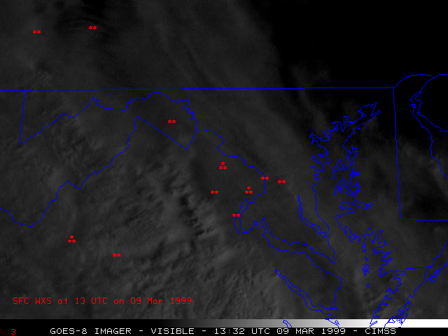
This loop of GOES-8 visible imagery (at 0.5 km resolution) shows subtle shadowing and texture along the tops of the cold cloud band as it passed across the Washington DC area. This shadowing and texture is often a signature of convectively-enhanced precipitation rates. Hourly surface precipitation reports are also plotted on the imagery.
As the trailing edge of the cold cloud band moved eastward, the lower cloud layer over eastern West Virginia and northern Virginia exhibited a banding structure (oriented southwest-to-northeast). Such a banding signature is often seen in regions of strong frontogenetic forcing due to isentropic lift and warm air advection, or also in regions where Conditional Symmetric Instability (CSI) is released through moist slantwise convection.
