21 January 1999 -- Blowing Dust/Sand Over Northern Mexico and the Southwest U.S.
|
GOES-8 IR temperature difference product
|
|
|
GOES-8 IR temperature difference product
|
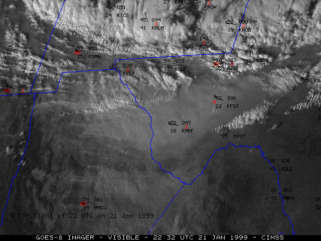
Large plumes of blowing dust and sand were seen over parts of northern Mexico, southern Arizona/New Mexico, and southwest Texas on 21 January 1999. NOAA GOES-8 visible imagery (above, left) shows several areas of blowing dust/sand which appeared to originate over northern portions of the Mexican state of Chihuahua. Several dry lake beds exist over that semi-arid desert region, which are often the source of sand and dust particulate in high wind events such as this. High Wind Warnings and Blowing Dust Advisories were issued for parts of southwest Texas, where winds were 40-50 mph (with gusts of 70-80 mph in some mountain passes).
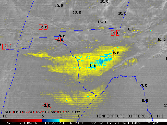
A GOES-8 InfraRed (IR) temperature difference product (above, right) is helpful in verifying the dust/sand nature of the hazy plumes which are seen on the visible imagery. Differences in emissivity of the fairly large silicate particles at 10.7 versus 12.0 microns yields a difference in brightness temperature when comparing these two IR channels. This IR product could also be used to track the progress of the airborne dust/sand at night, when visible imagery is no longer available. Automated surface reports did record reductions in surface visibilty (often less than 1 mile), but the cause of the visibility restriction (in this case, dust/sand) was often not reported.
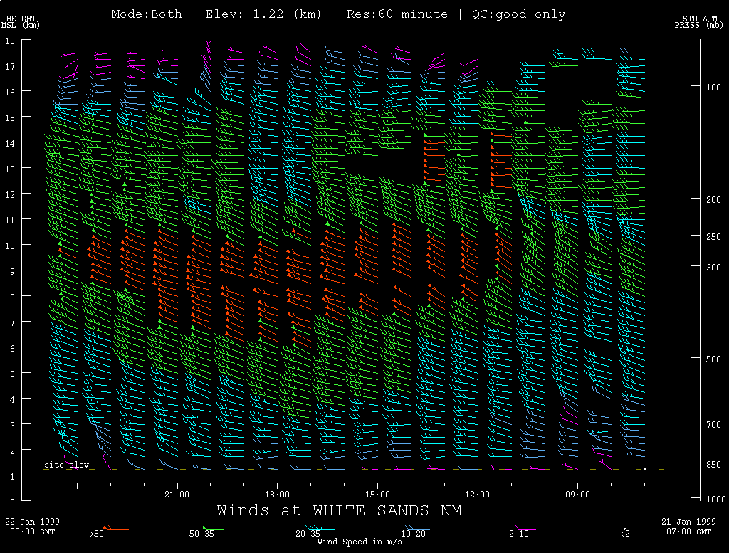
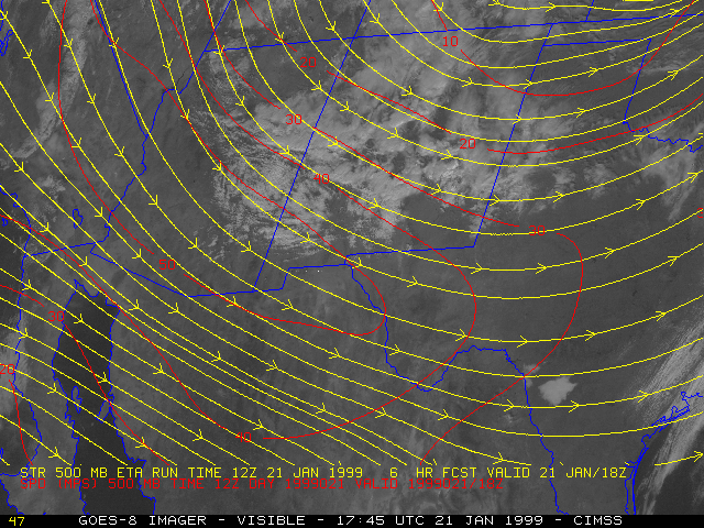
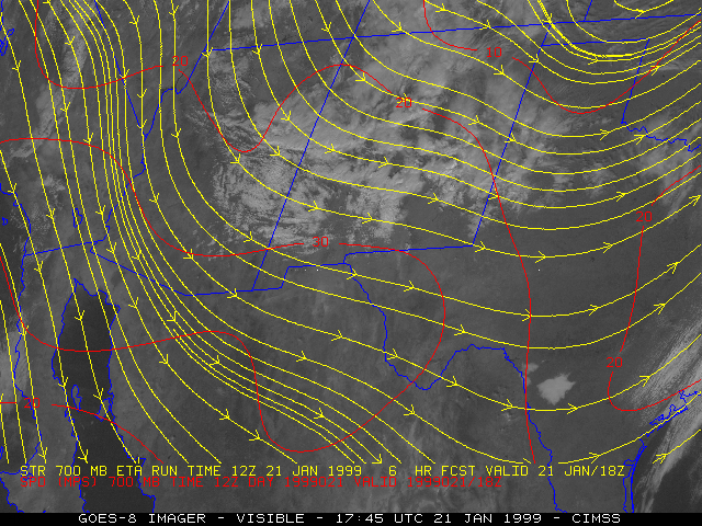
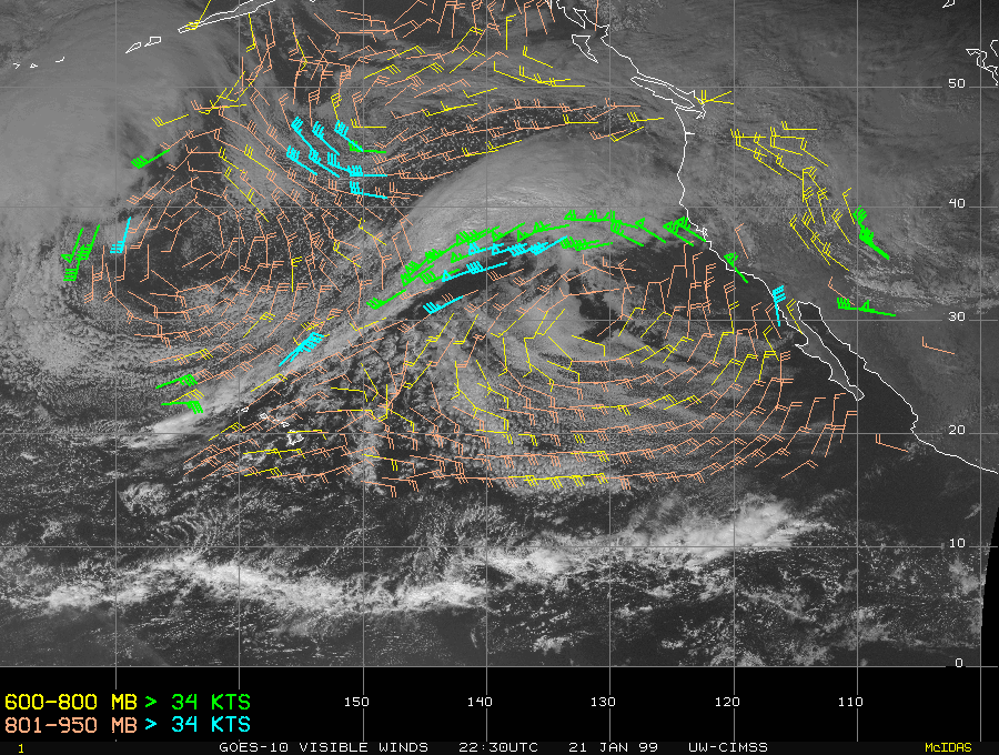
A strong jet streak was rounding the base of a broad trough over the southern Rocky Mountains (500 hPa winds | 700 hPa winds). Rawinsonde reports from El Paso, TX (below, left) reveal the very deep mixed layer by 00:00 UTC on 22 January, which allowed the downward transport of momentum and high winds from aloft. NOAA wind profiler data from White Sands, NM (below, right) shows the strong core of winds (> 50 m s-1) between 8-10 km above the surface, and the gradual downward mixing of higher wind speeds during the day. GOES-10 visible cloud-tracked winds also indicated a few 40-50 knot targets within the 600-800 hPa layer across this region.

|
|
