04 December 1998 -- Popocatepetl Volcano in Mexico
|
|
|
|
|
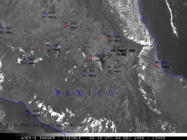
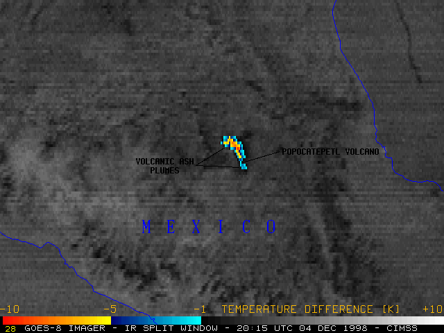
The Popocatepetl volcano in central Mexico erupted during the day (at 19:02 UTC) on 04 December 1998. NOAA GOES-8 visible and "split window" InfraRed (IR) imagery (above) shows the spread of the volcanic ash plume following the eruption. Volcanic ash can be a significant aviation hazard, so the monitoring of ash plume dispersion using GOES imagery is an important task.
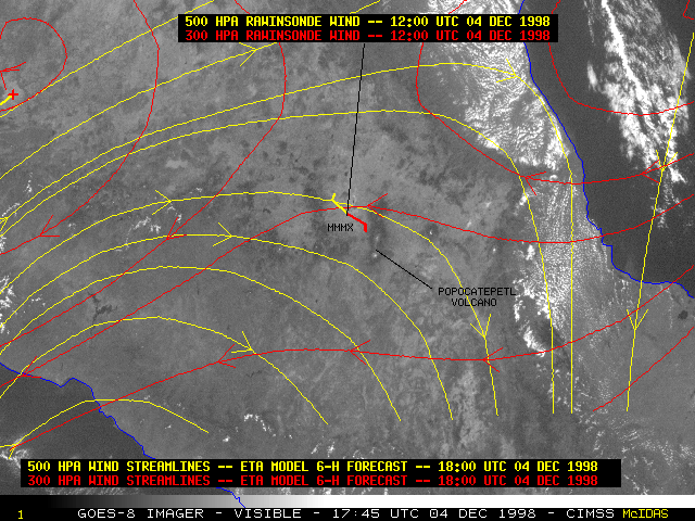
Most of the ash moved north and northwestward, toward Mexico City (station identifier MMMX), although parts of the ash cloud could be seen drifting to the south. This difference in ash cloud motion was due to wind shear in the upper troposphere -- the bulk of the ash cloud was ejected higher into the atmosphere (around 31,000 feet, or near the 300 hPa pressure level) where the winds had an easterly or southeasterly component. Weaker pulses from the eruption sequence only sent the ash cloud to around the 21,000 foot level (near the 450 hPa pressure level), where the winds had a northwesterly or a northerly component.
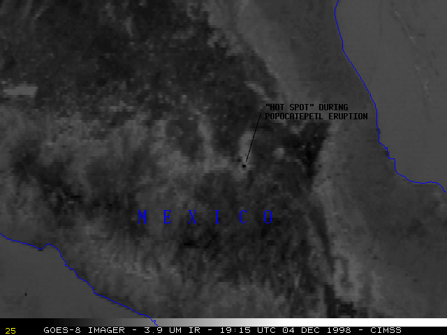
GOES-8 3.9 micron shortwave IR imagery (below) shows the relatively persistent "hot spot" (dark pixels) associated with the steam and hot gases before, during, and after the eruption.
|
