26 October 1998 -- Hurricane Mitch in the Caribbean Sea

|
|
- Interactive visible and 10.7 micron longwave IR comparison -
|
|
|
- Interactive visible and 10.7 micron longwave IR comparison -
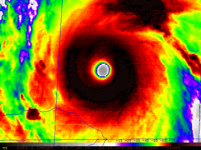
Hurricane Mitch strengthened to a Category 5 storm on 26 October 1998. NOAA GOES-8 visible and longwave IR imagery (above) show the very large (diameter of 20 nautical miles), well-defined eye and very cold cloud top temperatures (below -80 C) exhibited by this storm. Rapid-scan visible imagery at 5-10 minute intervals reveals some interesting low cloud motions within the eye of the storm. Some photographs from the Air Force Reserve "hurricane hunter" flight into the eye of Mitch are available here.
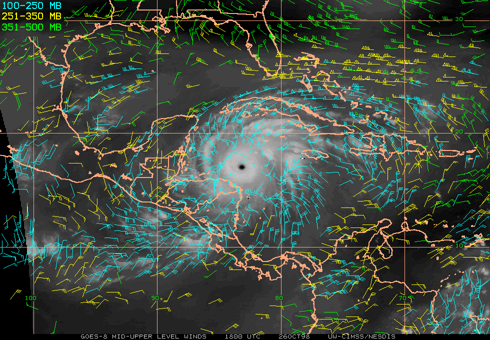
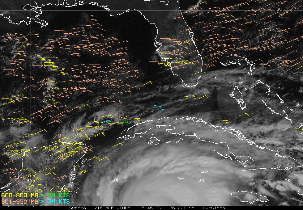
The upper-level storm outflow was well established and nearly symmetric, as shown by GOES-8 water vapor winds and divergence (below). GOES-8 low-level visible winds at 15:45 and 21:45 UTC revealed that tropical storm force winds (greater than 34 knots) entended far from the center of Mitch, as far north and northwest as Cuba and the Yucatan Peninsula of Mexico. Winds from a NOAA reconnaissance aircraft dropsonde were measured at 173 knots and the central pressure was estimated to be 905 millibars, making this one of the strongest Atlantic basin storms on record (especially for so late in the season).
|

|
The GOES-8 satellite experienced a data outage the following day (27 October) -- however, the eye remained well-defined as Mitch continued to drift slowly westward off the coast of Honduras.
