19 September 1998 -- Hurricane Georges in the Atlantic Ocean
|
|
- Interactive visible and 10.7 micron longwave IR comparison -
|
|
|
- Interactive visible and 10.7 micron longwave IR comparison -
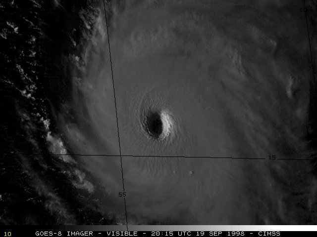
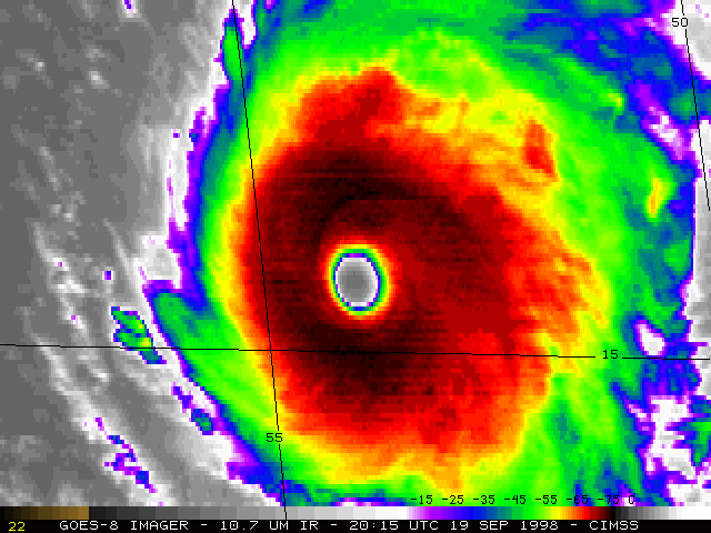
Hurricane Georges strengthened to a Category 4 storm on 19 September 1998, with maximum sustained winds to 145 MPH. NOAA GOES-8 visible and 10.7 micron longwave InfraRed (IR) imagery (above) revealed the well-defined eye and cold cloud top temperatues exhibited by the storm on that day.
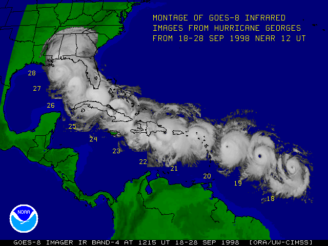
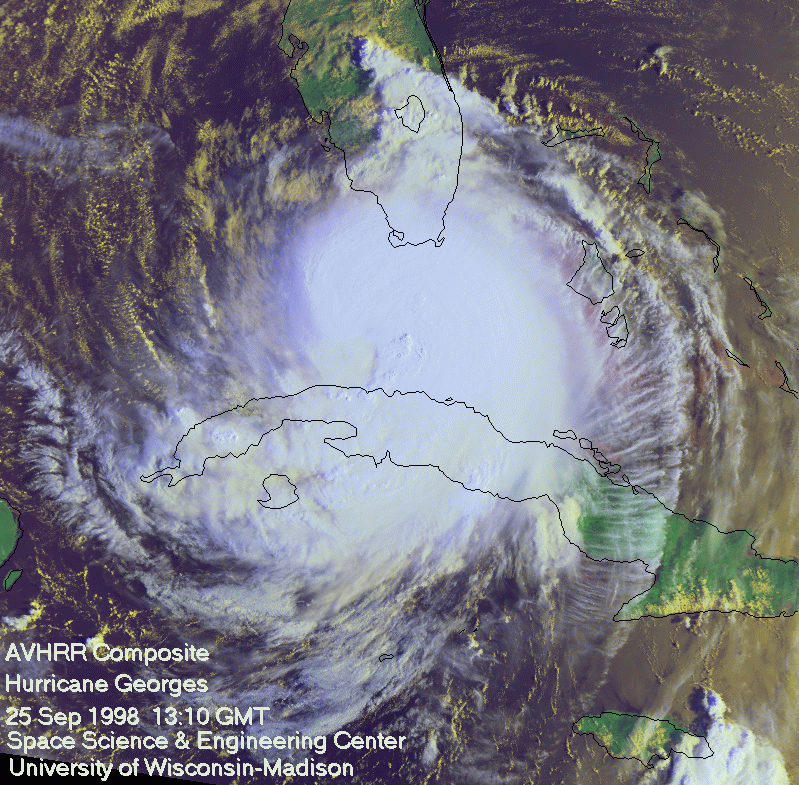
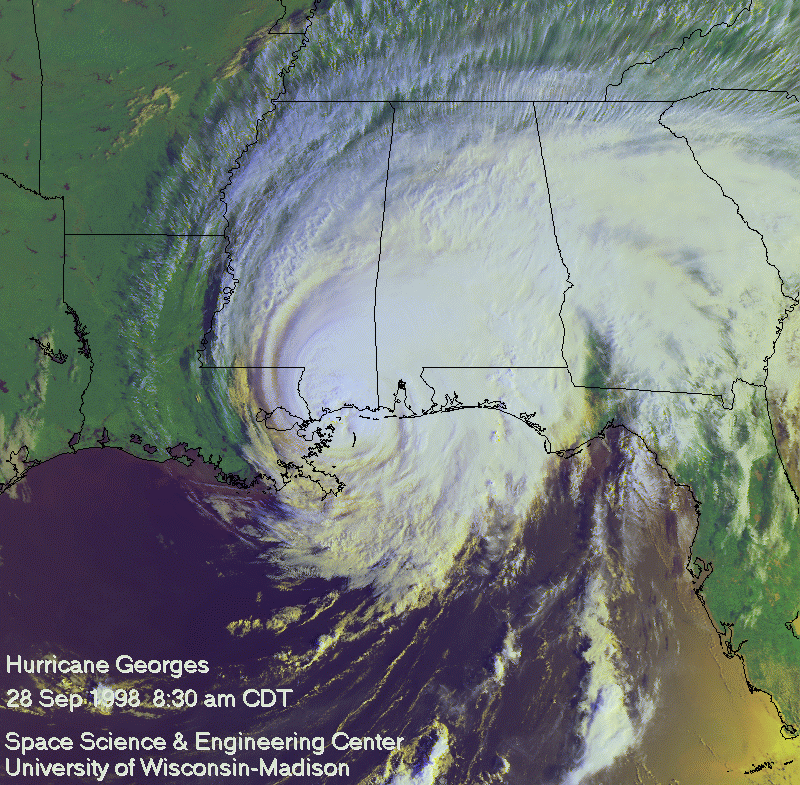
Georges continued to move northwestward across the Atlantic (below), affecting the Leeward Islands and Puerto Rico on 21 September, the Florida Keys on 25 September, and eventually the Gulf Coast region of the U.S. on 28 September.
For additional imagery and information on Hurricance Georges, see the CIMSS Tropical Cyclones Page and the CIMSS Realtime GOES Page.
