21 May 1998 -- Turbulence Off the California Coast
|
|
|
|
|
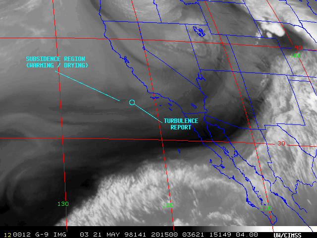
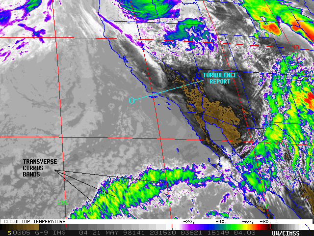
On 21 May 1998, a DC-10 aircraft enroute to Honolulu, HI from Los Angeles, CA encountered turbulence which injured six passengers and forced the plane to return to Los Angeles. The pilot report indicated that the moderate to severe turbulence occurred around 20:14 UTC at an altitude of 33,000 feet, about 200 nautical miles off the California coast.
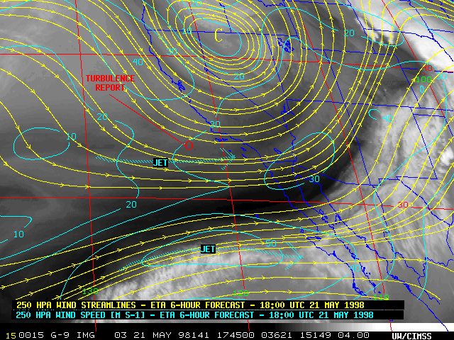
NOAA GOES-9 6.7 micron InfraRed (water vapor) imagery (above left) shows subtle hints of two elongated E-W oriented regions of subsidence which developed over and just to the south of the turbulence report location. This sinking motion, indicated by warming brightness temperatures (darker, "drier" regions on water vapor imagery), developed in the left entrance region of an upper tropospheric jet streak which was approaching southern California. Such a subsiding region is due to ageostrophic circulations resulting from convergence within the left rear quadrant of the jet streak.
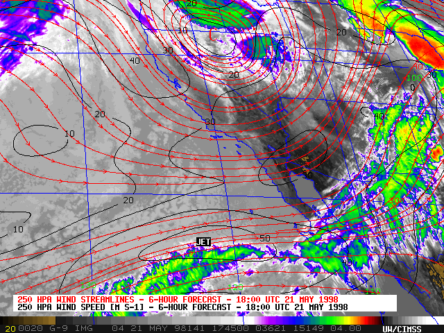
GOES-9 10.7 micron longwave IR imagery (above right) shows an absence of any high-level cloud features over the flight region at that time -- only low-level stratocumulus clouds are evident (well below the 33,000 foot flight altitude). This type of turbulence event is known as Clear Air Turbulence (CAT). The longwave IR imagery also reveals another satellite signature of turbulence, about 200 nautical miles to the south -- several "transverse cirrus bands" can be seen in the region of the stronger (50 m s-1) jet streak approaching southern Baja California. Any turbulence that might have been associated with these transverse cirrus bands was too distant to have had any effect on the DC-10 turbulence event to the north.