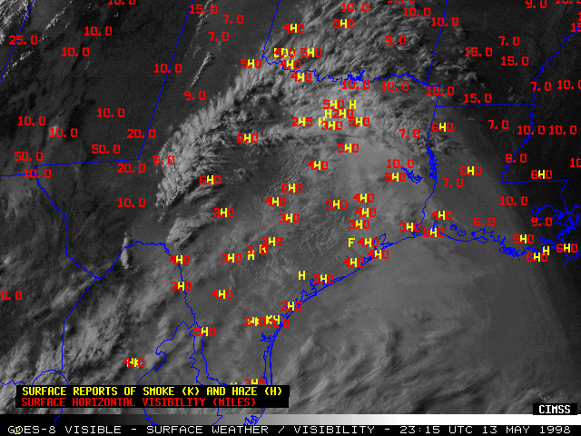
06-15 May 1998 -- Smoke From Central American Fires
|
|
|
|
|
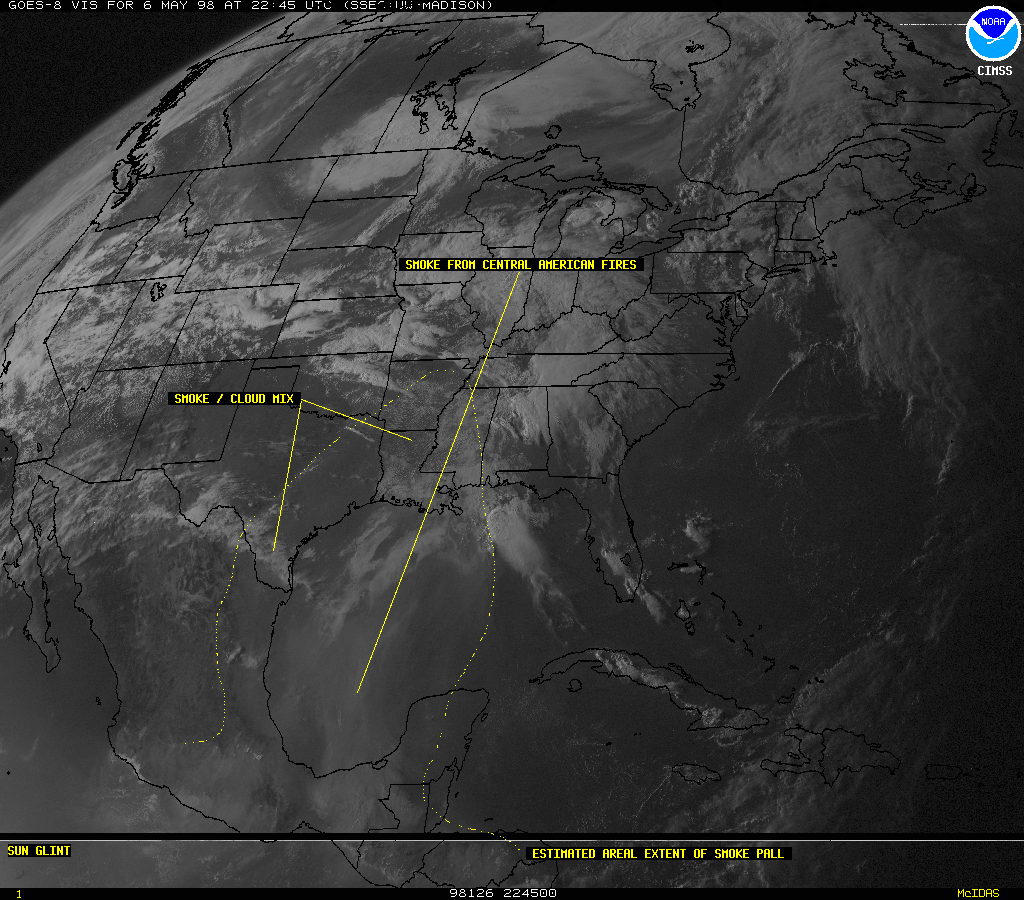
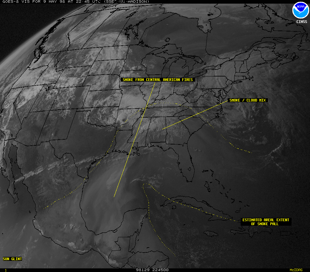
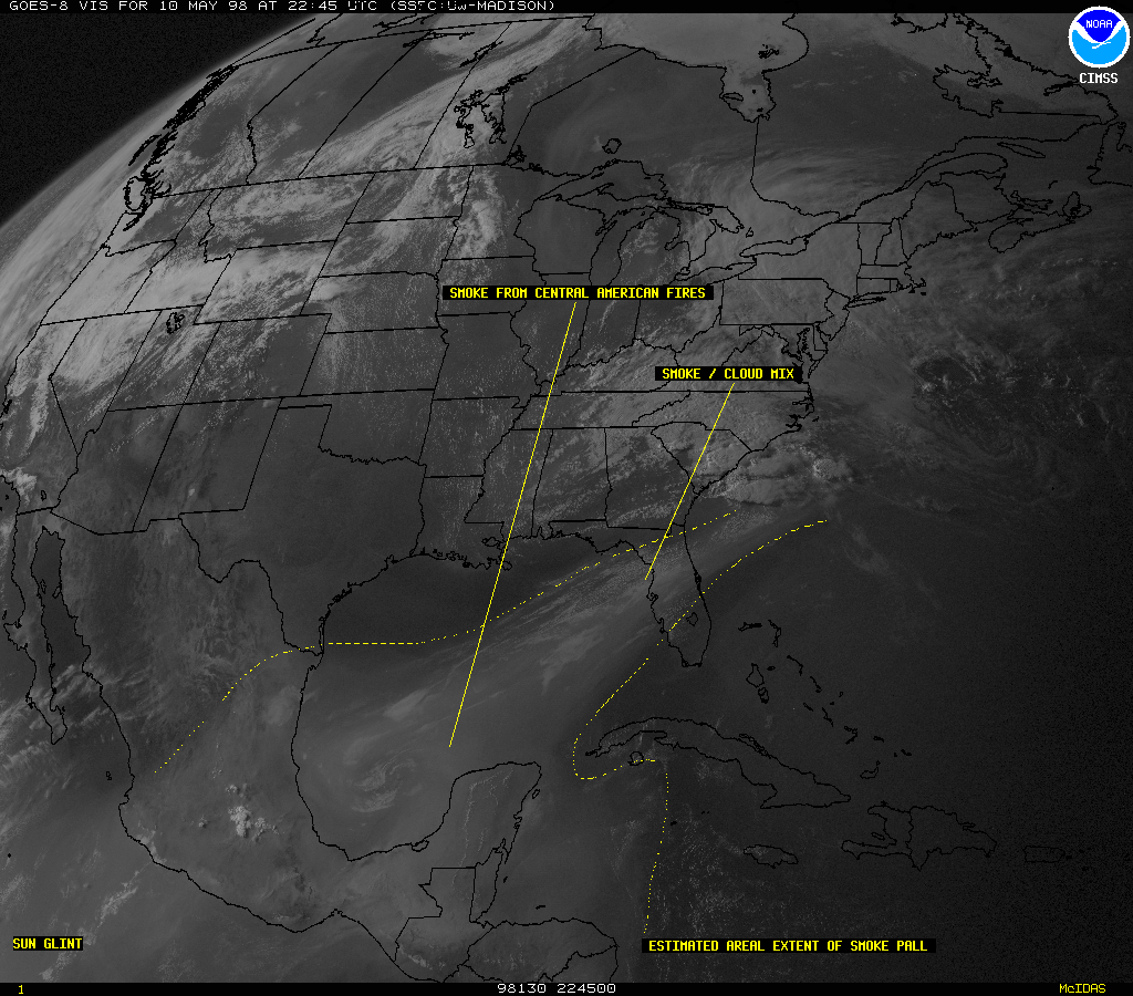
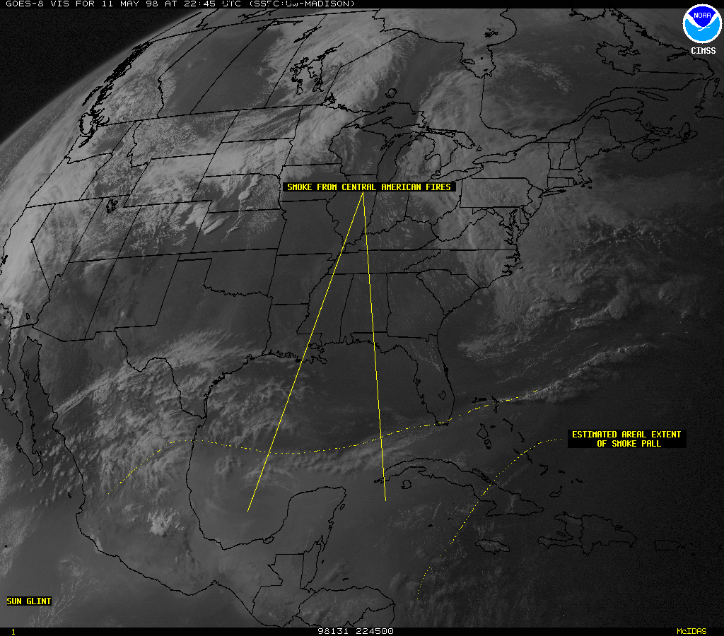
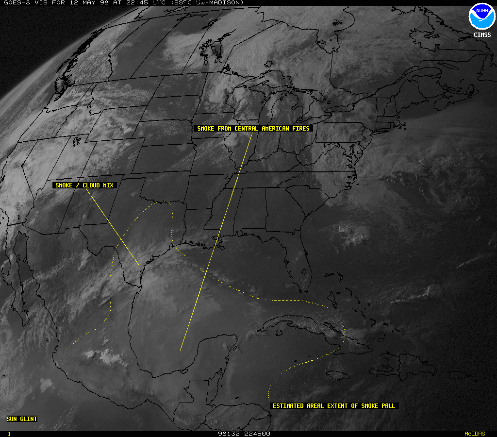
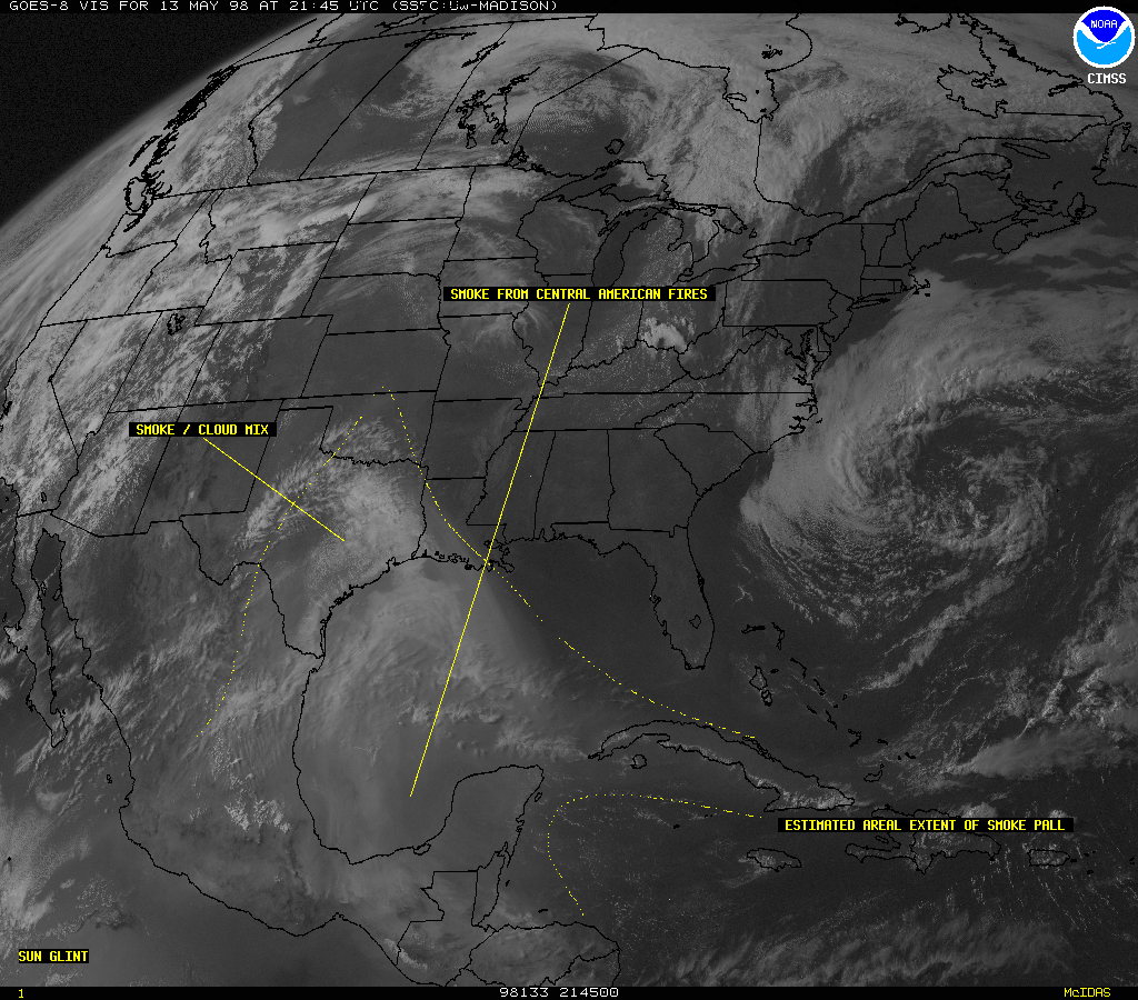
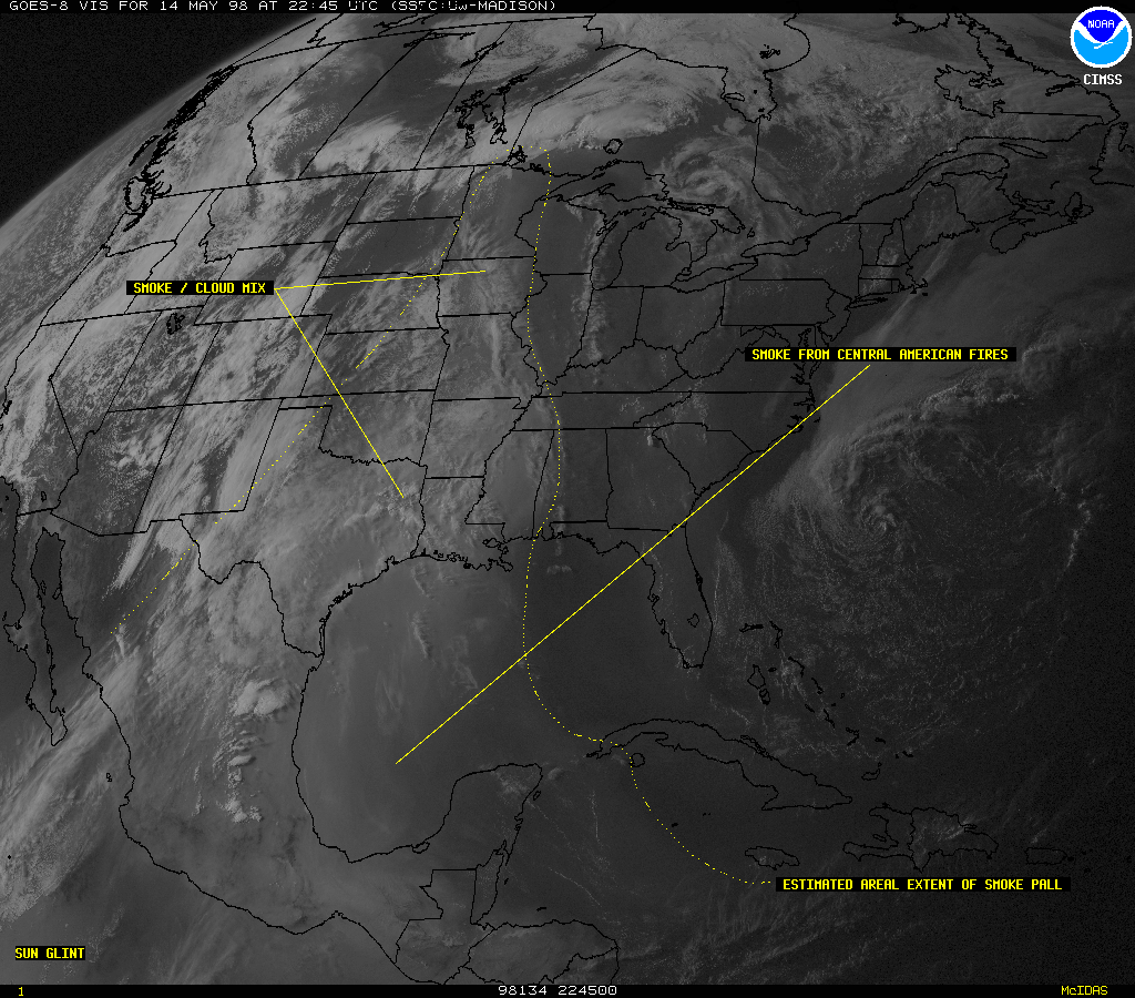
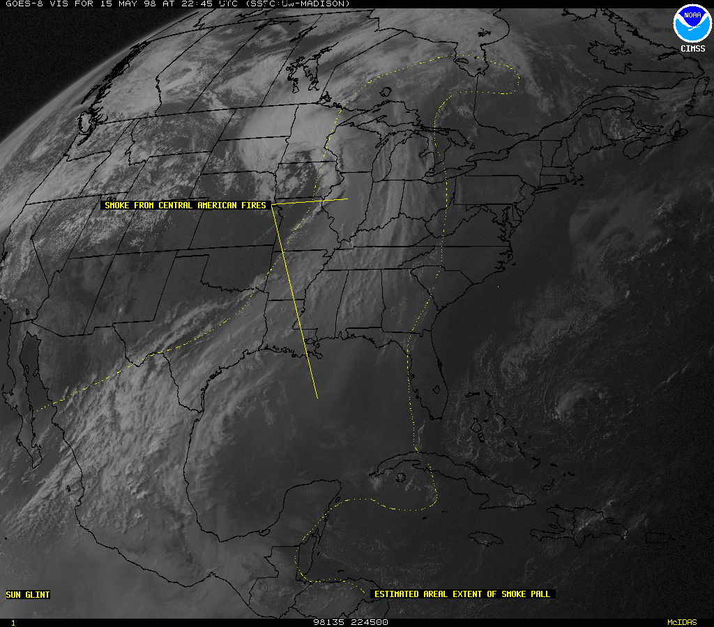
Numerous fires began burning in drought-stricken Mexico and Central America mid February 1998, these fires began to intensify in early April 1998. Persistent south/southwesterly flow has transported the smoke over the Gulf of Mexico, impacting the Gulf Coast states. Reduced visibility (as low as 2-3 miles) has been reported in Florida, Louisiana and Texas. A public health alert was issued on 12 May 1998 for portions of Texas due to the large amount of smoke particulate matter which has been transported into the region.
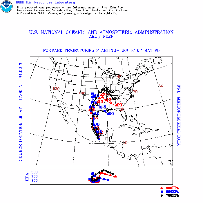
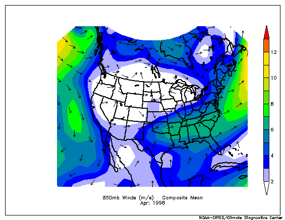
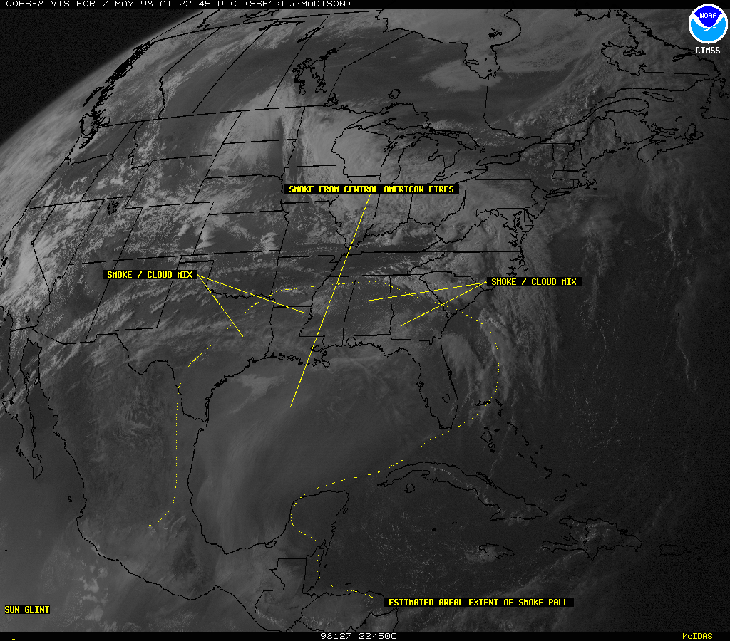
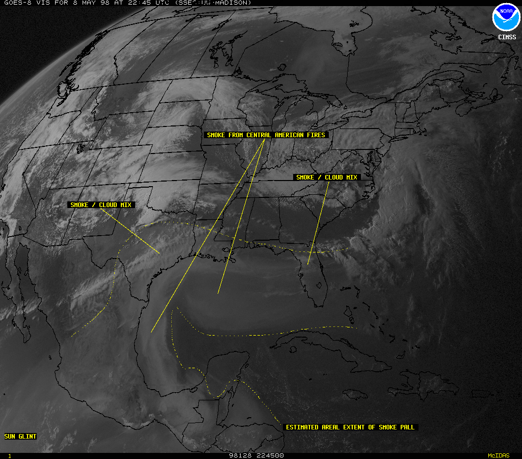
The Geostationary Operational Environmental Satellite (GOES) series (GOES-8, GOES-9, and GOES-10) are operated by the National Oceanic and Atmospheric Administration (NOAA). A series of GOES-8 visible imagery (06 May | 07 May | 08 May | 09 May | 10 May | 11 May | 12 May | 13 May | 14 May | 15 May | Animation) shows the daily changes and large areal extent of the smoke pall which originated in Central America. Forward air mass trajectories (above right) calculated by the NOAA Air Resources Laboratory HYSPLIT4 model show the likely path of transport of smoke-laden air parcels across the Gulf of Mexico and into the south-central and southeastern U.S.
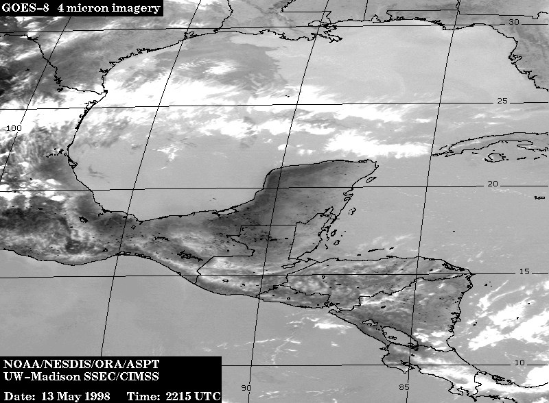
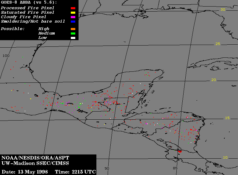
A GOES-8 3.9 micron shortwave IR image at 22:15 UTC on 13 May 1998 (below left) shows numerous fires (dark "hot spots") burning throughout Mexico and parts of Central America. Version 5.6 of the CIMSS GOES-8 Automated Biomass Burning Algorithm (ABBA) was used to automatically locate and characterize sub-pixel fire activity in that region (below right). The locations of GOES-8 ABBA fire pixels which were processed for subpixel fire size and temperature are indicated in red. Saturated fire pixels are shown in yellow; cloud-covered fire pixels are depicted in magenta; and smoldering or hot bare soil is shown in blue. Fire pixels are categorized into high (orange), medium (green), and low (white) probability fire pixels. At 22:15 UTC on 13 May 1998 the ABBA identified 450 definite and possible fire pixels. Only 76 of these were identified as medium or low possibility fire pixels.
|
|
Air Resources Laboratory Smoke Prediction