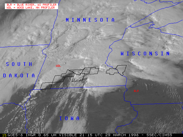
29 March 1998 -- GOES-8 0.65 Micron Visible
Tornadoes in Minnesota and Wisconsin
(this 16-image Java animation sequence will take a minute or two to load...)
(this 16-image Java animation sequence will take a minute or two to load...)
This loop of GOES-8 0.65 micron visible imagery shows the development of supercell convection across souther Minnesota into central Wisconsin. Counties reporting tornadoes are outlined in black.
