23 February 1998 -- Central Florida Tornado Outbreak
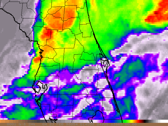
GOES-8 10.7 Micron Longwave IR
 (- Animation -)
This loop of 15-minute GOES-8 InfraRed imagery shows the progression of the tornadic convection that moved rapidly east-northeastward across central Florida. Colder cloud top temperatures are color-enhanced (magenta = -20 C, green = -40 C, yellow = -60 C, black = -80 C). County outlines are included on the map overlay, and the images closest to the times of the Storm Prediction Center preliminary tornado reports are annotated.
- De Leon Springs (03:45 UTC) -- Note the cold overshooting top just north of that location 15 minutes earlier (on the the 03:32 UTC image)
- Port Orange (04:07 UTC) -- The coldest cloud top temperatures were located just to the north of this event
- Winter Garden (04:50 UTC) -- Note the upwind enhanced-V signature 30 minutes earlier (04:15 UTC) and the cold overshooting top just north of that location 15 minutes earlier (04:32 UTC)
- Altamonte Springs (05:30 UTC) -- Note the cold overshooting top just west of that location 15 minutes earlier (05:15 UTC)
- Campbell (05:50 UTC) -- Note how the trailing convective cluster appears to merge with the downwind convection at this time
A similar Java animation of 6.7 micron IR (water vapor) images is also available.
Back to 22-23 February 1998 Central Florida Tornado Outbreak page