14 December 1997 -- Heavy Snow Over Mississippi/Alabama
|
|
|
|
|
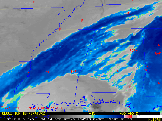
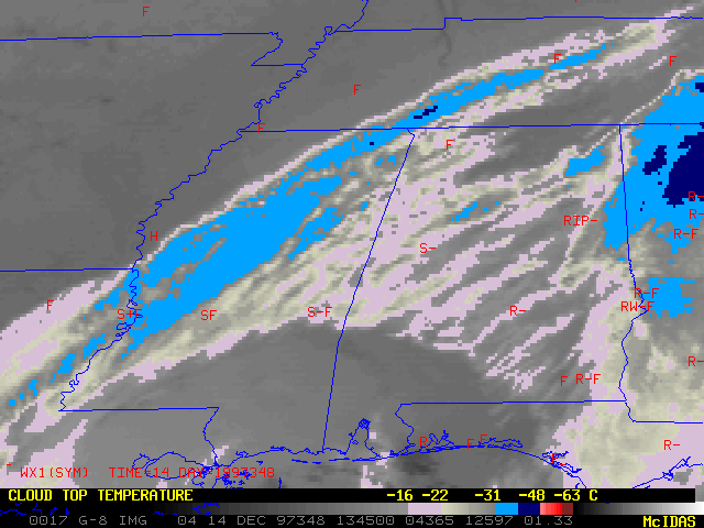
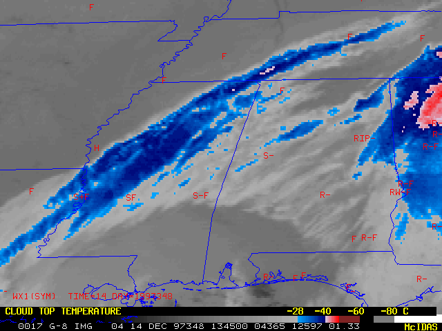
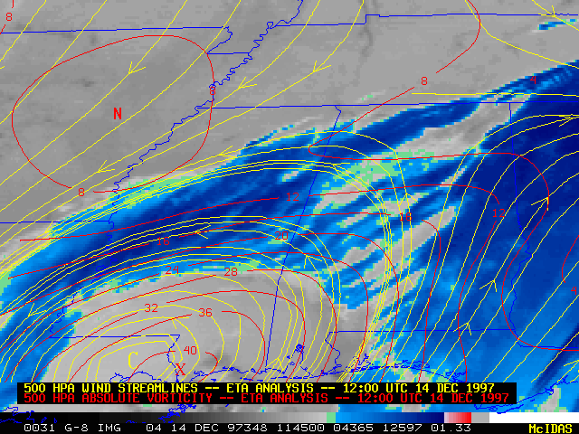
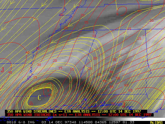
Several inches of snow accumulated along a narrow band across central Mississippi and Alabama on 14 December 1997. This snow band occurred beneath a deformation zone that formed just to the north and northwest of the cold cloud shield "pivot point" associated with a nearly barotropic (vertically stacked) closed low (500 hPa | 350 hPa) along the Gulf Coast. Dynamic cooling by falling precipitation was sufficient to maintain surface temperatures near or just below freezing, allowing the snow to accumulate along the northwestern fringe of the precipitation shield. The slow movement of the deformation zone/snow band also contributed to the heavy snow totals (4 to 8 inches).
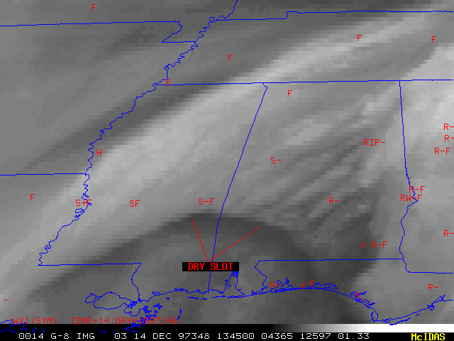
Three different enhancement curves have been applied to the 10.7 micron IR imagery -- these particular enhancements did a fairly good job of highlighting the location of the snow band. The EC enhancement (above left) is a cool-season precipitation curve; the DD enhancement (above right) delineates the -16 C to -22 C range of cloud top temperatures (the "snow production zone"); the CE enhancement (below left) highlights the -28 C to -40 C "glaciation level". The 6.7 micron water vapor imagery (below right) shows that the SW-NE oriented deformation zone developed just to the north of the edge of a well-defined dry slot.
|
|
AVHRR multispectral image showing snow cover on 15 December from Johns Hopkins University APL