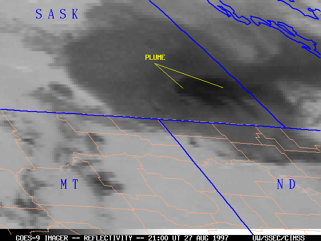
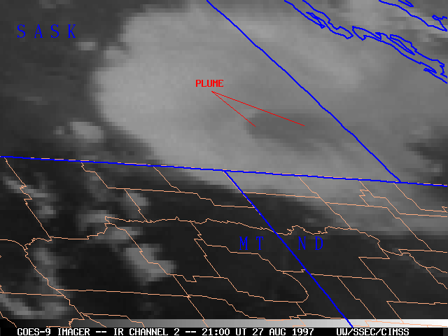
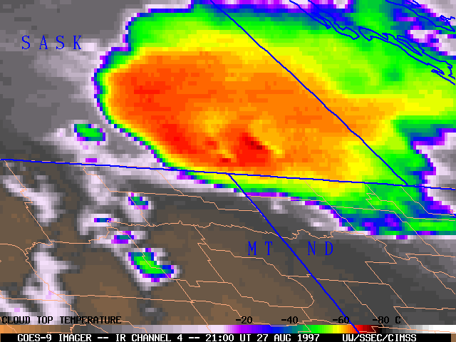
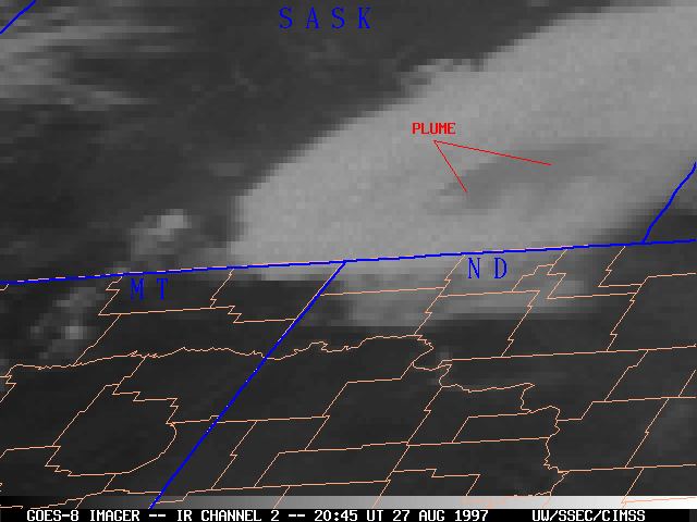
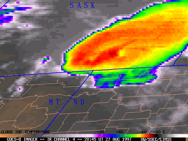
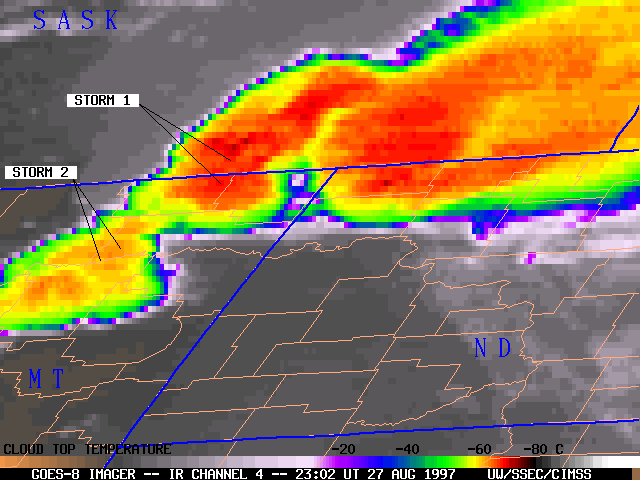
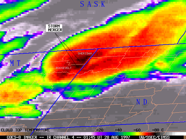
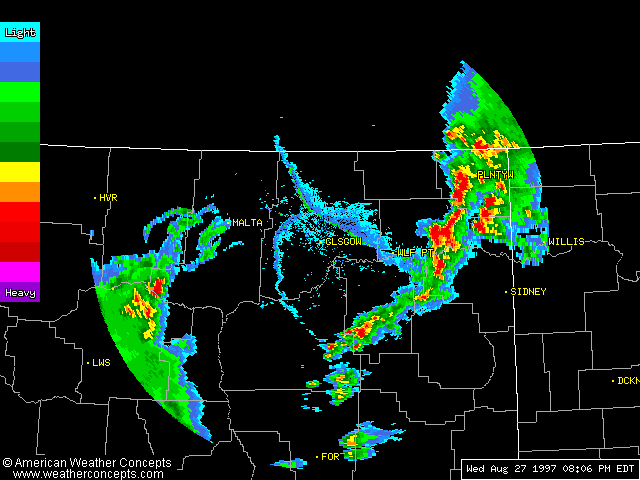
27 August 1997 -- Convective Cloud Top Plume
and a Storm Merger over the Northern Plains

GOES-9 IR channel 4-2 reflectivity

GOES-9 reflectivity | IR2 | IR4

GOES-8 IR channel 4-2 reflectivity

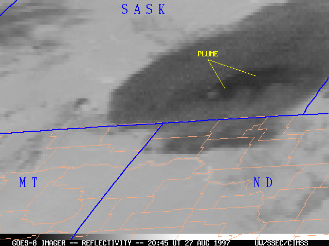
GOES-8 relectivity | IR2 | IR4

A cluster of severe thunderstorms developed over southeastern Saskatchewan, Canada during the afternoon of 27 August 1997. GOES-8 and GOES-9 imagery revealed an interesting feature that is sometimes observed with convective cloud tops: a "plume" of enhanced cloud top reflectivity which is detected using shortwave infrared (channel 2) and longwave infrared (channel 4) data. The appearance of this plume results from the fact that the 3.9 micrometer IR channel 2 is very sensitive to variations in the microphysical properties of clouds (cloud droplet size, ice vs. supercooled water, etc.).

There is no clear connection between these satellite plume signatures and the strength of the associated convection or the occurence of severe weather. These plumes often originate just downwind from the region of coldest cloud tops. [see Doswell, et al., 1996]


GOES-8 IR channel 4

23:02 UT 27 August
GOES-8 IR channel 4

GOES-8 IR channel 4

01:45 UT 28 August
GOES-8 IR channel 4

GOES-8 IR Java animation | Glasgow MT Doppler radar animated GIF

As this convective system propagated southeastward across the U.S.-Canada border, the right flanking convective cluster merged with a newer cluster developing over extreme northeastern Montana. Such storm mergers often result in a phase of convective intensification, manifested by a rapid cooling of cloud top temperatures. Following this merger over eastern Roosevelt and Sheridan counties in Montana, the radar echoes assumed a bow configuration as they moved into western North Dakota. Preliminary storm reports included flash flooding and wind gusts of 60 to 65 mph, and a significant amount of 1-inch diameter hail which accumulated to a depth of 3 to 6 inches in some areas.


Back to The GOES Gallery