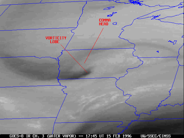
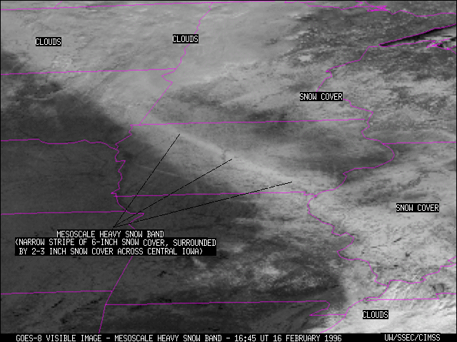
An "Alberta clipper" system moved rapidly southeastward across Iowa on 15 February 1996, producing a mesoscale band of heavy snow oriented NW-SE across the entire state (isolated 6 to 7 inch accumulations within a narrow 30-mile wide swath). A well-defined vorticity lobe was evident on the water vapor imagery, which tracked just to the southwest of the heavy snow band. A comma head signature developed along the leading edge of this feature as it propagated across southern Iowa.
Prior to affecting Iowa, this system produced heavy snow over eastern South Dakota (2 inches in 1 hour at Aberdeen). Thunder and 50 knot wind gusts were reported with the passage of this feature through the Omaha NE area. The system went on to cause problems in the St. Louis MO region, where evening rush hour snow totals were 2-4 inches.
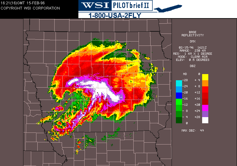
Base reflectivity images from the Des Moines IA WSR-88D Doppler radar reveal an arc of >28 dBZ echoes which curves around the northern periphery of an eye-like region. This circular region of low reflectivity corresponds to the warm (dry) vorticity center seen on the water vapor images, while the higher reflectivities produced the heavy snow band just to the northeast of the track of the vorticity lobe.