|
|
|

|
|
|
|

|
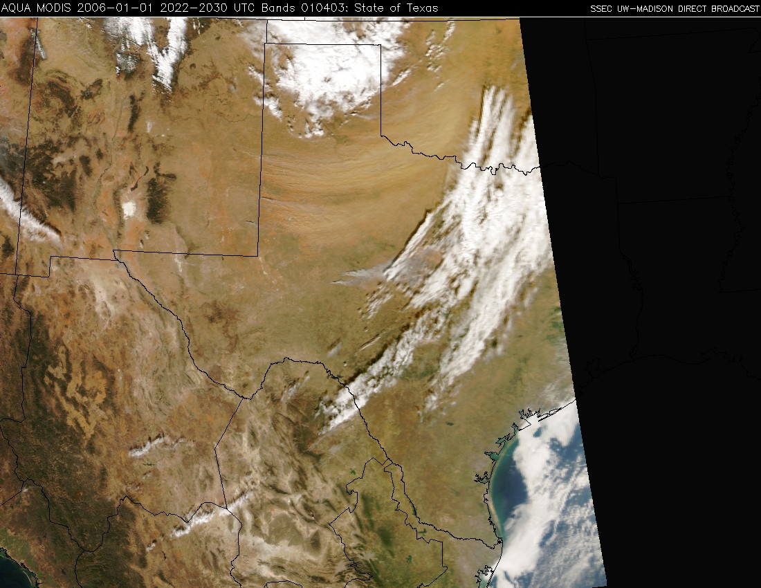
NOAA GOES-12 3.9 micrometer shortwave InfraRed (IR) imagery (above, left) shows the presence of several "hot spots" (red to black enhancement) due to fires that were burning across parts of New Mexico, Texas, and Oklahoma on 01 January 2006. Prolonged drought conditions across the southcentral US led to a critical fire danger over that region. Strong winds gusted to 50-67 mph in the wake of an advancing cold front, helping to promote the rapid growth of many of these fires (note how quickly the fire pixels spread eastward across New Mexico on the shortwave IR animation). Corresponding GOES-12 visible channel images (above, center) show large plumes of smoke and blowing dust/sand advecting east/northeastward across Texas into Oklahoma. A "true color" image derived from Aqua MODIS visible channel data (above, right) helps to further discriminate between the smoke plumes (which appear as lighter shades of gray) and the blowing dust/sand (which exhibits more of a tan to light orange color, due to the composition of the soil over the source region).
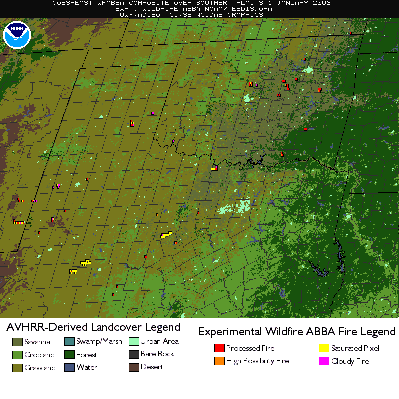
The GOES-12 Wildfire ABBA product (below) displayed several of the fire pixels as "saturated" (yellow), meaning that the satellite detected 3.9 micrometer brightness temperatures of 336 K (63 C) or warmer at those locations. A 13-day Wildfire ABBA composite covering the 23 Dec 2005 - 04 Jan 2006 period shows extensive wildfire activity across the southcentral US, which burned about 600,000 acres in the states of New Mexico, Texas, and Oklahoma. International Space Station astronaut photography also reveals several large fires burning in Louisiana on January 2 2006.

|
