|
|
|
|
|
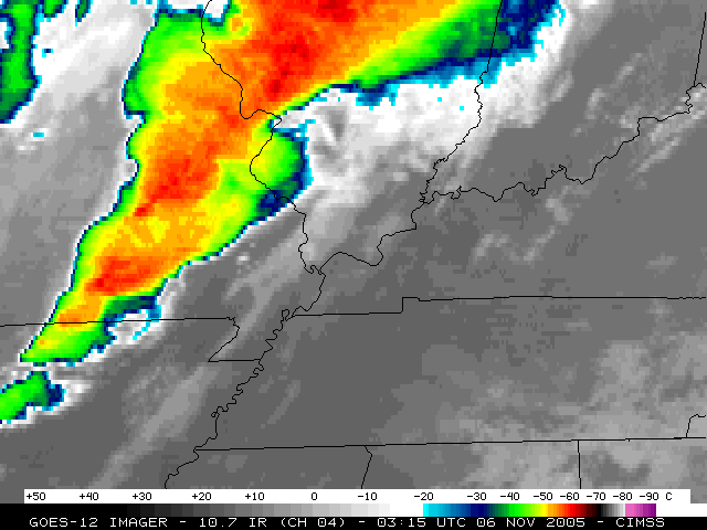
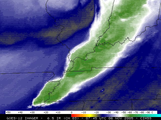
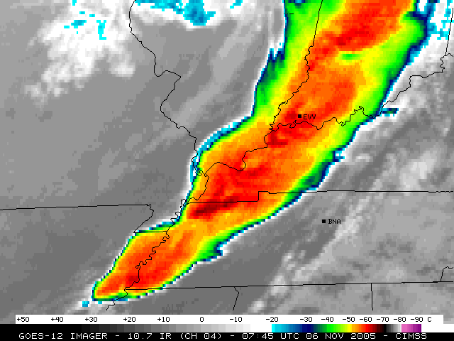
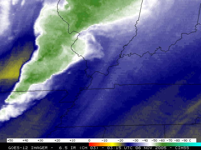
NOAA GOES-12 10.7 micrometer InfraRed (IR) and 6.5 micrometer "water vapor" images (above) show the progression of a line of severe thunderstorms across the Ohio River Valley region on 06 November 2005. This convection produced widespread reports of damaging winds, hail, and tornadoes -- the F3 tornado that struck the Evansville IN area (station identifier EVV) around 07:59 UTC was responsible for 23 fatalities, making it the deadliest tornado in the US since 1999. The supercell that produced the Evansville tornado exhibited an "enhanced-v" signature on IR imagery from about 06:25 to 08:15 UTC; the satellite detected overshooting cloud top temperatures as cold as -66 C, a few degrees colder that the tropopause temperature indicated on the 00 UTC Nashville TN rawinsonde report (station identifier BNA).

