|
17:47 UTC Terra MODIS true color image (250 meter resolution) |
|
|
|
17:47 UTC Terra MODIS true color image (250 meter resolution) |
|
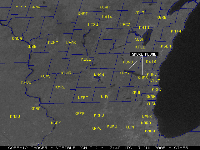
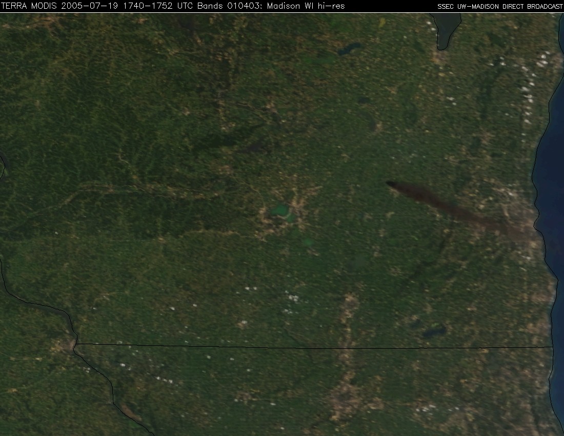
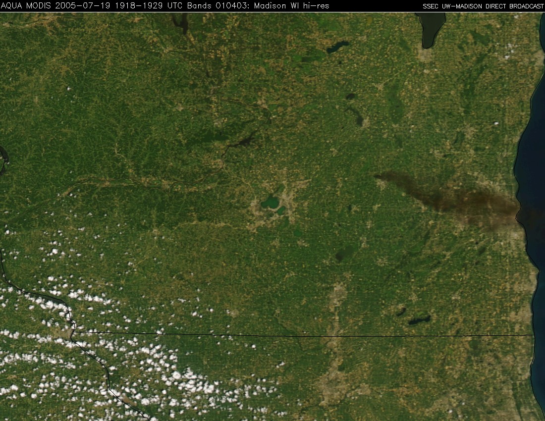
A large fire broke out at the Watertown Tire Recyclers plant near Watertown, Wisconsin around 15:00 UTC (10am local time) on 19 July 2005, buring about 6 acres (local media story). The 12-acre tire recycling facility reportedly contained nearly a million tires at the time of the fire (far exceeding the 200,000-tire licensed capacity). The smoke plume was somewhat unusual in appearance on satellite imagery, due to the dark color (smoke plumes normally exhibit more of a lighter grey color) -- this characteristic has been observed in previous tire fire events. Note the dark color of the plume on the NOAA GOES-12 visible imagery (above, left), which was even more apparent on the Terra and Aqua MODIS true color images (above, center and right). The smoke plume rose to estimated heights of 5000-6000 feet above ground level, and was advected east/southeastward by the prevailing winds.
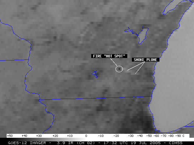
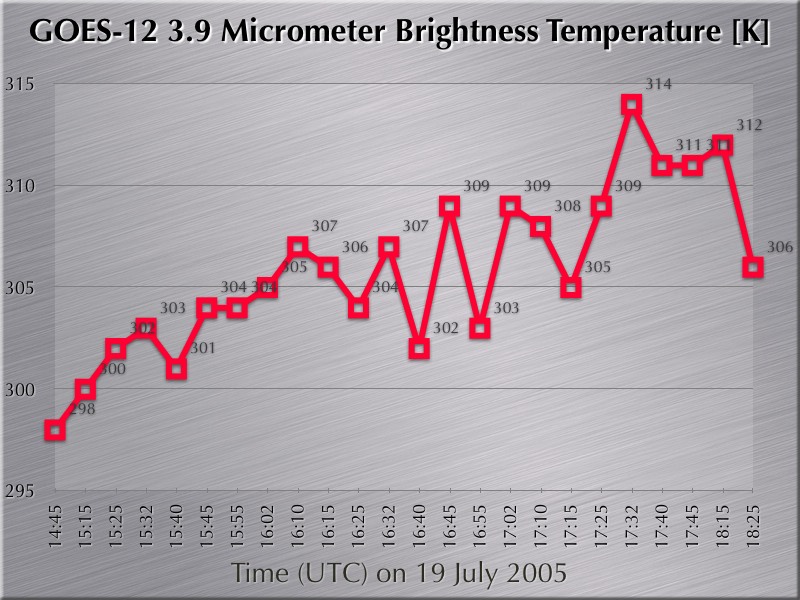
GOES-12 3.9 micrometer "shortwave IR" imagery (below, left) revealed a local "hot spot" associated with the tire fire, and the CIMSS Wildfire ABBA processed a fire pixel at that location. The shortwave IR brightness temperatures (below, right) only reached a maximum value of 314 K (41 C) at 17:32 UTC (12:32 PM local time), which is well below the 3.9 micrometer channel saturation temperature of 336 K (63 C) on the GOES-12 satellite; the thick smoke plume may have partially obscured the fire from the satellite viewing perspective, causing cooler shortwave IR brightness temperatures to be sensed.
|
|

|

