|
|

|
|
|
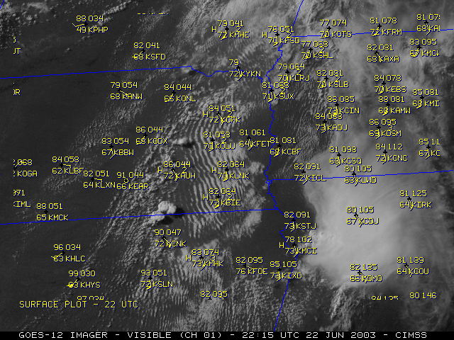
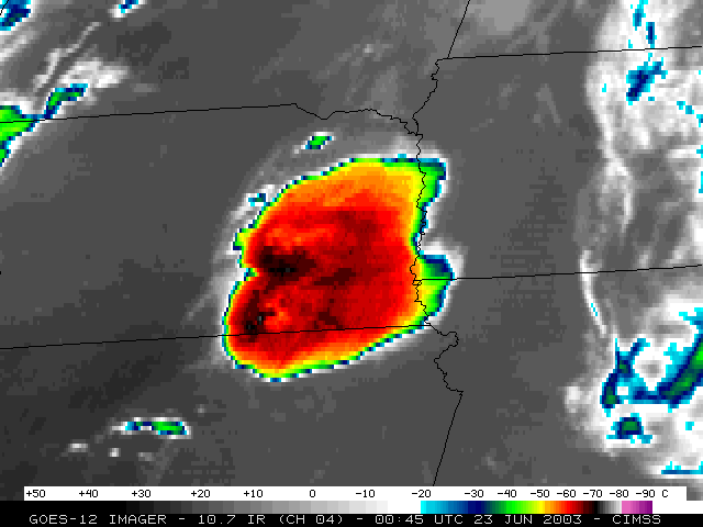
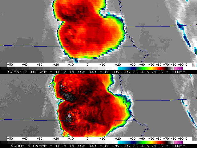
Record-setting hail (6.5-7.0 inches in diameter) was reported at Aurora in Hamilton county Nebraska around 00:05 UTC on 23 June 2003 (7:05 PM Central time on 22 June 2003). The convection that produced this large hail was also responsible for several reports of tornadoes and damaging winds across that region. NOAA GOES-12 visible imagery (above, left) revealed that this convection was initiated along the western edge of a region of stable boundary layer wave clouds over southeastern Nebraska (remnants of a convective outflow from earlier in the day). GOES-12 10.7 micrometer InfraRed (IR) imagery (above, right) depicted classic, long-lived "enhanced-v" cloud top signatures with this convection.
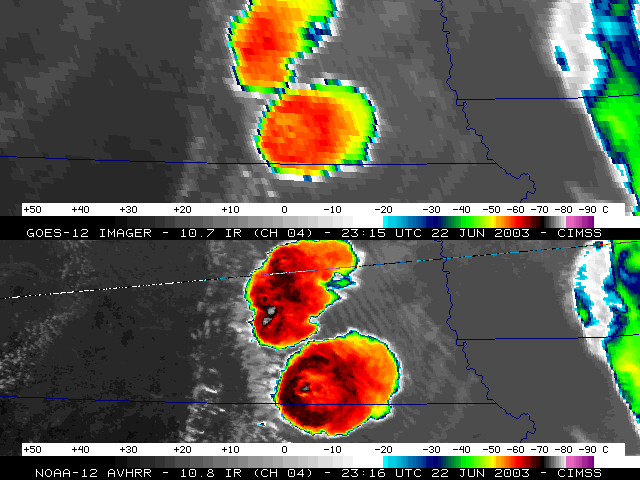
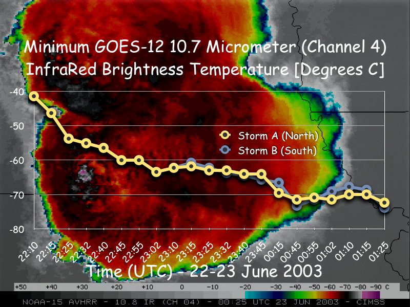
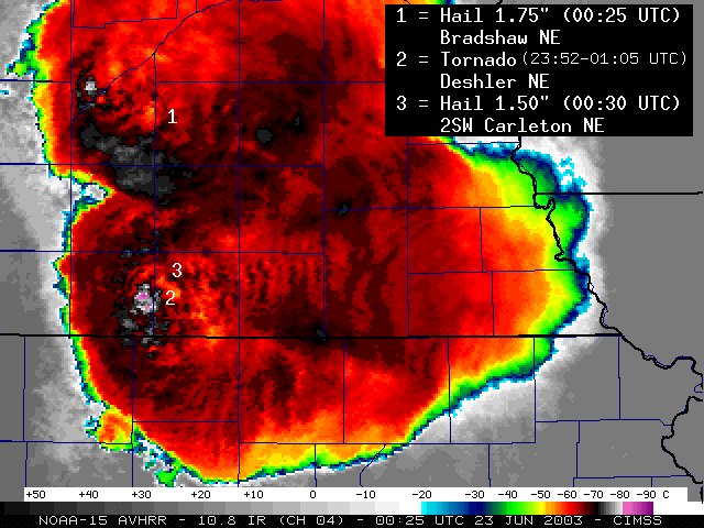
Cloud top temperatures detected by GOES-12 (below, center) cooled quickly as the convection intensified, becoming colder than the regional tropopause temperatures (-63 to -65 C) by 00:15 UTC, and colder than -70 C after 00:45 UTC. Higher spatial resolution data from the polar orbiting AVHRR revealed even colder cloud top temperatures associated with the overshooting tops of these storms -- NOAA-12 measured -78 C at 23:16 UTC (below, left); NOAA-15 measured -87 C at 00:25 UTC (below, right), which was close to the time that large hail and the Deshler Nebraska F2 tornado were reported. A fatality from the Deshler tornado was the first tornado-related fatality in Nebraska since 1988.
|
|
|
|
|
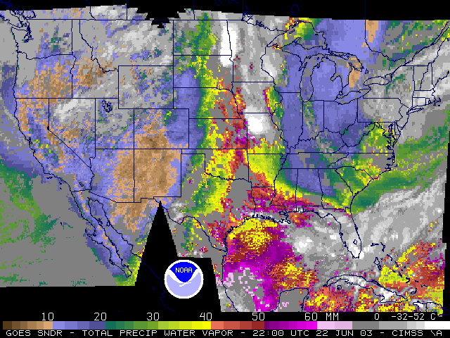
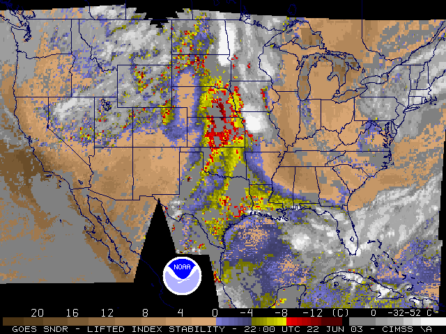
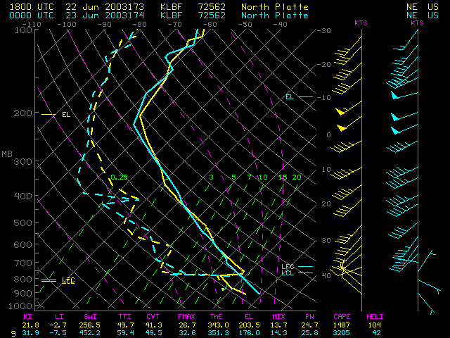
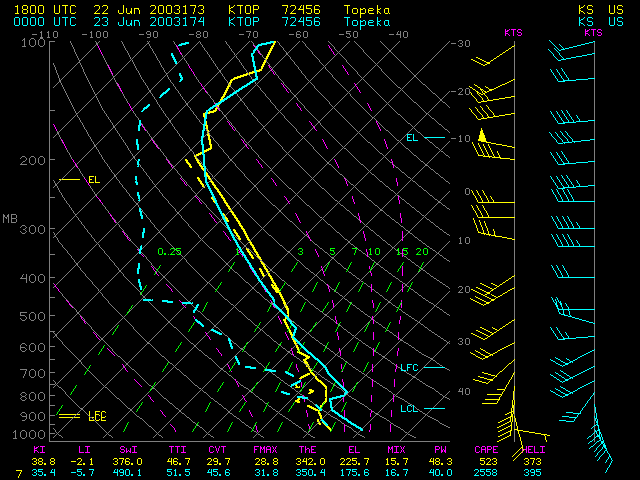
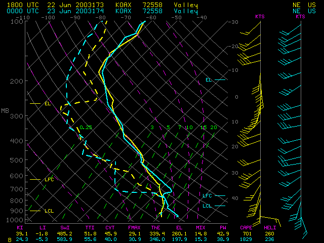
Single field of view (SFOV) GOES sounder derived products (above) revealed that the pre-convective environment across eastern Nebraska became increasingly moist (Precipitable Water values of 40-50 mm) and unstable (Lifted Index values of -8 to -12 C) during the afternoon hours. Regional rawinsonde data (below) also showed that favorable wind shear profiles were in place across eastern Nebraska and Kansas to support severe convection.
|
|
|
