
|

|

|
|
|
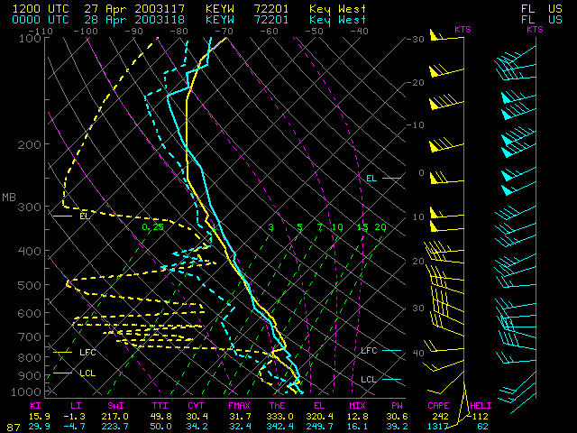
Record-setting hail (up to 1.75 inches in diameter) was reported at Key West, Florida between 20:10 and 20:20 UTC on 27 April 2003. The convection that produced this hail was also responsible for surface wind gusts of 53 mph at Key West.
InfraRed satellite imagery from GOES-12 and NOAA-16 (above) was rather unremarkable in terms of cloud top temperatures and patterns associated with this hail-producing convection. Convection to the south and west of Key West exhibited large anvil regions with "enhanced-v" cloud top signatures (which often indicates severe convection capable of producing hail or tornadoes) and cloud top temperatures as cold as -76 C (white enhancement), while the convection over Key West presented a much smaller anvil region and only showed cloud top temperatures as cold as -52 C on GOES-12 (orange enhancement) and -59 C on NOAA-16 (red enhancement).

|
|
