|
|
|
|
|
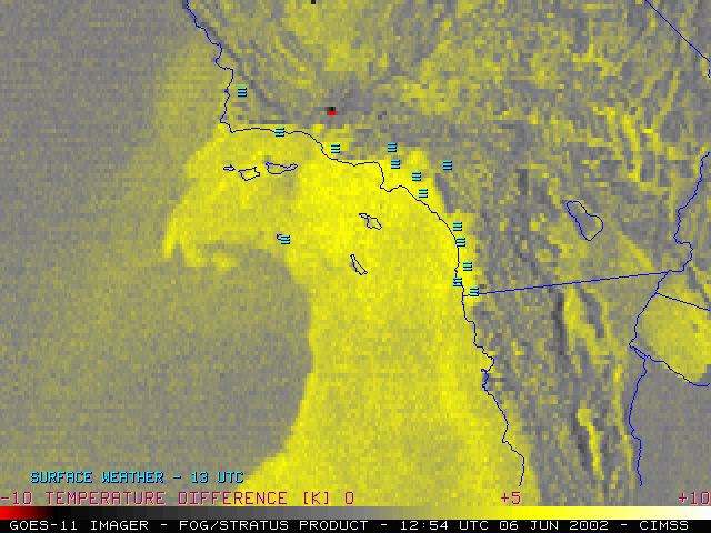
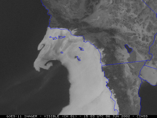
NOAA GOES-11 imagery shows the evolution of marine fog/stratus as a Catalina Eddy circulation was intensifying off the coast of southern California on 06 June 2002. The fog/stratus product (above, left) shows the motion of the offshore fog and stratus during the pre-dawn hours, as well as the location of a 10,000 acre wildfire (black to red enhanced pixels) that was burning in the Los Padres National Forest. The visible channel (above, right) reveals the formation of mesoscale vortices along the northwestern edge of the marine stratus, as well as the southwesterly drift of smoke aloft from the aforementioned wildfire. The onshore flow associated with the Catalina Eddy was acting to slow the burnoff of fog and stratus along the immediate coastal region of southern California. (a composite image of 250-meter resolution Terra MODIS data is available here)
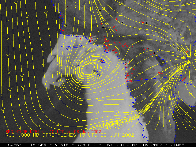
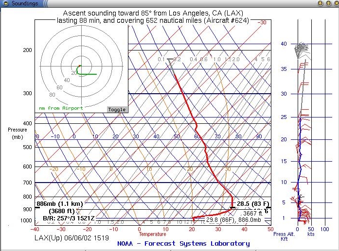
1000 mb wind streamlines from the RUC model at 15 UTC (below, left) indicate that the ofshore eddy circulation was well defined. An ACARS sounding profile from an aircraft ascent out of Los Angeles International (below, right) shows that the marine inversion was very shallow, and was capped by a very deep and strong temperature inversion.
|
|

